People are Strange, Passes seem Wicked (When You’re Alone)…

Day 13:  Unnamed Creek below Mather Pass to LeConte Canyon

August 30, 2015 at 5 am: Waking up below Mather Pass

I had a rough night. It was freezing and the rocky ground causes every muscle and bone to ache, even through my Therm-a-rest. It’s definitely not as cushy as the dirt floor below the tree line. Even with Advil PM, I tossed and turned all night, feeling every scrape, rash and sore muscle.  (I scraped my fingertip on a rock while soaking yesterday and it’s throbbing!).

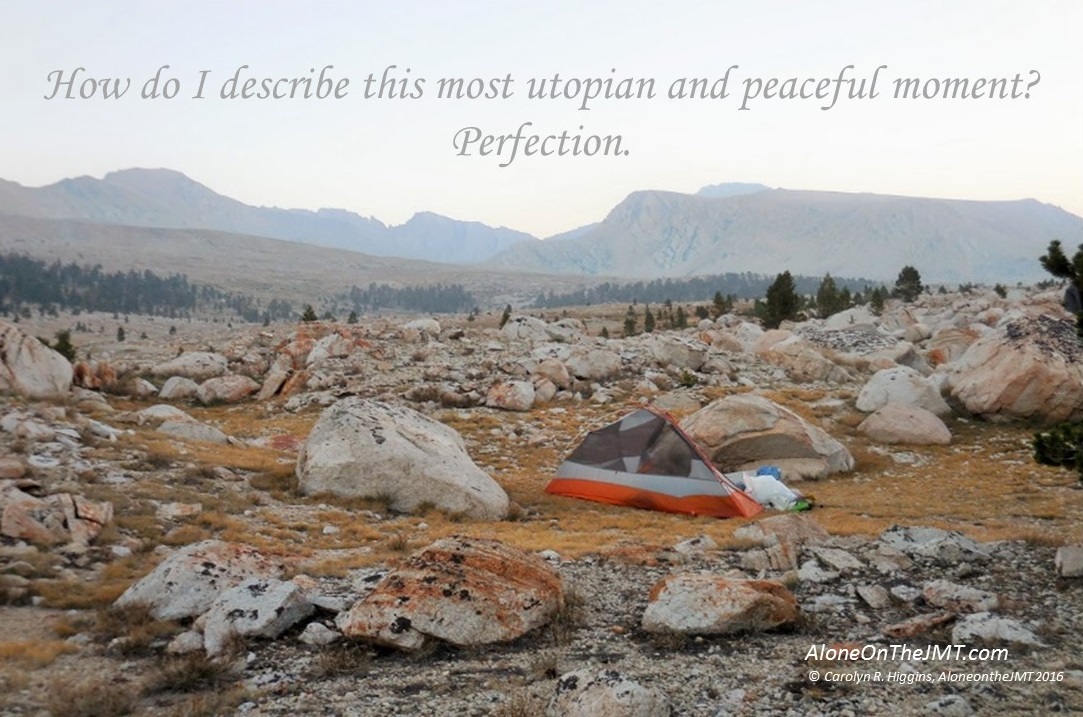
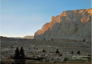
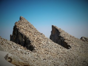
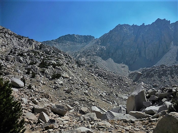
On the bright side, every time I got up to go to the bathroom (which was a lot) I was thrust from the comfort of my tent into the desolate and barren landscape of Upper Basin, in the shadow of Mather Pass.  The near-full moon cast an eerie glow onto the bouldered moonscape, making it feel other-worldly.  I stood frozen, holding my breath, acutely aware of my alone-ness and a tranquility so smooth and silent.  Have I woken up to a dream? Is this real? How can a place so devoid of sound, light and movement exist on the same planet as my  noisy hustle-and-bustle life?

All around and above me, millions of stars carried out their nightly duty:  twinkling innocently in the far-away depths of our universe. I slowly drew in my breath, inhaling the cool night.   A My body ached to absorb every atom of the purity around me.  Seductively, it pulled me in with it’s  silent tranquility. As I stood motionless, my Earthly Being  merged into the landscape.  I became Nature and Nature became me. I  reveled in the power it had over me and in the knowledge that I was a mere speck on the ancient historical timeline of this place that now held me.

day 13 somewhere

Chilled – and maybe a little spooked – I’d hesitantly crawl back into my tent and try in vain to get a few hours of sleep….

I’ve finally given up. I unzipped my door and rainfly to enjoy the view from the warmth of my sleeping bag:  the bright sparkling star of The Hand (ORion’s belt to you, but I see a hand, not a dude and a belt) Constellation is just above the eastern peaks of Cardinal and Split Mountains.  The world is silent and still.  I’m sipping my coffee, anxious for the sun to rise. I’m ready to get on the trail, but for now I’m enjoying the silent serenity of a world that I have all to myself… just the stars and the sky and the fading moon to keep me company.

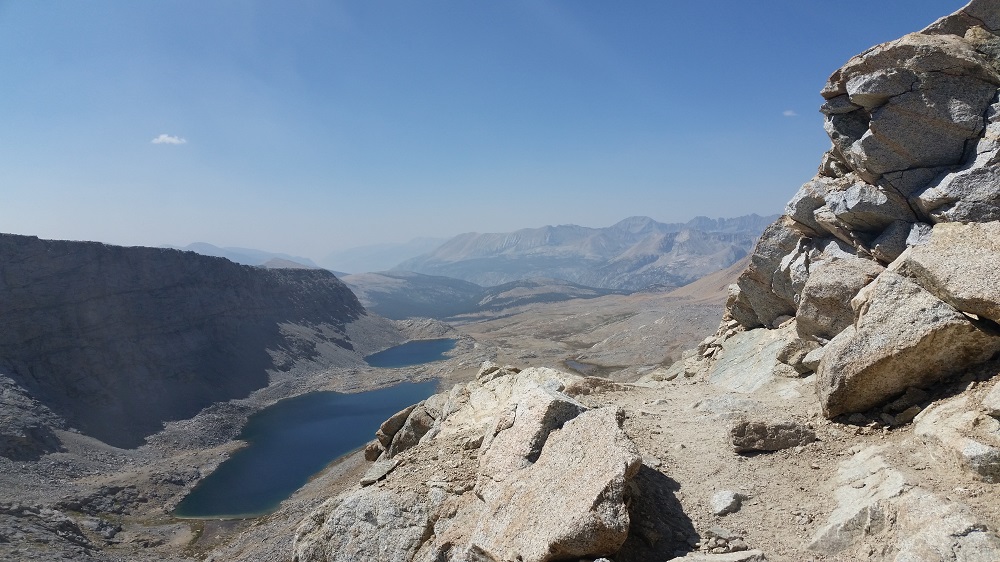
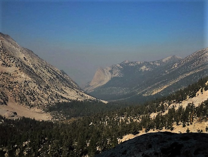
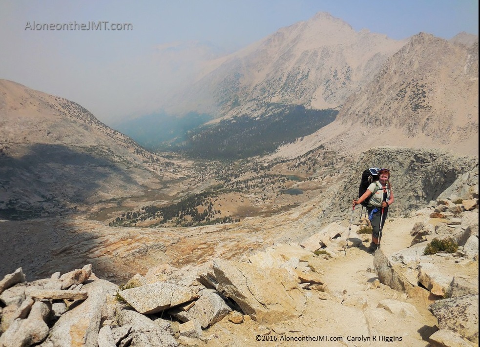
12:30 – Lunch – Descending into Leconte Canyon from Mather Pass

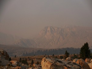
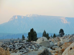
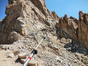
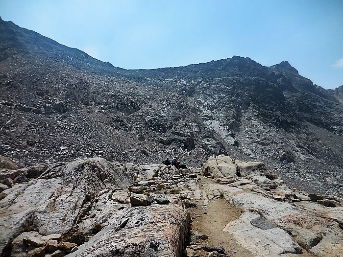
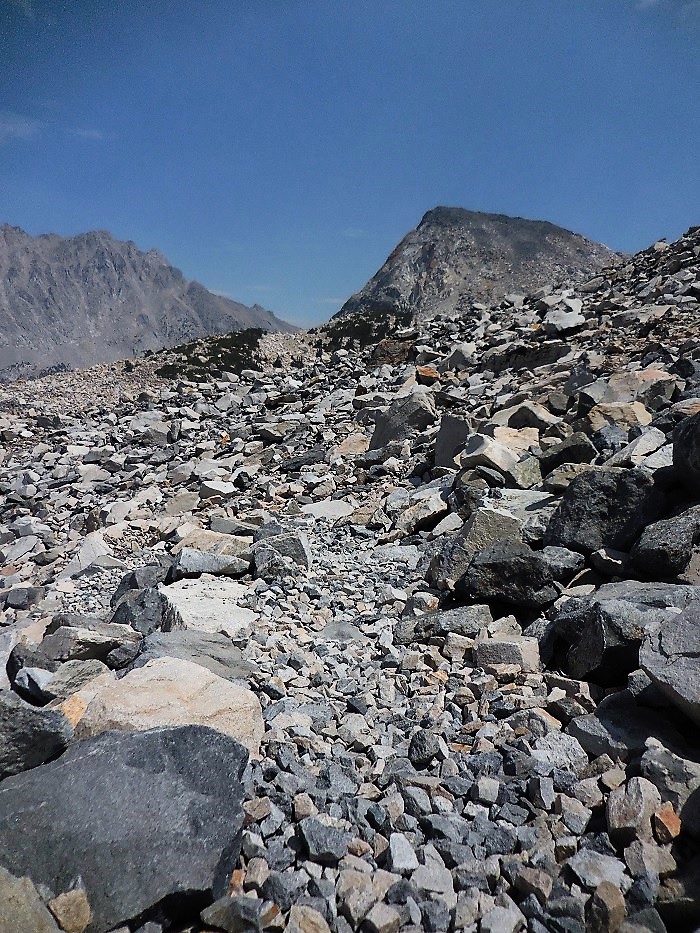
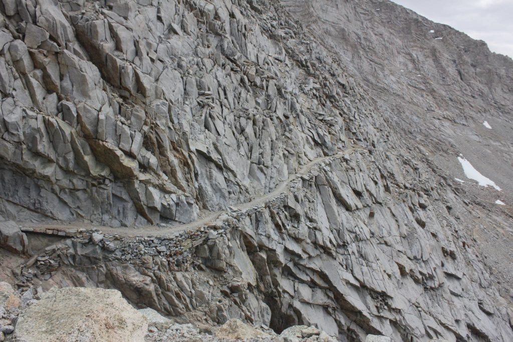
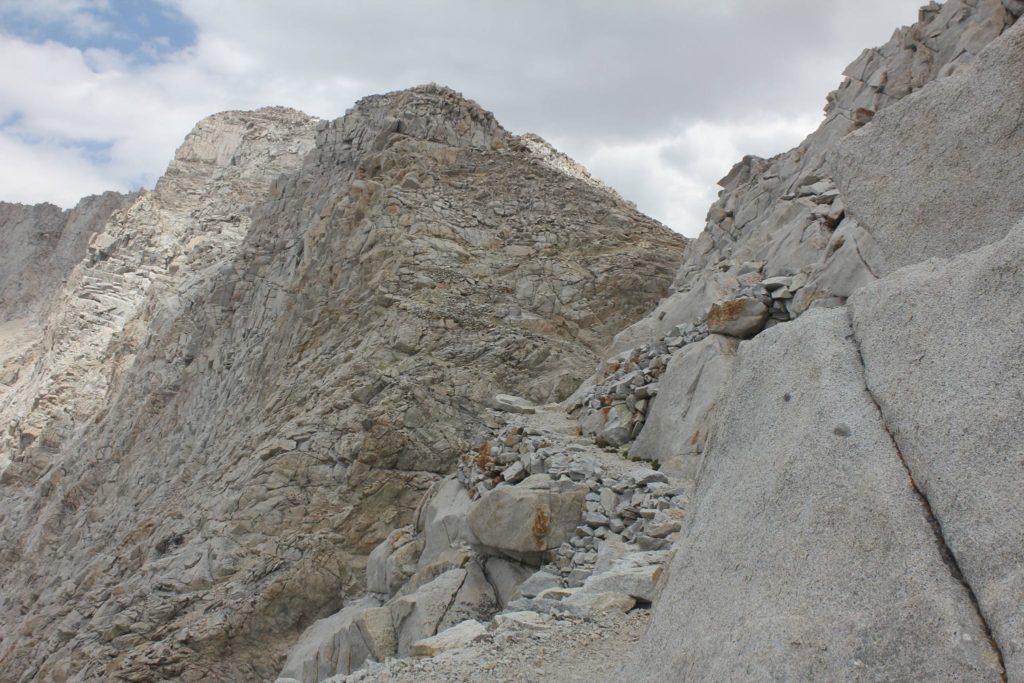
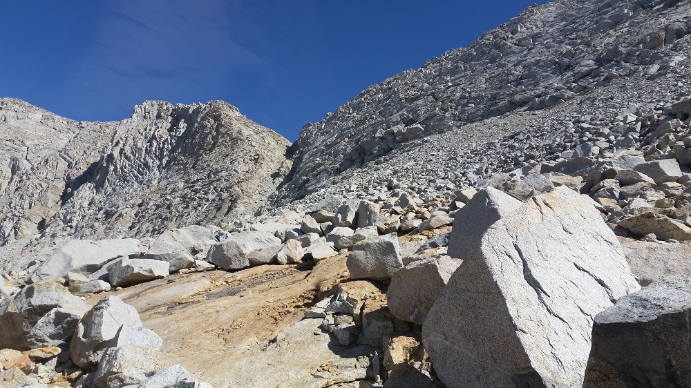
No wonder most of the South Bounders I’ve run into today have been grumpy. Mather Pass is a bitch; my irritating descent is their horrific 4100’ never-ending ascent.  How I missed this on my maps, I’ll never know – oh wait, that’s right I fucking SUCK at reading topo map! Plus, I keep making the same mistake over and over again; thinking it’s going to be an easy day.  I was so full of excitement and optimism as I half-assedly studied my map this morning, broke camp and merrily skipped along the trail toward Mather Pass. I was like the Mary Poppins of JMT hikers, all that was missing was the umbrella and the “Sound of Music” piping through the mountains as I frolicked.day 13 waterfall and bp

You’d think that after my Glen Pass melt-down I’d have learned my lesson. Repeat after me: THERE ARE NO EASY DAYS ON THE JOHN MUIR TRAIL! When will that sink into my head? Damn my optimism and willful ignorance! It bites me in the ass every single day out here. On top of a grueling 4100-foot descent down rocky slippery, torturous trail, my quads and hips are achy (despite handfuls of ibuprofen), I think I’m getting blisters, a couple of my fingertips are cut and bleeding and throbbing and the rash on the back of my legs is burning. Yeah, this shit is real. Being out in the elements and hiking 100 miles over 13 days takes a toll on my fragile ill-equipped human body!

On top of all that, my pants have become annoyingly baggy (I would have never thought in a million years that I would complain that my pants had become too baggy.  Sear this moment into your brain and forever cherish it.) They’re falling from my hips and drooping all down my ass, chaffing my already rashed butt and legs.  Seriously, I’m getting the weirdest ailments. I planned for sore muscles, minor cuts, scrapes, infections; but fingertips that split open and throb constantly, a rash on the entire back of my lower body; who would have thought to prepare for such nonsense?

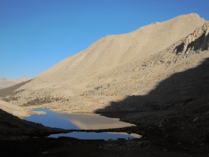
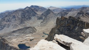
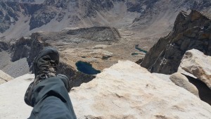
After what felt like decades of trudging downhill, I finally stopped to eat lunch on a huge flat rock overlooking a gorge with a cascading waterfall. As I devoured my favorite Cashew Caramel Go Macro Bar and handfuls of trail mix, a tall lanky dude about my age stopped next to me. He just stood there for what seemed like a ridiculously long time without saying anything to me. He stared at the river flooding through the narrow gorge. Does he not see me, I wondered.  How can he not see me? I’m RIGHT next to him.

“HI!” I yelled to him over the roaring noise of the water, trying to snap him out of his clueless trance.

Not taking his eyes off the gorge, he mumbled something I couldn’t hear.

“Excuse me?”

He mumbled again.

Ok, now this mumbling intruder was just annoying me, “I can’t hear you over the waterfall.”

He raised his voice about a half a decibel, I think he asked, “is this the Golden Staircase?”

“I don’t think so. Isn’t the Golden Staircase further north near Donahue Pass?” I answered.

“No. I think this is it,” he replied, still studying the gorge and not looking at me.

Okay, if you’re so damn sure,  then why did you ask??? “Hmm. I’m not sure then…”

Then he suddenly jerked his head around as if noticing me for the first time and just stood in place on the trail a foot away from me,  watching me pick cashews out of my trail mix.  He was starting to creep me out.  I was sitting on the edge of a gorge after all and there was no one around for miles. Will this be the day my flippant, “No one hikes into the wilderness to kill people” reply to “aren’t you scared hiking alone?”  bites me on the ass?

Why was this odd tall man watching me eat? Finally he mumbled,  “where are you from?”

I’d been meeting people from all over the world and  I never assume anyone knows where little Concord, California is, so I replied, “The Bay Area – San Francisco, Bay Area.”

The odd man snarled at me, turning up his lip in disgust. Showing obvious contempt, he  snapped, “you could have been more specific!”

I gave him a questioning look. His annoyance caught me off guard and I wanted to reply, “Ok, is “none of your fucking business”, specific enough for you?”  but since I was sitting on the edge of cliff overlooking a gorge  I thought it best to not provoke the odd man.  “Ok, I’m from Concord, Concord CA. Why, do you know the Bay Area?”

Again with his annoyed tone, “Yeah, Orinda.”

“Oh.”

Silence. He just stood there. Looking at me. Looking at the gorge. I started packing up, I wasn’t taking any chances that he was trying to figure out  if he could push me over without taking himself down in the fall too…

Finally, he mumbled something and moved on. I watched him hike up the trail (that suddenly seemed an awful lot like a staircase…) and out of sight. Relieved to be alone again, I laid back onto the rock and let the warm sun wash over me, thinking, What is up with today? I have not met one “normal” hiker today, just a bunch of people who seem like they’ve never been on a trail before and absolutely hate being out here. But then,  I suppose the people who passed me climbing Glen Pass could’ve thought the same about me. Trudging up this hellacious mountain must kill every ounce of joy in even the best and most optimistic hiker.

I have no idea where this is, I think it was on Day 13 below Mather Pass, before the Golden Staircase, maybe?
I have no idea where this is, I think it was on Day 13

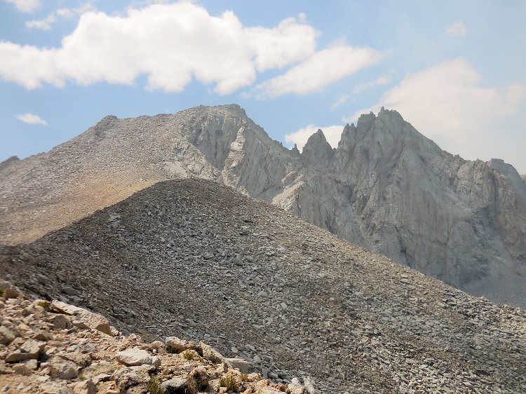
So today it was the Mather Pass descent, more than the ascent  that killed me. Really, that fucking mountain just went down for days.

With all my odd physical ailments and wavering mental fortitude I’m realizing that my fantasy of dropping out of society, loading up my backpack with as much survival gear as I can carry, grabbing Capone and traipsing deep into the wilderness to live off the land probably isn’t a realistic option.  Besides being completely grossed out by the idea of having to kill things to eat, I’ve only been out here 13 days and already I miss my warm comfy bed, hot showers, soap and shampoo, fresh veggies, real coffee and lotion (my skin is so dry).  Yes, that fantasy has died within me over the last several days. I would surely starve and die a slow and wholly uncomfortable death without  Peet’s coffee and 900 thread count sheets.

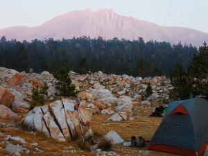
8:30 pm at Le Conte Canyon

 I hiked 16.4 miles today!!!  And I finally broke my 100-mile mark! Woo hoo!!

After a long and strange day with lots of cranky people and a brutal 4100’ descent I finally stumbled into LeConte Canyon around 6 pm. I was determined to make it here tonight, so for the first time I hiked past 4:00. Why have I been stopping so early? I got an extra 3 ½ miles in! (That’s right, “I’m not in a race. I’m supposed to be enjoying the journey… blah, blah blah… Yeah, I’m pretty much over that – I’m ready to be home!)day 13 deer

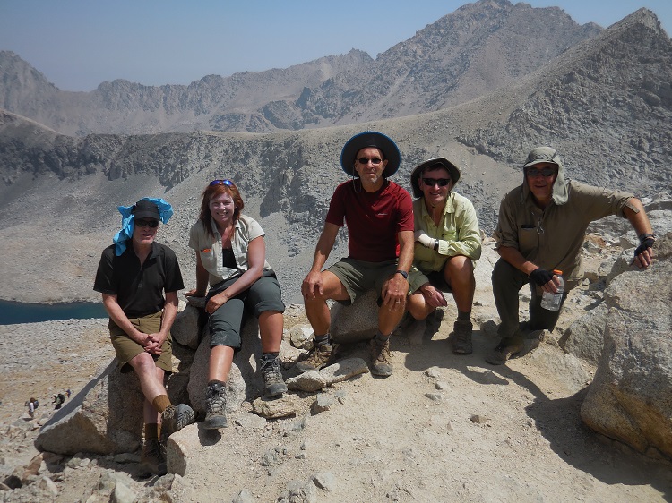
Guess who’s here!?! Arkansas Tim and Tony!!! I was so excited to see my old trail friends!  But I quickly noticed they were one short, “Where’s Robert?” Tim told the story of how his knee got worse after tweaking it coming down Pinchot Pass and he had to exit. They’d gotten to LeConte Canyon yesterday and hiked Robert out to Bishop over Bishop Pass today so he could get medical help. Having hiked their friend out over a brutal pass, sharing the weight of his gear and their day packs, and then back to LeConte Canyon in one day, they were physically exhausted, emotionally drained and worried about their friend. But there’s a hiker code: you do what you can for your injured comrades-in-boots, but in the end you have to hike your hike.

It made me sad to hear the bad news and missed Robert’s big happy smile and his familiar “you just never know who you’re going to meet out here” greeting. Knowing that fit, tough Robert – the happy-go-lucky workhorse of the group –  had to exit the trail was another reminder that this endeavor is no joke.day 13 pinchot and mather sign

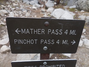
They invited me to camp with them so I excitedly pitched my tent and ate dinner with them.  And while we shared stories of trail challenges and triumphs, the concern over our friend’s  health hovered in the air like a heavy fog.

(Oh and-Tony confirmed that mumbling, Specifically-Orinda guy was right, it was the Golden Staircase I was descending. How did I not know that?? *Sigh*)

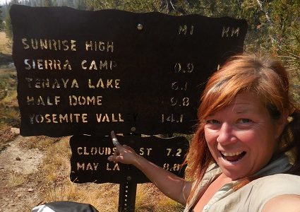
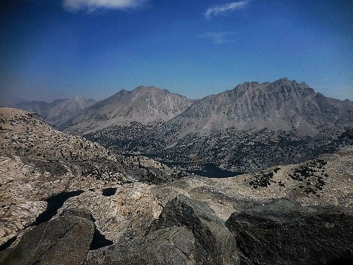
I’m relaxing in my tent now, getting ready for bed and studying my maps.  Tomorrow will be a tough day: 7.9 miles to Muir Pass. (7.9 TOUGH miles, I KNOW this one won’t be easy… see how I’m reversing the psychology on this one?? I hope it helps!). Then on to Evolution Basin and Muir Trail Ranch (MTR) for my next resupply!!!

I had a low point today coming down the endless 4000’ Mather Pass Golden Staircase (more like “Staircase of Hell”) where I was bored with being out here and ready to be done. I don’t want to quit, but I wouldn’t mind picking up the pace to get out sooner than 30 days. I miss Capone terribly and I worry about him being at puppy camp all alone. I miss my bed. I miss showers. I miss not having every inch of my body ache or burn or pulse in pain. Maybe I was just a little tired and lonely and I was reacting to all the negative people I ran into. Being with Tony and Tim has made me feel better. All in all, I’m happy to be here and tomorrow is another day…

Sidenote: A thought I had on the trail today after the Golden Staircase:

Ahhh,  I’ve descended to 8700’!   I’m speeding along the trail and the little hills, my muscles feel less fatigued and I can breathe!  I mean REALLY breathe!  I feel like Super Woman! I can do anything at 8700’!!!

I can only imagine what it will be like when I get home to sea level! Watch out Bay Area. When I get home I’m gonna go on a huge Oxygen bender.  I’ll be sucking in all that thick sea-level ‘O’ the Nine-Two-Five is known for! Oh yeah! My lungs are jonesing for a big whiff of that good stuff! I’ll be running the streets  and doing cardio like a mother-fucker! Watch out Bay Area, here I come! 

Yeah- the trail gets boring and you find interesting ways to amuse yourself! 🙂

Glen Pass: I Met my Match

Day 9: Kearsarge Lakes to Rae Lakes via Glen Pass

(August 25)

6 am: Brrrr.. what a cold night.  I woke up to ice in my water bottles, so the temps dipped at least into the 3os, if not the 20s.  Even my legs were cold with my midweight merino wool base layer, which is rare. Every time I woke up to feel cold air crushing against my legs I thought something had to be wrong.  Is there a hole in my sleeping bag? Did all the down somehow leak out? This morning I realized the gray side of my Thermarest was facing the ground, instead of up. I don’t know if it’s my imagination, but it seems to really make a difference. Maybe the gray side is some kind of heat barrier?   I’m not sure, but even with the cold I got a decent night’s sleep thanks to the Advil PM I bought yesterday,

I’m still snuggled inside my tent waking up with my strong black coffee, anxious for the sun to warm me as it glides above the eastern peaks and paints the Kearsarge pinnacles in brilliant morning hues.   There’s a chorus of birds awakening to a new day of life in the mountains.  Some are ear-insulting yawpers that pierce the morning air with shrill squawks, some whistle dainty tunes accenting the stillness of nature and then there is my new favorite: what I call the “pew-pew-pew bird”. I usually only notice it in the afternoons but this morning they are wide awake and busily pew-pew-pewing away in the trees behind camp.  It always reminds me of kids playing Cowboys and Indians, shooting play guns: “Pew-Pew-Pew. You’re dead par’ner”. Or Sheldon Cooper from Big Bang Theory when he’s doing the same. It amuses me how a bird can make a pretend/ cartoon gun sound.

Kearsarge Lakes
Morning at Kearsarge Lake

A loud pattering sound rushes above my head, like helicopter blades cutting through the still morning air. What the he… Oh, it’s ‘that’ bird again.  There’s one bird that has the loudest wing flapping ever and it always sneaks up behind me furiously flapping it’s wings, causing me to shriek out loud and nearly jump out of my hiking boots. It sounds like someone – or something –  is running up behind me.  This is the second time on the trail it’s gotten me,  and I nearly have a heart attack every single time.

As usual, I can smell the raging forest fires not-too-far from the trail churning out ash and soot, blanketing the distant peaks in a thin haze.   As much as I’m looking forward to my rest day at Rae lakes tomorrow, part of me wants to move on: I remain optimistic that I will eventually hike out of the smoke.   But I desperately I need a day off. I have to rest…

Dusk at Rae Lakes

Fuck today. Fuck the stupid mountains and fuck Glen Pass. Next time I think, “Oh it’s going to be an easy day”, I’m just going to reach right up and slap myself. I really have to stop thinking that, it only sets me up for disappointment and agony.  Just face it: there are no easy days on the John Muir Trail (they don’t call this the toughest part of the PCT for nothing).Glen Pass on the John Muir Trail and Pacific Crest Trial

I swear, the map made it look too easy. I was expecting a 7-mile day with about 1200’ up an d 1300’ down a small pass I’d barely heard of (I think it was closer to an excruciating 2000’ up and down). So this morning, I cheerfully left my perfect camp on the shores of the serene Kearsarge lake and its majestic Pinnacles glowing brilliant shades of orange, wondering what I’d do with my afternoon since I’d reach Rae Lakes so early.  I hiked toward Glen Pass, sluggishly climbing what felt like about 800 feet, feeling optimistic. Cool, I’m halfway there! And I climbed and I climbed and I climbed.  I finally saw a pass and felt relieved to be nearly done. But then Mother Nature played her most cruel joke yet: Psych! As I climbed closer I saw a giant bowl carved out of the scree mountain on the other side. Wait, that can’t be the pass. There should be nothing but air and sky on the other side. Not MORE mountain.  NO! NO! NO! 

With my morale fading, I inched toward the stupid giant granite bowl and spotted another pass up a bunch of switchbacks above it. So I climbed and I climbed and I climbed. Up massive rock-steps and narrow screed trail, mentally kicking and screaming like a petulant 4-year-old who can’t have her ice cream. No, no, no! This is supposed to be the top dammit! I’ve gone at least 1200’. I just know it. Wah, wah wah.

As I slogged past the massive bowl toward the pass, all sweaty and tired and whiny, I realized how spoiled I am – how spoiled ‘we’ are: life is just too damn convenient for us.  In our everyday lives, everything we could ever need or want is within arm’s reach, a short drive or just a few mouse clicks away. In nature, nothing is convenient. Out here you have to work for even your basics of survival: food, comfort, warmth – and Glen Pass.  My Mt. Whitney mantra echoed through my brain: “If you want it, you have to earn it.” Hike on Whiner Girl… glen pass nobo

My philosophical sojourn didn’t do much to soothe my agony and as quickly as those thoughts entered my mind they left again, leaving me to face the beast that was ripping me to shreds. mind, body and soul.  My hate for Glen Pass consumed me. Fuck you Glen Pass and your cruel, sadistic self: toying with us mere humans who assumed you’d be so easy to conquer. Who the hell are you anyway? I never even heard of you til a few days ago. Some little un-famous pass: you were supposed to be easy. Fuckyoufuckyoufuckyou.

As I lumbered along the slippery narrow ridge of the uninspiring bowl I kept sneaking peaks at the saddle above… Ok. Well at least the end is in sight. Just hike. One foot in front of the other. Don’t stop. Move forward.

At last, I crested it. NOOOOOOOOOO!  My heart sank and I felt a giant lump in my throat:  THAT wasn’t the pass either. Ohmyfuckinggod.  How many false summits can a single pass have?  I seriously felt like I was going to cry.

Fighting back the tears and the frustration and the pain, I labored along using my trekking poles to boost my full pack and me up giant rock step after giant rock step.  I went up and down and up and down again, nearly sliding off the edge of the slippery trail as I trudged over every size rock imaginable from the giant 2’ high boulder-steps to scree, to baseball sized busted granite that rolled under my feet and threatened to send me plummeting into the bowl of death.  In my fatigued and frustrated state, I was clumsily tripping over my trekking poles, stumbling, barely catching myself before falling to the ground. I hiked on: hating the mountain, hating the trail, hating my current state of misery.

glen pass
Glen Pass

And then I realized: it’s not the Glen Pass’s fault.

The mountain is just being a mountain. Innocently and cluelessly sitting there like it has for millions of years, doing its mountain thing.  It’s not Glen Pass’s fault we humans have gotten so far removed from nature that climbing him is worse than getting all my teeth pulled without Novocain, getting stung by an entire beehive, being forced to listen to “Happy” by Pharrell Williams over and over again and getting run over by a Mack truck all at the same time.

So I turn my frustration to Tom Harrison; cursing his map for making it look so deceptively ‘easy’ – fooling me again!  Fuck you Tom Harrison, why don’t you learn how to make a map! (No offense Mr. Harrison, I’m sure you’re a very nice guy.  And you are a fine map-maker). (*smiley face*)

Then I realize it’s not Tom Harrison’s fault.

And I curse myself for my lack of attention to detail and not reading the topo lines right. Why don’t I try harder to read those stupid little brown lines that are all scrunched together? Why don’t I actually count them instead of guestimating so I won’t be surprised every time I encounter a challenging pass?   Only on the trail has my stupid perpetual optimism turned on me:  It’s going to be an easy day!! Woo- hoo, isn’t this great. Yay, let’s climb another pass!!! Fuck myself! from here on out every day, every pass is going to be really fucking hard!

Then I cursed the JMT and PCT hikers who have written about the trail: why haven’t I  heard of this sadistic pass before? Here I thought this little not-famous pass would be of no-consequence; it doesn’t have the notoriety of Forester, Muir or Pinchot – or even Kearsarge. So when I was mentally preparing myself for the climb today I thought, how hard can this little not famous pass be? Glen Pass NOBO

And then a terrifying thought struck me: what if they’re all like this? What if all ELEVEN passes are steep and rocky and go on forever with false summit after false summit? What if it’s never been mentioned because it’s just another excruciating pass in a string of excruciating passes?  Nearly in a panic, the comments of all the SOBO hikers I met on Forester came flooding back: “what an easy pass”, “Forester is my favorite pass”, they cheerfully exclaimed as they passed me on their descent.  A panicky feeling fluttered in my gut like an angry wasp hive.   For the first time in 9 days I questioned whether I’d be able to finish the trail. I’m exhausted. My hips hurt. My quads hurt. My hamstrings, feet, toenails and hands hurt (from swinging trekking poles?). And even though I’ve had challenging and excruciating days, I’ve still been mostly positive and happy to be here. But today, for the first time, I’m cranky and miserable. Today was not fun.

Yes, this is harder than I expected. Way harder. I’ve hiked only 65 miles over the last 9 days, but probably climbed and descended more than 10,000 feet without a day off and on fewer than 2000 calories a day (because I STILL have no appetite). I’ve trying to force myself to eat more but the altitude is affecting my appetite (mental note: savor those last 2 sentences, because I’m pretty sure I will never utter the words, “I have no appetite” and “I have to force myself to eat” ever again!). I know from training for the ½ marathon a couple years ago how important recovery days are. But I’ve kept pushing on with a goal and an agenda on my mind,  ignoring the signals my depleted muscles are sending me. And now I’m finally here: Rae Lakes. I’m not sure one zero is going to do it. We’ll see…. DSCN0218 view from glenn pass maybe

I’m relaxing and stretching in the tent now. In my bed clothes eating trail mix. I’m too tired and not hungry enough to cook (again: savor that sentence!). There’s a sign at the bear box warning of bear activity in the area so I expect to get a visit tonight. I hope not, I just want to sleep forever….

When I was setting up camp I met my neighbor Michele, from San Francisco. She’s hiking SOBO from Red’s Meadow. She said tons of people are bailing because of the smoke. The trail is going to be quiet. And soon my only other NOBOers  – my Arkansas friends – will be days ahead of me.  The next few weeks will be interesting.

Ok, it’s early, but I’m going to try to take a nap and maybe get up and cook dinner later….Tomorrow will be a better day…

**SCROLL ALL THE WAY DOWN PAST COMMENTS AND CLICK TO READ THE NEXT POST! ***

Forester Pass: A story of Life and Death

Day 6 Tyndall Creek to Vidette Meadow via Forester Pass

After leaving the granite cirque and my peaceful creekside oasis, the trail led me across a maze of streams that seemed to flow in every direction, past tarns of all shapes and sizes and through more rock fields and high sierra meadows. It was almost hard to believe California is in it’s 4th year of drought, with the amount of water there.

When I reached the foot of the Kings-Kern Divide I craned my head back and searched for the notch I’d be crossing. I couldn’t tell where Forester Pass was exactly. To my right was a wide saddle but the trail didn’t seem to go in that direction. The only other notch was far to my left at about nine o’clock and that seemed disconcertingly  far away: the map showed 4.7 miles from camp to the pass and I’d already come at least 3.  Oh well, sometimes you just have to move forward and trust that the trail will get you where you want to go.forester views 2 reduced

I turned around scanning the basin toward Tyndall Creek, now below me, searching for my Arkansas friends.  All morning I’d been thinking: they have to be behind me, they like to take their time over morning coffee, so they can’t be ahead of me already.  But they’re faster, so they would have caught up by now.  And then I’d get worried, maybe they decided to move on over Forester Pass last night.   That thought depressed me a little. I like having trail friends that I can run into now and then. If they crossed Forester yesterday I may not see them again, they’d be nearly a whole day ahead of me… With hope I’d see my friends again, I hiked on.

Ok, here I go!  I excitedly began my ascent up the rocky trail neatly carved into the mountain, anxious to get my first real JMT pass under my belt!  Forester Pass is 13,145 feet. Looking up at the top of the ridge, I guessed I was at about 12,000 and it didn’t take long to feel the now-familiar heaviness of high altitude climbing.   Adding to the fatigue, this time I had my 35-ish pound pack strapped to my back. Ok, easy does it. Slow… baby steps.forrester pass trail not my photo

The climb was slow, but Whitney taught me to honor the challenge and take my time; that it’s ok to reach the top one baby step at a time. With heavy legs and pack, I trudged higher; zig-zagging up the mountain, one switchback at a time.  It was getting warmer and I was constantly wiping sweat from my forehead, catching it before dribbling into my eyes and burning. I need a bandanna. I’m going to buy a bandana when I get to Independence.  This one little thought started an internal battle that kept me amused for several agonizing switchbacks:

Critical Self: But you have a bandanna, you don’t need another one.

Wanting a bandana self: Yeah, but it’s the Scottish one that we brought to signal other Facebook people we’re part of their group and it’s bright yellow and red.  I’m not wearing THAT thing on my head. I want a blue one, to match my eyes…

Critical Self: But we have a million blue bandannas at home and we purposely left them behind. Remember, we’re counting weight here!

Wanting a bandana self: Seriously? How much does a bandana weigh? Like a tenth of gram? Stop being a gram weanie!  Besides I’ll be wearing it on my head, not carrying it.

Critical self: Ok fine, you can get a blue bandanna in Independence. 

Wanting a bandana self: Thank you. Geesh, was that so hard? 

After my argument was settled, I kept my mind occupied by making a mental list of all the things I wanted to buy in Independence: Kettle Salt and Pepper potato chips, Tylenol PM, a few gallon Zip-Locs for garbage and stuff (somehow I seemed to have a shortage) – I wonder if they sell them individually? I don’t need a whole box. And fruit. Hopefully I can find fresh fruit.

Inching higher and higher and still searching for the elusive Forester Pass, I encountered a metal sign attached to a giant boulder off the side of the trail.  Not wanting to interrupt the momentum I had going, I pushed forward. But several feet past it, the curiosity overwhelmed me and I had to turn back.

It was a memorial to the men who built the trail, and specifically, 18-year-old Donald Downs who died when a boulder came loose and crushed his arm in 1930.  I took a minute to let that sink in; realizing that I take these trails I love for granted. I never think about how much work and sacrifice went into building them. This mountain is no joke, and almost 100 years ago they were blasting it out with sticks of dynamite and moving these car-sized boulders with brute force (and maybe mules?).  To realize that someone died so generations of hikers can follow in John Muir’s footsteps (sort of) was pretty sobering. I was glad I stopped. It felt like a small way to pay homage to the people who made – and those who maintain – the trail that I feel so honored to be on. Thank you Donald Downs. And thank you California Conservation Corps (CCC) and all the volunteers who keep the trail safe for us. forrester pass trail not my photo2

Many, many, many, many, many, many (yes, that many!) switchbacks later, I finally spotted the pass- or what I assumed to be the pass… Are you kidding me? How am I supposed to get up THAT? It rested just above a narrow slit that ran perpendicular to the ridge and looked like a deep ditch slicing it in two. Am I going to have to climb all the way down and then back up that? Ok, this is going to be interesting…forester reduced I was relieved when the trail curved toward the head of the slit, not down into it.  I spotted a narrow shelf cut in the nearly vertical mountain as I entered a dark cool alcove just a few hundred feet below the pass.  It felt like being behind a waterfall, without the water.  I crossed the head of the steep, jagged ditch that cut a thousand feet down the mountain.  As I exited, voices from above were cheering me on, “You’re almost here. You’re doing great. See you up here!”   I couldn’t see them, but I heard them loud and clear.  I was elated to be so close to the top and excited for the camaraderie that awaited me. I climbed a small set of switchbacks that took me up the final stretch and spilled me onto the pass. Forester Pass! I’m here!

It was buzzing with activity. There were five, or maybe six guys sitting around enjoying the victory. After doing a couple three-sixties to absorb the views that lay behind – and ahead of me –  I searched for a suitable place to squeeze my butt and pack in on the very narrow landing.  I finally settled on a pile of lumpy rocks.  The group cheerfully welcomed me and introduced themselves. One group was from Nevada City, just a couple hours from me and the others from the east coast, I think. We had a good time sharing trail stories, talking gear and eating trail mix.  I love summit parties!

I stretched my stiff achy hamstrings and quads and then sat back and relaxed as much as I could with a bunch of rocks up my butt.   I’d been there maybe 20 minutes when the steep southerly trail delivered another hiker.  Robert!  It’s Arkansas Robert!   Where the heck did he come from? I didn’t see them coming up the trail…

forester view from top reduced

“Robert!!! Hi!” I beamed at him, excited to see my friend.

“I need a minute,” he answered with a shaky voice and headed up away from the rest of us.  He was clearly having a moment; this wasn’t the happy jolly Robert I’m used to seeing. I figured he was having a flood of emotion like I had summiting Mt. Whitney. This stuff can be pretty powerful.

Later I learned that he’d climbed Forester Pass before.  It was the summer following the last big wet winter California had.  That year, Mother Nature dumped so much snow on the Sierras that hikers encountered snow well into late summer. The Sierra/JMT hikers who were out tell stories as if it’s ancient folklore: “Back in the Big Snow of ’10 parts of the trail were covered with snow until August and we had to crampon up the passes and glissade down them. Yep, there was even snow at Guitar lake in July! AND we had to cross 2 bridges in 12 feet of snow, barefoot to get there!” (Ok, I made the last part up.)

After the rest of the Arkansas Four arrived, Robert rejoined the group and told us his story of the Big Snow of ’10: “I was coming up this pass,” he started, nodding toward the trail from which he’d come, “and it was still buried under a bunch of snow. It was icy and slick. A lot of people had gotten off the trail because it was too scary. But for some reason, I forged ahead. I was near the top, right down there,” he said pointing to a spot near the big scary slit with his trekking pole, “and lost my footing. I slid so far down… I don’t know how, but I caught myself.  In those few moments, I really thought I was going to go all the way down. I thought I was a goner.” He paused for a few minutes and I could see the emotion in his face, “and coming up here today, I wasn’t expecting it, but it all came flooding back…” His voice was shaky and his eyes were a little misty. “Whew. I’ll tell ya, I’m sure glad to be here now!” We were silent as we listened to Robert’s story. A single word crossed my mind listening to his story and reflecting on the memorial I’d passed on the way up: Respect. These mountains demand our respect. Snow or no snow, it can be a dangerous place.forester views 3

The summit party got even better with my trail friends there. It was good to be reunited with familiar faces. The others left and we had the pass to ourselves: lounging around for a long time sharing trail mix and snapping photos.  I found out they’d stayed at Lake South America last night where they found a remote and picturesque lakeside spot that sounded perfect.

forester group pic
Arkansas Four and me (with Zinc Oxide all over my face.. geesh)

We spent the afternoon hiking together toward Vidette Meadow. Descending Forester pass we were immersed in soupy-thick smoke. The expansive views were diluted and cut off by a wall of yellow smoke: but displayed before us were vast glacial bowls and cirques dotted with patches of subalpine greenery and gloomy charcoal gray tarns sweeping toward the north. The air quality was the worst it had been since it rained ash at Crabtree Meadow.  Feather light shreds of burnt forest – some as big as a quarter –  wafted down upon us.  I felt a slight burning in my eyes that wasn’t sweat and my breathing was a little more labored than it should have been (we were descending!). It was so bad that some of the SOBO hikers we passed had bandannas over their noses and mouths trying to filter the polluted air. I guess this will go down in trail lore as the “Smoky Wildfire Year of ’15”.

By 3:30 we’d descended into Vidette Meadow Valley and the smoke wasn’t as bad.  Around mile ten, we found a big clearing with a bunch of sites next to a small creek and there was some discussion amongst the group about camping there. After exploring the area and finding lots of options for camp I dropped my pack and decided to call it home for the night.  I was hoping the guys were done too and was a little disappointed when they decided to move on.  I was enjoying their company and didn’t want it to end.

Yesterday at Wallace Creek, in their characteristic respectful way they’d invited me to camp with them. Tim was the first to offer, “we don’t want to infringe upon your independence in any way and we want to honor your solo adventure, but we want you to know you are more than welcome to camp with us…”  I was so appreciative of the offer  – and the way he presented it. This is why I love backpackers – we just ‘get’ each other.

But today, I was being characteristically stubborn and maybe a little pig-headed.   I thought that by staying with them, I’d be giving up something; latching on to men for comfort.  And I didn’t want to do that. That’s not who I am or why I came out here. I’m doing this alone dammit! I must do it alone!  So I dropped my pack and boldly proclaimed. “I’m home for the night.  I hope to run into you guys again.”

We said our farewells and as I watched them disappear around a bend into the thick forest, I felt my stomach sink and then a flood of loneliness swelled inside like a noxious gas.  I just stood for a few minutes in the big barren clearing, all by myself, in complete silence for the first time since ascending Forester Pass. I shrugged it off, picked up my pack and headed into the woods toward Vidette Meadow which by now was glowing vividly through the trees beneath the afternoon sun.

With boots off and feet soaking in the cool water, I looked back at the contents of my pack scattered about, ready to set up camp.  I got an uneasy eerie feeling being so deep in the trees and realized I didn’t really like the spot I’d chosen.  I didn’t want to be there… “Fuck this,” I said out loud, pulling on my socks and boots and leaping up to pack up and go find my friends. I’m not sure if I just needed an excuse or if I really just didn’t like the spot, but once I got back on the trail, I was excited and I comforted myself about my decision as I hiked along:  It’s ok to not want to be alone. This doesn’t lessen my experience or make me any less independent. Some company tonight will be nice…  

The two miles of trail between my almost- campsite and my friends’ camp was easy and quick.  And about half a mile in I stepped over a giant pile of fresh bear poop. I knew I didn’t like that site or a reason. There are bears here!

Within an hour, I again emerged from the woods and appeared on the edge of the camp of four friends from Arkansas.  They were clearly surprised and seemed genuinely happy to see me. “Yes, of course, we told you – you are more than welcome to camp with us! Find a spot to pitch your tent and come join us for dinner,” Tim said as I approached them asking, “hey is there room for one more?”

dear near vidette for blogh
nice buck near Vidette Meadow

After pitching camp, taking a hiker bath down the creek away from camp and filling my water, I joined them for dinner. We had a good time telling stories and watching the dear in the meadow over dinner.

Excerpt from my journal that night:

It’s been dark a while. I stayed up late enjoying the company of fellow backpackers and hearing their many stories of adventure.

I’m inside my tent now getting ready for bed and feeling veeeeery relaxed.  Someone I may or may not have met on the trail may or may not have given me a Xanax to help me sleep (in case the DEA is reading this, I don’t remember what they looked like and I didn’t get a name) :-).  I think it’s already kicking in… I hope to sleep tonight.

It was a good day!

Tyndal Creek Camp – Night 5 on the JMT

Day 5, August 22, 2015

Tyndall Creek- Sunset

I love it here! I feel like I’m in a Star Trek episode: beamed onto a friendly alien planet where I get to explore the desolate moonscape-like terrain. My only wish is that this planet were free of the thick yellow smoke that hangs in the air so I could see the craggy mountainscape off in the distance. Oh well, it could be worse… I could be home in front of the TV dreaming of being on the trail! No need to beam me up Scotty, I’m good.

tyndall creek camp smaller
Smokey views from Tyndall Creek Camp

After hiking all day, trekking past a couple of small lakes and finally reaching the twisty Tyndall Creek which I had to cross multiple times, I found the few worn-down-to-the-dirt camping spots crowded together in the conifers on the left-hand side of the trail.  I’m here! I made it!  However, the vast and untouched boulder-strewn landscape that surrounded me beckoned to be explored; so I moved on. Being confined to that tiny area with everyone else isn’t exactly the wilderness adventure I came out here for.

I ventured up the trail and to the right, searching the several hundred feet of rocky terrain between the trail and the creek for my new temporary home. To my dismay, I was confronted by a string of “No Camping: Closed for Restoration” signs for at least a ½ mile.  It seemed that no matter how far I hiked with my tired legs and heavy pack, I couldn’t escape the signs. Determined to find my own private piece of heaven I crossed the shallow, gently cascading waters of Tyndall Creek and headed toward the trail that leads to Shepherd Pass.

I easily reached the other side and did a quick visual scan: No signs! Awesome! I guess most people don’t bother to cross the creek to camp so no need for restoration.   Treading lightly, I conscientiously searched for a spot where I would leave the smallest imprint to call home for the night.

When planning for this hike I saw Facebook posts, books and articles advising on the best camping spots on the trail. I scoffed at the idea of camping in worn out back-country campgrounds.  For me, doing the John Muir Trail was about experiencing “true wilderness” as much as possible – much like John Muir did (despite the crowds I knew I’d encounter).  My imagination led me to virgin spots where I could experience the natural, untouched solitude of life on the trail. Huddling in dusty camper corrals with everyone else, where a million people have camped before isn’t how my adventure played out in my imagination.  I suppose that goes against my self-proclaimed Leave-no-Trace (LNT) Nazism a little bit, but I’m diligent and step carefully. I’m determined to enjoy unspoiled lands and leave no visible sign I was here for the next adventurers who seek the same.

Morning views Tyndall Creek camp

And now camp is set up more than 100 feet from the creek tucked away in the field of boulders of every size and shape, closer to the Shepherd Pass trail than the JMT.  I pitched my tent on crushed rock,  doing my best to avoid the short yellowish-brown tufts of grass that would be crushed underneath my weight. When I leave no one will know I was here.

I’m absolutely exultant. This place is magical, awe-inspiring, breathtaking and profoundly serene.  I can’t wait to wake up to clear blue skies and the morning views that await. Like every other night out here so far, I’m optimistic that tomorrow I’ll wake up to another smoke-free morning. The smoke wasn’t as bad today as yesterday, but I saw it, still flooding the Crabtreee Meadow valley as I crossed Bighorn Plateau.  I’m keeping my fingers crossed that it will only get better as I travel north.

The easy 8 mile day I thought I was going to have today turned out to be not–so-easy.  I’ve made up my mind: the Tom Harrison Maps LIE! They lie about mileage and they especially lie about elevation. I swear I didn’t see all the elevation I climbed today on my map. I guess it could be I’m just not very good at reading those tiny little topo lines that are supposed to represent 40 feet intervals. 40 feet my ass – more like 4 HUNDRED feet.   So I hiked mile after mile after mile this afternoon thinking, I should be there by now. Where is Tyndall Creek? Did I pass it already? Did I miss it somehow? Am I even on the John Muir Trail? Pulling out my map every mile or so to make sure I hadn’t missed an important turn off or walked right by my destination.

In my frustration I half-jokingly came up with a new business idea: I’m going to create my own maps.  On my maps, all elevations and mileages will be exaggerated. For example:  when you study your map to plan your day you’ll think you have  12 miles and 2000’ elevation gain to get to your destination,  but it will actually only be 8 miles and 1000’.  That way, you’ll be ecstatic when your destination is so much closer and easier than you expected! I’ll call them the “Surprise and Delight” maps with the tagline:  “Hike further with less effort.”  I know this “brilliant” idea is completely ridiculous, but it kept me amused on my alleged 8 mile hike today. dnner at tyndall creek

The truth is, hiking is still hard. I’m still at 11,000’, my pack still weighs close to 40 lbs., I hiked 8 miles and a couple thousand feet today, and I’m 48, not 28.   Stuff hurts!  When will I earn my hiker legs? Day 7? Day 14? When??? Soon, I hope.

After meeting up with my friends from Arkansas at Wallace Creek today, I decided they need trail names.  When I wasn’t trying to figure out how to launch a new business of fake maps, I spent much of my afternoon trying to come up with fun monikers for each of them.  But in the end, the best I could do is a collective trail name: “The Arkansas Four”. I know, not very original… but I didn’t have the creative energy to name each one as I trudged up and over mountains carrying the ill-fitting pack they helped me adjust a little better at lunch. That led me to ponder how boring trail names would be if they were just the city or state we came from. I’d simply be “California” But there are lots of people from California. So maybe “Concord”- or “California number 15044”. Yah, I’d need to come up with something more creative for the Arkansas Four.

When I arrived at Tyndall creek I kept an eye out for the Arkansas Four, but didn’t see them. They must have gone on to Lake South America.  In a way I was relieved (even though, I have to admit, I found myself eagerly searching every campsite for them). I had mixed feelings about running into them; I came to do this alone, I didn’t really want to have to make the decision to camp with them or not.  This is better.

I met my first woman solo hiker today! I was ambling down a wooded trail somewhere between Crabtree Meadow and here when we crossed paths. I was so excited to see her that I  practically lunged at her and shrieked, “You’re Alone!?!”  She looked a little surprised (frightened?) and took a step back, probably thinking I was some wild old- lady lunatic. I realized it’s probably best not to greet solo female hikers in the middle of nowhere with what could be translated as: “Are you alone, little lady???” (insert malicious sneer). I guess she was convinced I didn’t have plans to eat her for dinner and stopped to chat with me a bit. She was half my age – if that – and didn’t seem nearly as impressed with the whole solo-female hiker sighting as I. She left Happy Isles 16 days ago and is finishing out of Whitney Portal tomorrow. Oh, the speed of youth! Anyway, I was thrilled to finally see my first solo female through-hiker. I hope to meet more.

***

Alpenglow from Tyndall Creek

I’m back from the creek now where I took a quick hiker bath and filled my Camelback and Nalgene bottle. The water is cool and crystal clear and fresh.  I’m not going to bother treating the water in my Nalgene. I’m pretty high up and the water is flowing enough.  I’ll mostly use it for making coffee and oatmeal and brushing my teeth in the morning anyway. Dinner is done and my Soloist pot washed. I’m enjoying my tea, sitting on a boulder soaking in the alpenglow views on the peaks to my north and east. How do I describe this most utopian and peaceful moment? Perfection.

Tomorrow is Forrester Pass- my first JMT Pass!!! A 5 mile, 2300 foot climb (or so Tom Harrison claims!) and then only 2-3 miles to my next camp somewhere in Vidette Meadow I think.  I’m not really sure yet, I’ll see how my day goes… From there it’s on to Kearsarge Pass and Independence for my first resupply. Wow!  It looks like I may end up there a day ahead of schedule.  I finally fit all my food, toiletries and first aid items in my bear canister this morning and now I have to fill it up again in a couple days. That means one thing: I better eat up!

**SCROLL ALL THE WAY DOWN PAST COMMENTS AND CLICK TO READ THE NEXT POST! ***

Day 4 – Climbing Mt. Whitney

Day 4: Thursday, August 20

It’s 5:20 am and I’m huddled in my sleeping bag inside my tent sipping  coffee and soaking my oatmeal with dried raspberries.  It’s still too cold to be outside. It was a chilly night but I stayed warm inside my bag with just my base layer and beanie. My guess is it’s about 40 degrees out now, even though the tiny key chain thermometer  I picked up at the last minute while standing in line at REI says 48 – I don’t believe it.

For the brief time I was outside to retrieve my bear can and stove I noticed the last of the nighttime stars earnestly fighting to keep their place in the morning sky against the imperious rising Sun. I was relieved to see them – that’s a good sign it’ll be a smoke free morning.  I thought about hurrying and hiking in the dark to get an early ascent on Whitney but I hear coyotes howling and the trail to Guitar Lake is in the woods. Dawn is not a time I want to be alone in woods. Starting my day as prey to pack of wild hunters is not how I envisioned my 4th day on the trail going for me.

The Starbucks Via’s bold French Roast flavor and jolt of caffeine are warming my insides and waking me up. I’m preparing my backpack for the day’s climb, tightening all the straps to make it smaller and more compact and filling it with what I’ll need for the day: Mary’s multi seed crackers and Justin’s Almond Butter for lunch, a couple of Lara Bars, Gorp, Orange Stinger Energy Chews and Nuun tablets for electrolytes and flavor. I’m also packing my rain jacket and pants, headlamp, first aid kit, Swiss Army knife, SPOT, phone, journal, map, and my Tyvek ground sheet. I’ll wear my down jacket since it’s still cool. I think that should give me all I need for the day and in case I fall off a cliff and need to survive a couple days before Search and Rescue finds me….

Guitar view heading into guitar lake smaller 1000 px
View heading toward Guitar Lake on the JMT from Crabtree Meadow

7:30 am at Guitar Lake

Where the hell is Guitar Lake? I’ve done at least 3 miles, I should be there by now.  I was growing impatient that the trail seemed longer than I thought it should have been. But I quickly forgot my frustration as I hiked out of the tree line and into the land of majestic granite mountains and peaks jutting toward the sky.  I strained my eyes – and my neck – to find the peak I’d be conquering. Honesty I had no idea what I was looking for.  This is where I usually regret my lack of attention to detail and planning. It would’ve been nice to know what Mt. Whitney actually looked like.  I expected to see one giant peak rising high above the rest, but that wasn’t the case. Everything around me was giant!  All I knew was there are jagged ridges and a hut somewhere near the top, but from my angle I couldn’t distinguish Mt. Whitney from anything else in the vast range that lay before me.

Heading toward Guitar Lake from Crabtree

As I continued up toward the expansive granite sierras I was still searching for the elusive Guitar Lake. Another small hill to climb. Please let Guitar Lake be on the other side of this ridge. I reached the top of the hill and breathed a sigh of relief: there it was.  I was looking straight down on a guitar shaped lake. A wave of emotion swept over me as I froze in my tracks. I was awe-struck.  Tears flooded my eyes and my jaw quivered.  I can’t begin to describe everything I was feeling standing atop the little ridge at 11,460’ overlooking Guitar Lake. A jumble of happiness, peace, pride, accomplishment and even a little sadness swirled deep inside me while my mind quickly took inventory of all I’d been through and overcome to get me to this very spot: standing alone on the John Muir Trail overlooking Guitar Lake at the foot of Mt. Whitney.  My eyes devoured the scene before me and I reveled in my aloneness: a tiny speck amidst nature’s enormous beauty. Standing in the silent and crisp morning air as the sun’s orange glow illuminated the gray-white peaks to the West. I’ve reached another milestone.  I am at the famous Guitar Lake. The very place so many of my hiking heroes  visited and wrote about. My heroes- all those people who seemed bigger than life doing things that “people like me” don’t do. And yet here I am. Doing it. 

Guitar Lake
Guitar Lake

I took my first break to shed my down jacket and have a snack before heading up.  I plopped down on a big rock above the lake  writing, nibbling on a peanut butter Lara Bar, sipping Nuun infused fizzy water from my Nalgene, and gazing upon the very same Guitar Lake about to summit the very same Mt. Whitney that before today had only been places I fantasized about.   I let it sink in. I’m here! Pretty surreal.

Later…

Shit got real about a half mile above Guitar Lake: right on cue, at 12,000’.  I became lightheaded and even a little disoriented as my brain sluggishly tried to function normally. My legs felt like oversized granite boulders that instead of doing their job and carrying me to my goal, had to exhaustingly be lugged along.  The thin air felt like a giant invisible hand reaching out of the sky and wrapping its greedy little fingers around my lungs squeezing the oxygen from every cell in my body. Suddenly a climb that felt challenging felt almost impossible. My already slow progress halted to a crawl as I began the slow ascent up what seemed like a million and one switchbacks to the top of the highest mountain in the lower forty eight.

View of whitney and trail

So this is what all the fuss is about! This is why people turn back (usually at 12,000’!).  I pushed on, going slower than a sunrise on a frigid morning. It was frustrating, but it was either go slow or not at all. And I’d made up my mind:  Unless I’m puking my guts out or so dizzy I can’t stand up by myself I am NOT turning back so just keep moving forward, this isn’t a race. I have all day…  One foot in front of the other. You got this. My supportive inner voice was wide awake and doing her best to coach me through as I battled every impatient cell in my body that ached  to go as fast as possible and be done with it. Slow down. This isn’t a race. Take your time.

The trail to Mt. Whitney - last mile
The trail to Mt. Whitney – last mile

I had to stop and catch my breath after every few steps (literally, like 5 steps).  After doing this for who knows how long, I’d sit and take a real break to drink some water and eat a snack which would energize and invigorate me.  Feeling refreshed I’d leap up and forge ahead all Gung-Ho again.  I quickly learned there is no Gung-Ho above 12000 feet. Each time, the thin air would immediately zap the Gung-Ho right out of me. And literally within 10 seconds every muscle in my legs was spent and I couldn’t breathe again.  My stubborn and impatient “fuck it, just push through as fast as possible” self was defeated. I began to accept that wasn’t going to work on this one.  As soon as I tried to pick up the pace Mother Nature’s invisible hand pushed against my chest holding me in place despite my earnest attempts to hike forward.  I could hear her admonishment reverberate through my brain, “this is not your mountain, it’s mine. And if you want it, you will do it my way!”

Fuck!  Ok Mountain you win.

Baby steps…Left foot. Right foot…Just take baby steps. Baby. Steps. Right. Left. Tiny little steps. Step. Step. Step. Just 6 inches at a time. No big steps…

The harrowing Trail to Whitney

And for the next 3 ½ miles and 3000 feet up I was forced to give in to the mountain, dragging my heavy legs one tiny baby step at a time. Repeating to myself over and over and over again: baby steps, breathe, and don’t look up. Nothing matters but the 2 feet of trail right in front of me.  Baby steps: left… right…. left…. right…breathe….  

Whitney Spires
Whitney Spires

After a little while I entered an almost peaceful Zen-like state. My mantra pulsed through me, pushing the pain and the exhaustion and every other thought out of my brain.  Left. Right. Left foot. Right foot.  Left…..Just a tiny step. Just worry about the 2 feet of ground in front of you, don’t look up.  Just another 6 inches – left… right…..left… breathe…

Omg this is so hard. Why are my legs so heavy?  FOCUS: Breathe. In and out, in and out. Right foot…. Left foot….. Right… Left…. Right… 

My impatient self was not digging this baby- step shit at all. Frustrated with my snail’s pace and anxious to be done with this sadistic mountain I’d lift my head and sneak a peek at more than 2 feet of the trail in front of me, totally killing my moments of Zen. How much further is it?  Am I there yet?  FU-UCK!  Am I moving backwards??? Ohmygod. I’m going backwards!!!  The next switchback is actually farther away! Am I walking so slow that I’m actually going backward??? Oh my god I’m in hell.  FOCUS. Baby step. Baby step. 2 feet in front. Breathe.  In and out. In and out. Breathe. Left….right…. Leeeeftt… riiiiight….

And so my Mt. Whitney assent went: climbing up and up and up, dragging my heavy legs, looking no more than 2 feet ahead and moving no more than 6” at a time.   As much as I wanted to rush and have it be over with the mountain demanded: “if you want me you have to earn me…MY way!”

View toward Guitar Lake from Mt Whitney trail

Every once in a while I’d break my 2 foot rule and lift my head to soak in the jaw-dropping views surrounding me. I’d gaze yearningly at the crystal blue tarns below, teasing me with their serene and inviting waters. I’d pass the time fantasizing about diving off the side of the hellish mountain directly into their crisp sapphire waters, washing the salty sweat mixed with zinc oxide and dirty grime off my exhausted body. How I wished I could plunge into the pure high Sierra holy water and cleanse myself of this brutal and unforgiving mountain. Later. I’ll jump in later. I promised myself a refreshing dip in one of the tarns on the way out as my reward. But now. I must. Climb. Baby steps. BreatheThe earth 2 feet in front of me is all that matters – don’t look ahead. Just keep moving these leaden boulder legs up this mountain. 2” at time.

The mountain whispered in my ear,  “If you want me you have to earn me. If you want me, you have to earn me. If you want me, earn me.” Whitney view 20150820_115650

There I was at nearly 14,000 feet, totally exposed, on a trail carved out of the edge of a vast granite mountain, succumbing to Mother Nature.   Understanding that if I wanted to reach the summit, I’d have to do it her way.  Woman vs. Nature. My will to get it done fast versus her will to make me honor the challenge of conquering her. She demanded my respect: “If you want me, you have to earn me.”  I had a sudden and stark realization:  I could learn a lot from this mountain. And up I went, one tiny baby step at a time. 

Whitney feet 20150820_120509
My tired feet at the top of Mt Whitney. Great views!

 11:30 am: The summit of Mt Whiney.

I’m here! I made it!! (Not everyone did, I passed several people on the trail who  turned back before reaching the top- many half my age! This was no joke.)

The last leg of the climb seemed to have no end… The summit hid from view on the other side of a huge field of broken rock with a narrow and harrowing trail blasted into the side of the mountain.  You can’t see the summit until you’re just a few hundred feet away – and before that you just climb and scramble, and climb and scramble- hoping you don’t get a bout of dizziness and tumble 4000 feet down the steep western slope of the mountain.

I’d caught sight of the hut at one point and then lost it again. Where is that damn hut?  And finally about midway up a humongous 45 degree rock slope I felt I was close.  And when I finally reached the last 1/8 mile of the trail and spotted the tiny rock hut sitting amidst giant pieces of broken mountain. , I cried from sheer exhaustion, relief and immense pride.   Another milestone.  I’m here! On top of the tallest mountain in the continental US. I made it!!!  Holy shit, I made it!

Me on top of Mt. Whitney.

Click here to read the next post:  Hanging out on Mt. Whitney