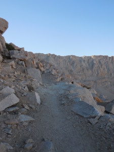
Day 4: 7:30 pm at CrabtreeMeadow BaseCamp
I reluctantly peeled myself away from the top of the U.S. around 1:30 this afternoon and began my 7 1/2 mile hike back to camp. As I descended the rocky summit I immediately ran into familiar faces. First, Robert and Tim, two of the four guys from Arkansas I met early this morning. I’d been hiking along at a good pace and was lost in thought when I came upon their camp in the trees next to the trail. It was one of just two or three camping spots along the creek that flowed from Timberline Lake down to Crabtree Meadow. The men seemed as surprised to see me appear out of the crisp morning mist as I them. They were waking up with hot coffee and leisurely preparing themselves for the day’s climb. Anxious to get to Guitar Lake and begin my summit, I only lingered long enough for introductions and to learn they came from Arkansas to hike the JMT, they started at Cottonwood Pass the day after me and were also headed to Happy Isles! Yay! My first fellow NOBOers.
“You just never know who you’re going to run into out here!” Robert greeted me just yards below the Mt. Whitney summit with his big warm smile. They were resting on a giant rock waiting for their fellow Arkansians who were still inching their way up Mt. Whitney. I was elated to see my fellow NOBOers again and excitedly told them about the brutal climb and my emotional summit. They looked way too relaxed and fresh sitting on that rock, smiling away, nibbling on trail mix. “I really didn’t think it was that bad” Tim said, and Robert nodded in agreement. (Whatever…!). They may be 10 or 15 years older than me, but obviously in much better shape!
We said “Goodbye for now”, knowing the chances were good we’d meet again. I continued down the trail and ran into the other half of the Arkansians, Tony and Lee, not too far away. They didn’t appear quite as chipper and fresh as their friends – looking like I felt during the last steps of the summit just a couple hours before: red faced, out of breath and slowly dragging their booted feet up the mountain 6 inches at a time. They looked exhausted, frustrated and completely over it. I smiled and offered encouragement, “You’re almost there. It’s not too much further!” They both managed to eke out pained half-smiles as they inched past me.
As I maneuvered my way up and down the rocky trail, through narrow passes blasted out of rocks the size of two story buildings and along the narrow path wedged into the narrow crest, the sapphire blue tarns I’d fantasized about on the way up still beckoned. Soon. I’ll be there soon. I passed day hikers who’d breathlessly ask “Are we close?” Their eyes searched me, begging for the answer they craved…
“Yes, you’re almost there… you’re doing great!” I empathetically answered. They’d give me a weak grateful smile as they trudged up the monstrous mountain 6 inches at a time.
Next I ran into Scott who I met my first night out at Chicken Spring Lake. His two female companions were somewhere behind. After exchanging congrats and trail tidings I continued on.

The trail between the summit and Trail Junction is the most harrowing 2 miles of the whole trek. As much as I wanted to rush down (damn my impatience!), taking my time, scouting the trail ahead and watching every step was critical to getting to the bottom safely. On my ascent I thought, it’s just 1000 feet over 2 miles, this will be easy! HA! Sure, the elevation gain isn’t bad, but there are sections where the 12 inches of trail are carved into the 60 degree sloped mountain. That means there was nothing but nearly-vertical slopes of jagged granite above and below me. The fact that I was just one misstep, dizzy spell, or twisted ankle away from sliding down 4000 feet of rock-shards didn’t escape me. If I slip, I’m gone. Period.
I kept thinking, I can’t believe more people don’t die up here. With all the inexperienced hikers, dizzying thin air, slippery slidey narrow trails and the rapid changes in weather how is it possible people aren’t falling off every day? And at one point I even said it out loud to a young day-hiking couple who stopped to let me pass. They looked terrified, “don’t say that!” they half-jokingly scolded. Ok, so maybe it’s not something you say out loud when you’re in the depths of a potentially life threatening situation. Ooops.
As I mulled this over and carefully hiked on, the trail suddenly dropped off into nothingness 10 feet in front of me. What the hell? This can’t be right… I’m supposed to go down THAT? I looked around to confirm I was on the trail: I didn’t see anything else that looked like a trail… But this can’t possibly be right… I’ll kill myself trying to get down that. I didn’t come up this way — did I?? I scanned my memories of the hike up, trying to remember coming up a trail as treacherous as what lay before me… Nothing. There was no such memory. This just can’t be right… ?
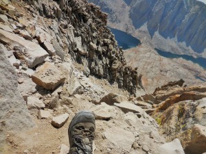
So I halted, froze in my tracks just feet from the edge of an abrupt drop-off, scouting the area, desperately hoping to find another way. After two or three visual passes of the rocky landscape, I spotted the outline of a trail snaking up the mountain above me. Oh thank god. One more step and I’d have been vulture food! Finding a rock trail in a field of broken rock is challenging sometimes! (I took a picture of this moment, see above. It looks like a trail, doesn’t it? –Except for the falling off the cliff part!)
Yes, descending Mt. Whitney was way scarier than ascending Mt. Whitney!
It took me about 90 minutes to reach Trail Junction where I rested before heading down the endless switchbacks to Guitar Lake. As I nibbled a Honey Stinger Chocolate Waffle given to me by a group of young guys from New Jersey I’d met at that very spot on the way up, I wondered where they were. They had flown from New Jersey just to climb Mt. Whitney, but their adventure was ending at Trail Junction. They were turning back without summiting. They were done. Despite taking their time hiking up and acclimating for a couple days, the elevation was making them sick. They offered me their food because they’d been too sick to eat it and they didn’t want to carry it back down. I gratefully took all the vegan options they had; which was four Honey Stinger Waffles. As I savored the sugary chocolaty deliciousness of their discarded weight, I pondered their defeat; it was hard to imagine getting that close to a goal and not finishing… I felt grateful I’d made it.
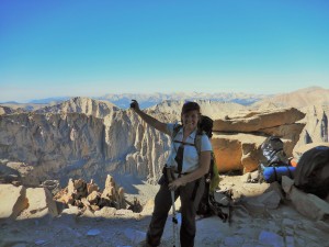
I so wanted to skip merrily down the switchbacks and get to the tarns before the smoke washed out the sun; but skipping wasn’t an option. As I slowly zig-zagged down the mountainside, my strained knee started to throb. The pain that had been tolerable on the climb up became a handicap going down. If I didn’t land on it just right, a sharp pain shot through the back of my knee and up my leg. The Ibuprofen may have helped slightly, but it wasn’t giving complete relief.
Hobbling along trying to ignore the pain in my leg, I welcomed the distraction of meeting SOBO JMT hikers who were on the last leg of their journey. Some had been out 25 days and despite looking dirty, tired and even a little miserable climbing their last peak 6 inches at a time, I could see the spark of elation, pride and achievement in their eyes. I was in awe: they were at the finish line of the journey I was just beginning. (And they were carrying all their gear! I can’t imagine carrying a near-full backpack up to Trail Junction at 13,000 feet.)
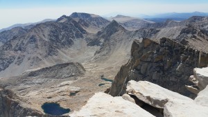
As the hours passed, smoke from the forest fires flooded into the valley obliterating what I suspected were hundreds of miles of magnificent views. I was disappointed: there I was at 13,000 feet, high above giant craggy spires and granite mountains and all I could see were faint outlines through the thick sooty haze. But it wasn’t a total loss: while the wildfires stole my views of vast peaks and majestic horizons, the lakes and tarns directly below took center stage; framed by the ashy vapor spewing from scorched wilderness. Tiny buds of color sprouted around Guitar Lake like wildflowers, as hikers set up camp and pitched their tents, completing the picture before me.
After several hours I finally reached the end of the switchbacks and the trail alongside the tarns I’d so dreamily fantasized about. But they were too far away – at least a quarter mile over rock and mud and I was too tired to walk any more than I had to. On a normal day it might have been worth it. But putting out the extra effort to jump into a freezing cold lake under chilly smoky skies wasn’t exactly motivating me. So I hiked on…

As I approached Guitar Lake for the second time today, I could hear and feel the same buzz of excitement I’d felt coming into Crabtree Meadow last night. Guitar Lake had transformed from the quiet serene place I’d encountered early this morning to another refuge-like camp. It was packed; with tent upon tent and people everywhere. As much as I wished I was done hiking, I was glad I wasn’t staying at Guitar Lake. It was way too crowded (and rocky and completely barren. Where do they all go the bathroom???)
Approaching the crowd I got the community and engagement I didn’t get at the summit. Backpackers!!! They smiled at me, said hello and asked about my summit experience. Many of them were JMTers finishing up the last leg of their journey. Out of the sea of tents, Kat came running toward me. “Carolyn! Hi! I’ve been watching for you since we got here. How was it??? CONGRATULATIONS!!! ”
I met Kat last night at Crabtree as she headed to the outdoor facilities too-close to my tent. She noticed me sitting alone with maps and the contents of my bear can spread on the ground around me and yelled “Hi!” When I said hi back she came closer and started asking me a whole bunch of questions: “Are going up Whitney? You’re hiking the JMT? Alone? Do you have your camp spots mapped out?”
I told her I was summiting Whitney the next day, doing the JMT, yes alone and no, I hadn’t mapped out any specific camp sites. I was playing it by ear and figuring it out as I go. She got all excited and walked into my camp, introducing herself and immediately started giving me tips. She’s about my age and friendly and upbeat. I liked her instantly. We also discovered we live 15 miles from one another in the Bay Area. Small world.
She sat with me marking the best places to camp on the section of Tom Harrison’s maps I was carrying with me. She confessed that she’s always wanted to thru-hike the JMT but hasn’t because her husband isn’t healthy enough, so she’s settled for doing small sections over the years. She told me they were going to attempt to climb Mt. Whitney, but she wasn’t sure he’d be able to make it. I sensed a familiar sadness and regret for the sacrifices she’s made in her marriage. I could empathize.
She gave me lots of helpful information about the trail up to Vidette Meadow. It perfectly augmented the information my friend Steve had given me from his JMT hike. It was good to learn where there is no camping. It would be extremely frustrating if, after a long 10+ mile day, I got to a spot and discovered there was no place to camp.
I was happy to see my new trail friend running toward me, excited to hear all about the summit! We spent several minutes chatting on the edge of Guitar Lake before wishing each other luck in our respective journeys and saying goodbye. 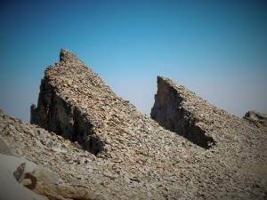
The last three miles went pretty quickly, despite how tired and achy I’d become. I stopped at the creek on the south end of the picturesque Timberline Lake (no camping) to fill my Camelback bladder, soak my tired feet and clean up. It was about 6:00 and the sky was dark and gloomy and the air cool enough that I needed to put on my down jacket. I could have laid down on the soft grass and slept all night. But I had to move on. Another mile and half to go.
______________________________________________________________________
7:15 pm – Ahhhhhh. I’m back at Crabtree Meadows. Exhausted. Happy. Content.
I’m stretched out on my Tyvek sheet leaning against my big rock sipping tea and boiling water for dinner. What a day—a host of emotions, experiences and sights… a lot to process.
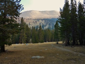
I arrived back to an empty and desolate Crabtree Meadow. Everyone has moved on to Guitar Lake to position themselves for their Mt. Whitney summit tomorrow. There are a few people here, but they’re spread few and far between. I have the whole southern section to myself tonight. What a difference a day makes! It’s quiet and kind of spooky: the smoke is super thick like pea soup, I can’t see anything but the trees immediately before me. The air smells like burning forest and it’s raining ash. I wonder how close the fires have gotten. With the amount of smoke in the air, they feel too close.
What will I do if it gets any worse? How will I know if it’s time to —– Wait… Is that a helicopter? Uh oh, I hear a helicopter and it’s really close… It’s right above me. Oh shit, it just landed. UH-OH… Are we getting evacuated?
Stay tuned…. (to continue reading, scroll all the way to the bottom and click on “Next Post“)
LMAO 😂, I was getting a kick from watching your you tube vidios about boondocking, and found the link about your JMT trip. You had me rolling! Your an amazing person Carolyn, keep up the positive, humorous and emotionally genuine attitude! You go girl🤗 Your a hero!
Charlotte- I love hearing that you’re enjoying my writing AND my videos! What an awesome compliment! Thank you so much! I appreciate you taking the time to let me know. It made my night! – Carolyn
Hi Carolyn,
This is Jeannie from the RTR. I’m loving your blog and so impressed with both your backpacking and writing skillz! Including the mental and emotional parts of the trip along with the physical make me feel really connected to your experience.
How was Lake Mary? Where are you now? How is Capone?
I’m back in the Bay Area working and trying to catch up on chores. Trying to hold on to the relaxed feeling that developed during the trip. Already planning the next one!
I hope we can stay in touch.
Jeannie
Jeannie! Great to hear from you! I’ll reply in an email. Thanks for reading!!
I just found your blog and it’s so real! I love it!! Thank you for writing it. I’m looking forward to “the rest of the story”.
Hi Gary,
I’m glad you found it and very glad you enjoy reading it! Thank you for taking the time to let me know.. comments like yours inspire me to keep writing. – Carolyn
When did you hike? I got smoked out Aug 17. Spent the night at Gilbert lake, just over Kearsarge Pass – beautiful!
You left the day I started. I started at Cottonwood pass on August 17 and finished at Happy Isle on Sept. 11. The smoke was a bit of a bummer, but still an awesome trip! Lots of beauty to be seen!
Loving it.
Thank you Rhea!
Another fascinating episode of a great adventure. Well done Carolyn.
Thank you Brian! 🙂
Yes Whitney is a Bear. I have been up there 4 times, and it has never been easy. Last year, at the summit, we heard a loud crash, sounding like a jet breaking the sound barrier, but as we looked around, a large plume of dust could be seen about 5 miles away. It was a rock slide, and quite a big one. Wondered if anyone was down below there, and moreover, I wondered how often it happened even on the massive structure of Mt Whitney itself. I got some great shots of Whitney and the Guitar lake area. I miss it already, just thinking about it. Eager to read your next post.
Ernesto – Can you imagine doing it when it’s covered in snow? – Or maybe you have…? I can’t imagine what that experience would be like.
And a rock slide – wow! That must have been something to hear.
Being out there sure does change you, doesn’t it? I think about it and miss it every day and writing about it is making me miss it even more… It’s such a special place. When were you there last? – Carolyn
Glad you decided to write about your descent… you seemed iffy about it. I remember hiking down Whitney towards the Portal at the end of our HST thru-hike, and getting a chuckle out of the day hikers who looked and smelled like they had just stepped out of a L L Bean catalog.
David, Yes, true to form, I wanted to jump ahead and be done with day four already! :-p Writing about this journey is as much an exercise in patience and baby steps as the actual hike. But as long as you keep reading and commenting, I’ll keep writing.
LL BEAN!! I wish I had thought of LL Bean, that would have been the perfect brand for the day-hikers in my last post! It’s funny how we all tease day-hikers. I laugh at myself, because I’m often one myself! :-p. Thanks again for taking the time to comment. I enjoy reading them. – Carolyn
Met many of those LL Beanerhikers……..lol
I had a day around Mammoth I think where I went off on them in my head. I have a funny story about that day that I’m looking forward to writing. By then i was wearing my dirt like a badge of honor! 🙂