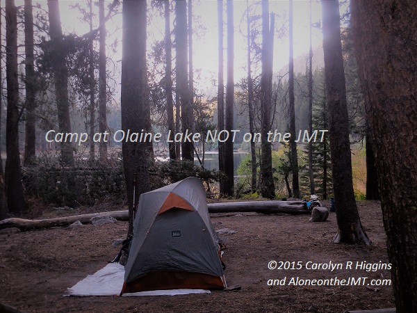
After my My Final Resupply: Dusk at camp on Olaine Lake (not on the JMT!)
With renewed energy and a feeling of “I got this-ness” I hiked away from Mammoth Lakes’ Red’s Meadow Resort and my final JMT resupply point. I navigated the confusing and ill-marked JMT/PCT trails amid the maze of Devil’s Post Pile National Monument trails, weaving in and out of the flocks of Labor Day tourists oozing manufactured human-ness: pseudo-white smiles; squeaky-clean skin reeking of overly-perfumed soap; fresh clothes cloaked in counterfeit ‘summer breeze” or ‘spring fresh” scents.
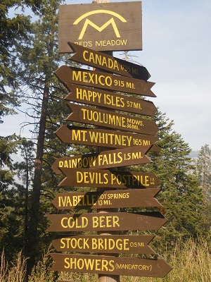 Before I even reached the Devil’s PostPile monument, less than a mile away, I realized, that despite my phone having been plugged in for hours, the battery was only at about 23% full- and that quickly drained to 13% after trying to pull up my JMT Guthook app to scout my camp for the night. Crap! I plugged it into my 12-watt solar charger, which hadn’t been working the last few days- hoping by some miracle it would suddenly come back to life. Please don’t be broken. I hoped it just wasn’t strong enough to charge a battery zapped of life by the sub-freezing nights. But no go. The tiny panels failed to turn the blazing sun into power.
I tried not to panic, despite being nervous about how I’d contact my friend Steve when I got to Yosemite Valley so he’d know it was time to come and get me (at least I’d written down his phone number on my emergency contact list in my backpack so I could always borrow a phone). But even worse, now I’ll have to rely on my maps to scout water sources and camping spots for the rest of my hike – and my topo reading skills haven’t proven to be very accurate!
I’d loaded the Guthook app before I left, hearing from friends and other backpackers on the JMT hikers Facebook group what a great tool it was for finding water sources and the best places to camp along the trail. I was hesitant – for this reason exactly. I didn’t want to be reliant on something that could be yanked away on a whim of bad luck. It’s been helpful in finding the best places to camp and water sources on the trail for the week I’ve been using it. Oh, how quickly we get used to the conveniences of modern technology! Oh well, I only have a few more days, I can live without it.
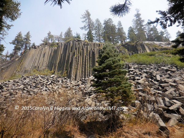
I reached into the side pocket of my hiking pants and pulled out the Ziploc bag holding the last section of the JMT map I’d just picked up from my resupply bucket. I unfolded the crisp, clean pages of the Tom Harrison maps (good ole Tom Harrison!) representing the last days of my hike. I absent-mindedly glanced over it as I forged my path through the buzzing crowds of Devils’ Post Pile National Monument.
When I got to the base of the mountain, I stopped amid bustling tourists snapping selfies and carrying plastic water bottles, to scan the area for signs back to the JMT. I couldn’t help but notice the stares. I could feel eyes on me. Despite having just showered and washed my clothes, I was conscious of my trail-worn state: my formerly light green hiking shirt now dingy with dust and dirt; the tips of five fingers bandaged with fresh medical tape; and my fatigued, weather-worn face. I felt like an exhibit; a native creature on display as part of their holiday sightseeing adventure. I tried to block out the clamor of humanity, realizing I stood out like a black sheep among the bright SHP (Shiny Happy People).
“Are you alone?”. I kept my eyes on my map, trying to ignore the voice that I knew, without looking was aimed at me. I wasn’t in the mood for another “have you seen Wild?” conversation.
“Excuse me, are you a backpacker?” Hmmm. I wonder if the 40lb backpack strapped to my back gave me away? At this point, politeness won over my annoyance at being lost in the maze of people and feeling obligated to talk to an intrusive tourist.
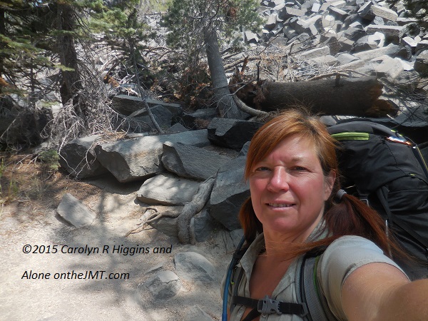
I looked up to see the inquisitive face of a 60-something year old man squeezed into the last few inches of a crowded bench, just a few feet in front of me. He was wearing faded-denim shorts that ended just above his swollen knees, a blue Mammoth Lakes T-shirt stretched over his round belly, white socks pulled up to his knees and pair of Keens that looked brand new. His obligatory tourist camera bag was strapped diagonally across his chest and he was grasping a Crystal Geyser water bottle with both hands on his lap. Despite the temperatures only being in the mid-80s and within a short uphill walk from the parking lot, he looked exhausted. His wife sat next to him, in white capris, a matching Mammoth Lakes T-shirt, and white Keds with little white ankle socks. She was holding her own water bottle and looked at me expectantly. I noticed she looked to be about ten years younger than him. As I looked at them, I wondered, is she younger or did she just age better?
“Yes, I’m a backpacker” I injected a good dose of feigned enthusiasm to mask my impatience. I just want to be back on the trail, away from this madness! Where is my damn trail?
The prying tourist repeated his first question, “Are you alone?” And added another, now that he had my attention, “how far have you hiked?”
As the inquisitive man and his younger-looking wife stared at me with expectant looks on their faces and interest and enthusiasm that was hard to stay annoyed at, I let my guard down and told them I was hiking the John Muir Trail and that I’d traveled nearly 200 miles. They were nice enough to say how impressed they were and couldn’t fathom doing it themselves, must less alone. And the woman added, “especially being a woman doing it alone! Wow, you’re more brave than I am!”
I learned they were from Humboldt, CA, which is just a few hours north of where I live, and had traveled to Mammoth to see their son and grandchildren who had walked the short path to the top of the monument. They wearily confided that they’d opted to skip the steep short climb and rest on the bench with the other older folks.
I was just starting to warm up to them when it all came to an abrupt halt (interject the needle screeching across the playing record sound effect here) Screeeeeeech…. the dreaded, predictable, and most annoying question nearly every solo female hiker can hear, came: “have you seen Wild? Are you like that girl in Wild?”
Gawwwd. Really? Fucking Cheryl Strayed taking away my thunder! Yes, I saw the movie. No, I’m not trying to be Cheryl Fucking Strayed. Anything else…? I flatly replied, “Yes, I saw the movie,” I tried to dilute what I was afraid was obvious annoyance, with some forced politeness and enthusiasm, “it was a great movie. But Cheryl hiked the Pacific Crest Trail, I’m hiking the JMT.” With a glance at my map, “Ok. I should hit the trail if I’m going to get to camp tonight. You both have a great vacation!” And I turned around and headed back toward the peace and solitude of the forest that never once, in 20 days asked me if I was Cheryl Strayed!
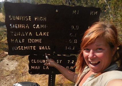
It took less than a half mile to shed the hordes of tourists, who, in my experience rarely venture to wilder parts of any national park. The trails were confusing and poorly marked: some said PCT, some said JMT and some weren’t marked at all. I finally came to a junction that was marked with a sign: “PCT- Agnew Meadows, 3.2”. Agnew Meadows! That sounds familiar! Yes, that’s where I should be heading! The JMT and PCT had been one trail for over a hundred miles; I was sure it was the right way and it sounded like the perfect place to stop for the night. Three more miles would give me just over nine miles for the day. With my long stay at Red’s, I would be happy with that!
So, without consulting my Tom Morrison map, I veered toward Agnew Meadows along the narrow, wooded path, happy to have it mostly to myself again. I passed a few tourists who dared venture off the paved well-marked trails for the national monument (the signs for Devils’ Postpile were well-marked, but NOT the trail to get me back to the JMT). As the afternoon ceded and the sun cast burnt-orange shadows on the towering conifers, my trail weariness soon replaced the temporary boost I’d gotten from Red’s. Devoured by the lush forest again with nothing but Ponderosa Pines, Aspens and Cottonwoods to keep me company, my legs felt leaden beneath my replenished pack- and I was anxious to reach Agnew Meadows and make camp for the night.
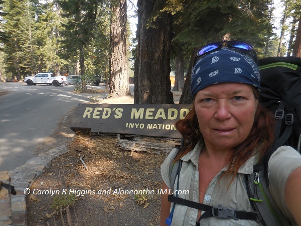
After what felt like two hours I reached a junction with a small sign pointing the way to Agnew Meadows: 1.8 miles. What? There is no way I’ve only hiked a mile and a half! How can that be?
Annoyed and too anxious to sit down, take a proper rest and study my map, I trudged on; up the trail toward Agnew Meadow. As I hiked, I thought about all the hiking books and stories I’d read, and Agnew Meadow was one of those iconic stops on the trail! This is where I’m supposed to be going, right??? It seems to be taking too long. I should be done by now. I must have hiked 9 miles by now.
I thought back to the junction with a faint path heading into the darkness of the forest and the sign I’d passed a while back; was I supposed to take that trail? But no, the sign clearly said “Agnew Meadow” in this direction. But why do I feel like I’m veering off the JMT? I begrudgingly slogged up the hill another quarter mile… I stopped. Looked around. Hiked a few more yards. Stopped, looked around again, trying to decide if I should push on or go back.
This can’t be right. Something’s wrong. I turned around and slogged back to the junction and the sign, flopped off my pack, sat in the grass, pulled out my fresh bag of home-made trail mix, took a long swig of orange flavored Nuun water and pulled out my map, carefully tracing the maze of trails through Devil’s Postpile and up toward Agnew Meadow. SHIT! No, No, No! There it was, right in front of me. How did I miss that? Way back at the first PCT/Agnew Meadow sign, the JMT and the PCT split. For weeks, the JMT and PCT had been one trail and I could follow signs for either. I knew it would split eventually, but I thought it was further along. Then the reality struck me: I AM further along. Further than I wanted to admit. I am almost to Yosemite. Almost at the End.
That sinking feeling in my gut returned, not just at being near the end, but now the added burden of being off my trail. I had hiked about 3 miles off the JMT. The good news was, the spur trail I was sitting at went back to the JMT, via Olaine Lake.

It would put me back on the trail at Shadow Lake. No real harm done, I’m just a few miles off… Not a big deal, just a slight change of plans.
I studied my map to recalibrate and plan my new camp for the night at Olaine Lake two miles away. It was already getting late in the day and my energy was depleting rapidly. I’m a morning person and by late afternoon all I want is to be done. Over the miles and days of my hike, I’d trained myself to hike past this state and eventually, I’d get a second wind. Time to pack up and walk toward that second wind!
As I hiked the narrow, faint path heading deeper into the forest, a sense of gloom enveloped me. I felt lost and abandoned on the strange trail. I missed the comfort and safety of the JMT: my home for the past 20 days. I began second-guessing myself again. Is this right? Even though I was sure I knew where I was this time, I questioned myself: are you sure you’re not lost? The trail felt abandoned and eerie. How do I know it’s not some random path to nowhere? Or worse, to the cabin of some deep-woods reclusive Unabomber psycho? I hiked on, trying to feel confident in my map reading skills.
Eventually, I heard laughing and shouting above me; the tell-tale signs of day hikers. Despite their ear drum-piercing yelps, I was immediately comforted. I’m on the right track. I’m not heading to impending doom!
They were coming down the mountain trail above me; the trail I’d have taken to Agnew Meadow, I presumed. It dawned on me that Agnew Meadows is a popular PCT stop. I’ve read too many PCT thru-hike stories, that’s why Agnew Meadows had sounded so familiar!
The hike to Olaine Lake was relatively flat and the hiking was easy and fast. I passed a couple along the way and asked if they’d seen any good camping there. Yes, they said, but the man added, “it’s not a very pretty place though, you should go a couple miles further to Shadow Lake, it’s much prettier.”
“Yes, but I’ve already done 9 miles and it’s been a long day. How’s the hike to Shadow Lake? According to the map, it looks like a steep climb along a gorge, which means no camping. Did you see camping along the way, in case I need to stop before Shadow Lake?”
“The trail isn’t bad at all. You can do it. And yeah, I think there’s some camping along the way.”
His female companion gently disagreed, “Um, I think, the climb is pretty rough—“.
The man interrupted her, “No it’s not bad. She can do it”
I thanked them and moved on, debating whether I should trust the man’s advice and keep going to Shadow Lake or stay at Olaine Lake. I liked the idea of being back home, on my trail. But that would mean two more miles: uphill miles. And if it was along a steep gorge, as it looked on the map, there’d be no camping along the way. I’d be stuck with a rough two-mile climb at the end of a long day.

About twenty minutes later, I spotted the small tree lined mountain lake. I was still contemplating whether I should move on. I couldn’t’ shake the feeling of being lost and alone, off my trail. But I didn’t exactly trust the couple’s opposing views of the climb and decided to make camp at a large clearing on the south end of the lake. As I set up, I heard voices approach the lake from the east. A group of young rowdy people stopped at the shore a couple hundred yards away. I set up my tent and then walked around the west side of the lake to explore the area, like I do at every new camp to familiarize myself with my surroundings. It helps me acclimate and sleep better.
Back at camp, I boiled water for chamomile tea and nibbled on a Bobo’s lemon poppy seed oat bar and a handful of Jelly Bellies (the “surprise “treat, I’d added to my resupply bucket!), while I boiled another pot of water to rehydrate my vegan white beans with tomatoes. I sat in the dirt with my back against a log enjoying the beauty of the lake, drinking in the warmth of my soothing tea and relishing in the jolt of energy from the sugary goodness of Jelly Bellies (I’d made a special trip to the Jelly Belly factory near my house for them! And yes, I know they aren’t vegan) and the grainy goodness of the lemon oat bar. The noisy people eventually left and I had it all to myself; just the way I like it. The sights and sounds of nature soothed me; whimsical songs of birds, playful squirrels chasing each other up and down trees and a gentle breeze blowing through the Lodgepole Pines… The day melted away and I began to relax.
Without my phone, I had nothing to read, so rather than retreat to my tent, I walked around the lake exploring the trail back to the JMT that I’ll be hiking tomorrow
As dusk settled and the shadows melted into the lake, I climbed into my tent and slid on the fuzzy pink socks (clean socks!) I’d put in my resupply bucket. I’d had the forethought to consider what a luxury they’d be toward the end of the trail! Boy was I right! I climbed inside my sleeping bag with my cozy socks and drifted off to sleep thinking about being back home on my trail tomorrow, and my last iconic stop: Thousand Island Lakes.
Thanks for posting
Greetings Carolyn,
I’m reading your JMT Blog, but I’m unable to acccess days 23 and beyond. There is no “next” option on day 22, and the Menu Bars do not function.
(I’m using my iPhone 6.)
Thanks,
Tom
I’m not done yet…. 🙁 stay tuned will get it done eventually.
Hi Carolyn Hi Capone 🙂 I veered off the trail of your videos and onto the FB trail and found this!! Wow you are an amazing writer!! You kept me up an hour later than I wanted to be up because I started reading this and couldn’t stop. Very impressive 🙂 Now going to get 4 hours of sleep before I have to get up because I have a ride to the grocery store. Still in Washington in my new or RV until the warranty ends at the dealership, mid Nov. Then probably heading towards Southern California to roller skate with all my friends and also hang out at the beach! At least that’s the plan for now but we’ll see where the wind blows me 🙂
Wow, just found this blog. Ihave followed your you-tube channel and love your honesty and openess. I binge read this and it is great. I am going to read the blogs from the beginning. Thank you for sharing.
Carolyn, This summer, I completed my JMT NOBO. Thank you for this blog, I used your itinerary as a base for my own.
My wife joined me at Red’s for the remaining 60 miles. You are certainly right that the trail signs near Devil’s Postpile are confusing. We had to stop a few times to make sure we were on the right trail.
Can’t wait to read your Thousand Island Lakes as that and Garnet lake with Banner Peak overall is one of the most memorable and beautiful spots on the trail – at least to us. Thank you for sharing your memories with us, it brings it all back so clearly.
Great story! Glad it turned out ok.
I was hiking SoBo and I almost got lost trying to get to Red’s. I ended up coming out at a bus stop and went into town instead — for a holiday weekend, where I had to wait until Tues to get my resupply from the post office! Then I took a bus up to Reds, so I never did do that little stretch around Devil’s Postpile. My feet were hurting that day, so I just wanted to find a place to wash up and soak. I ended up at the Snow Creek Athletic Club at the end of the Red shuttle in Mammoth — where I could pay a day use fee and shower then soak as long as I wanted! Camped at a forest service campground, a very long block off the shuttle line, east of the post office.
Carolyn,
After reading this post I am convinced since you have been in the RV you have returned to the peacefulness of the John Muir Trail. I can feel it in your writing. Please realize how fortunate you are to have reached this point in your life. Not many of us are successful in this area.
As I wrote on Facebook, I ever so much look forward to your posts on your hike. They are worth reading over and over.
Thanks for all your effort. Enjoy your time in the South.
Marilyn, that is very kind of you. Thank you so much!!
What a fabulous read! I can just feel the trip winding down. I could feel the cozy pink socks too!
I was recently at Devil’s post pile and hiked around all day. For me, it was epic just to hike three miles to Minaret Falls, which sounds ridiculous to me, but, that’s where I’m at right now. Work takes up 80% of my time these days. If it weren’t for my 2-mile walk/hikes everyday, rain or shine (thankfully it rarely rains here this time of years…he he) I’d be a jellybelly! Somehow with my eating habits and enough movement, I maintain a decent baseline of health, thankfully! I was quite sore for a few days after a long day of hiking around Devil’s Post Pile and Minaret falls! Whew!
I look forward to the next post and also the transition from your JMT adventure to your transition to the road. I recall hearing about it in your YouTubes, but, it will be great to hear more behind the scenes of it!
Thank you Gloria.. As I wrote these entries, the realization that I’m often a day-hiker didn’t escape me!! LOl If only we could all hike all the time! 🙂 Glad you got to enjoy the area! I hope to be there next summer and do some more backpacking!! I miss it. thanks for reading!! See ya soon!