Arriving at Onion Valley

At Onion Valley Campground, Night 7

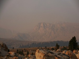
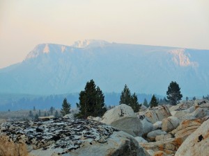
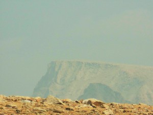
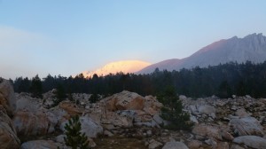
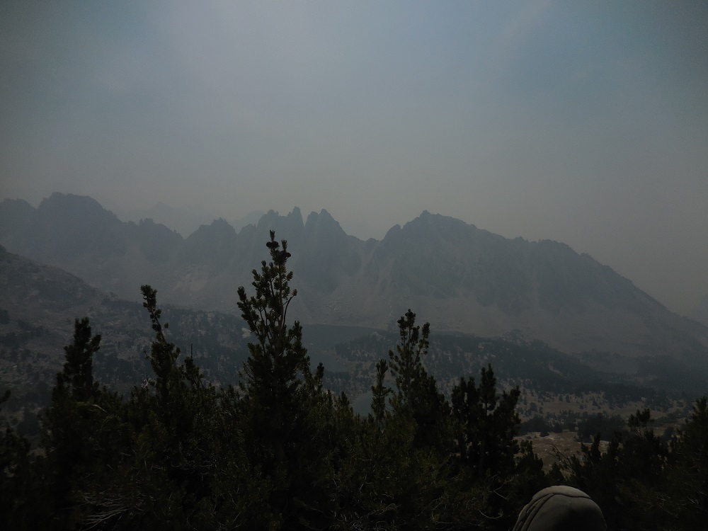
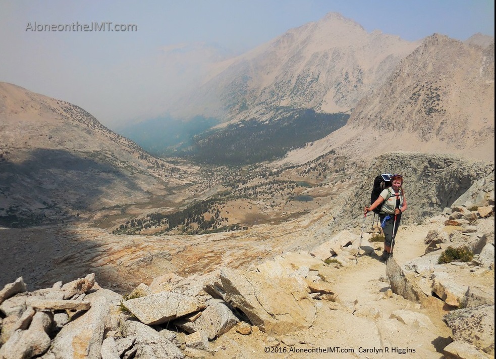
….And I hiked, winding back and forth, back and forth, down the endless switchbacks bargaining with the universe to show me signs of civilization below. Please, please, please, be around the next corner…  if it’s there this time, I’ll stop for a rest. Really, I promise… With the smoke hanging heavy in the air, blotting out the sun’s lively rays, it felt much later than it was. I’d been fooled by this smoke induced false-dusk before; dropping my pack to set up camp thinking it’s at least 7, only to discover it’s just 3:00. In a normal year, I’d probably be cussing the heat and looking for a lake to jump into by then, but this year, the year of the wildfires, I spend my afternoons hiking in perpetual gloaming: fooling my body into thinking it’s more tired than it is.DSCN0217

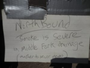
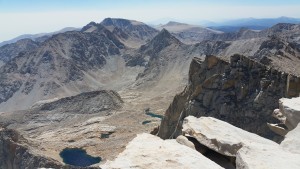
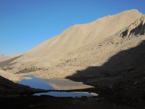
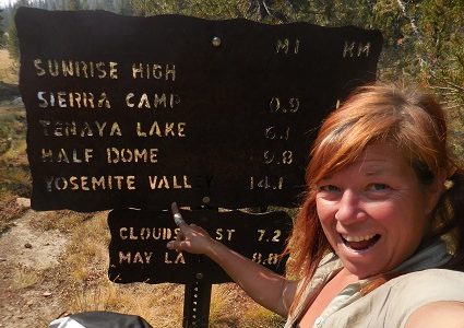
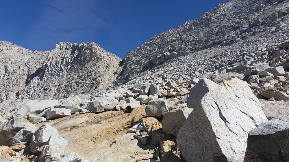
Is that red? Do I see red? Far below I thought I spotted something out of place in the earth-toned terrain of the eastern slope of Kearsarge Pass. I slogged along, trying to ignore the throbbing pains in the bottoms of my feet, desperately searching… YES! Oh my god a car! I never thought I’d be so happy to see a car in all my life.  A few more steps revealed (still hundreds of feet below) a whole parking lot filled with metallic bulbs of color – like a colorful garden nestled at the foot of this hellish mountain. With renewed vigor and a quickened pace I hobbled down the mountainside wondering how long it had been since I’d seen a car: Wow, it’s been 7 days! Have I ever, in my whole life, gone 7 days without seeing a car?  I had to think about it. And no, in my 47 years, I had never gone 7 days without seeing a car. That made me a little sad as the reality of approaching civilization settled in. Onion Valley Campground

From the time I spotted the parking lot to the moment I set foot in the campground, 90 excruciatingly looooonng and torturous minutes passed. But at last I made it…It was close to 5:00 when I finally retreated from the back country. 7 hours. 8.6 miles.  More than 5500 feet.  I was happy to be done, but not so thrilled about where “done” got me.

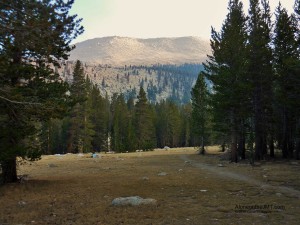
Despite my exhaustion, before dropping my pack I circled the campground to look for a site to call home for the night. You’d think I was taking a mortgage out with the amount of scrutiny I put into choosing my 12-hour home.  But after spending the last 7 nights mostly alone, I wanted a private spot away from the smelly pit toilets and the curious eyes of car campers.  I felt more exposed and vulnerable than I do in the backcountry and the curious stares were unnerving.

On my second pass of the small loop, the odd homeless-looking man who had been pretending to fidget around his creepy 1980-something gray van parked at a site in the center of the loop, directly adjacent to the campground host, walked toward me trying to disguise his nosiness behind nonchalance.  He failed miserably:  it was obvious by his anxious gait and expression that he needed to say something to me. He puffed out his scrawny chest that had long ago caved in from age and lack of any real exercise and stammered awkwardly, “Ummmm…?  Hullo?  Can I help you…. with sumthin?”

I copped an attitude before he even opened his mouth. I knew he was going to be trouble by the way he’d slow his fidgeting, and strain his long neck, to covertly scrutinize me out of the corner of his eye every time I passed. I surmised by the absence of a car outside the camp hosts 5th Wheel that they were probably in town running errands. Apparently, Van Guy decided it was his civic duty to hold down the fort and prevent dirty hiker chicks from causing mayhem on the Homefront while they were away. Great, a bored homeless guy with a cop complex, I am so not in the mood for this…. I gave him my finest “fuck you” glare and coolly replied, “just looking for a spot to camp for the night” I was curt and short, making no effort whatsoever to hide my annoyance.

The view West from Kearsarge Pass Trail

“Errrr… a’right,” he stammered awkwardly looking from my pack to my hiking boots and back up again, but never in the eye. “Well the camp host’ll be back soon…”  I could see his wheels spinning as he sized me up and sensed he had a whole lot more to say. I imagined he was mentally practicing his Ranger Rick speech: “Don’ be thinkin yer gonna get ‘way wit nuthin lil lady.  Comin in here all dirty and grimy, casin the joint and thinking you ain’t got to pay fer nuttin.  I got my eye on you, so just in case yer thinkin’ a causin’ trouble, you ain’t.”

I looked toward the giant self-register billboard 5 feet away and replied curtly, “that’s good to know,” and continued my 3rd trip around the loop to get a closer look at my final contenders. I felt his beady little gray eyes burning into my back as I walked away.

Coming around the loop toward wanna-be Ranger Rick’s camp once more, a real Ranger in an official green pickup truck pulled into the campground from the road and headed straight toward me. Now what? Geesh, can’t a dirty hiker look for a campsite in peace around here? He pulled up next to me, stopped and rolled down his window. A blast of cold air hit my face from the A/C blowing inside the cab. It felt refreshing on my sunburnt, salty face.  He was young – maybe thirty, with a brown beard like all the hip young outdoorsy guys are wearing now, wavy hair, full lips and big brown eyes. I was caught off guard by his rugged good looks. When he flashed me his smile my attitude dropped faster than you can say “cougar bait” and I suddenly had a burning  desire for a shower, shampoo, a little mascara and a miracle that would make me 15 years younger.

“How’s it going out there?”  Unlike wanna-be Ranger Rick, this real Ranger knew that despite my current appearance, I wasn’t a thieving homeless lady, but a backpacker. This was going to be a friendly conversation, not another attempt to infringe upon my freedom to walk around the campground as many times as I wanted.

Painfully aware of my current state of hygiene I replied as confidently as I could muster, “good. It’s smoky,” I decided to play the “I’m a super-cool-hiker-chick who isn’t bothered by a little dirt and B.O.” card: I casually flicked back my unkempt braid and wiped my sweaty forehead with my dirt-caked hand, trying like hell to act like I’d just come from a day at the spa and not 7 days in the wilderness without a proper shower. I smiled awkwardly, trying not to think about how I probably looked like a giant dirty tomato with my big round dirt-streaked sunburned face, “what do you know about the fires?” DSCN0217

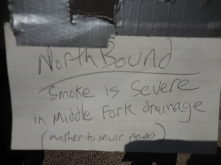
“Bad. Real bad.” THAT was not the answer I was hoping for.  “The Rough Fire in Kings canyon is burning outta control and it’s in the wilderness now, so they stopped fighting it.”  So, the rumors were true… I’d heard this from SOBO hikers who had talked to Rangers up north so it wasn’t a surprise However, what he said next was, “the fire’s about 10 miles off the JMT,” he paused and studied me, seeming almost reluctant to continue, “they pulled all the Rangers from LeConte Canyon and Rae Lakes…” What was he saying??? They pulled the Rangers but left the hikers? What the hell does that mean? I panicked a little. My gut knotted up and disappointment dropped into my core like a boulder. I don’t want to quit. I don’t want Onion Valley Campground to be my finish. Happy Isles, it’s supposed to be Happy Isles!

“Wha–? They pulled the Rangers?”  My concern about finishing the trail overwhelmed my little cradle-robbing Ranger crush and any self-consciousness over my giant tomato head. Now I was all business – now I was the hiker chick unconcerned with B.O. and dirt. “Is it that dangerous? Do you think the fires will make it to the trail…?”

“I don’t know if the fires are gonna reach the trail. But the smoke… They can’t live in that… “

That made sense and I felt slightly relieved. The Rangers live out there all summer and I’m sure there are OSHA laws about employees living in hazardous conditions. Conversely, I’m just passing through (and still holding onto hope that I’ll eventually walk out of the smoke). But still, 10 miles away, that’s a day’s hike. And they stopped fighting the fires… What does that mean exactly? I had to ask, but was afraid of his answer, “is it ok for us to be out there still?”

There was a too-long pause. I could see him trying to find the right words, “I can’t say ma’am.”  He looked like a man who didn’t want to say the truth and besides the sting of this young handsome Ranger calling me ma’am I was rocked by the reality of my situation with the wildfires: I may end up having to evacuate.DSCN0201

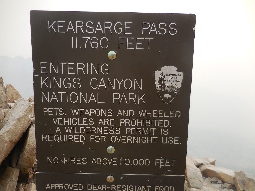
I was trying to digest and make sense of this tragic news. I wanted him to give me the answers, reassure me, tell me it would be ok to continue, “B…but what if the fire does get closer? How will we know? Will they evacuate us? Will they get us out?”

He looked me square in the eye with his big brown eyes and shrugged his broad shoulders. He didn’t have to say it; the answer was ‘no’. “Just be careful out there….”

A million thoughts were flying through my mind. OMG they won’t try to evacuate us!?!  If a big wind hits and the fire comes we’re on our own? No Rangers… We’re really and truly on our own.  I’m no stranger to throwing caution to the wind, taking risks and charging forward without thinking things to death, and for days I’ve rationalized being out here in these conditions: I came out here to experience nature. Forest fires are part of nature. They are part of my experience. It’s neither good nor bad. It just IS. And I will keep going until it’s too dangerous to move on. So with this new information from a professional – a Ranger – a dude who knows stuff – what the hell am I supposed to do?

I tried to be optimistic and cheerful and not read too much into his evasiveness, “Ok. I will be. Thank you for the info…”

“Sure thing. Be careful out there and good luck,” he gave me a little half smile this time- was that concern I saw flash across his handsome face?  “– Oh and by the way, #1 is a great site. It’s a car camping site, but it’s ok if you take it, we won’t fill up tonight.”

“Yeah, I was looking at that, thank you. And thanks for the info.” He pulled away toward the back of the campground and I walked down the driveway to site #1 one more time to try to make up my mind. But I was in a fog. What should. I do? Should I call it here? Am I walking into a wildfire? Am I taking an unnecessary risk by being out there?

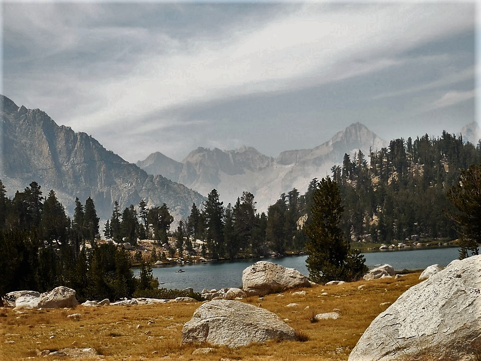
I finally settled on a quiet site in the backpacker’s section away from the car-camping looky-loos and wanna-be Ranger Rick. I’ve had dinner and now I’m sitting here at the picnic table in camp, looking up toward my nemesis, Kearsarge Pass, with the first of the stars barely twinkling against the darkening sky. My brutally tough day and the troubling conversation I had with the handsome Ranger is all I’ve been able to think about. I pondered how the wildfires would be the perfect excuse to bail. I’ve heard so many stories already of hikers leaving the trail because of the smoke and I’ve wondered how many used it as an excuse. How many had days like I had today and just said, “screw it- it’s hard, it’s smoky, it’s dingy and gray and the views suck. I’m done!”?

It would be a convenient excuse, for sure. But I really and truly do NOT WANT TO LEAVE.  As hard as today was, the LAST thing I want to do is quit.   And even if I wanted too, I couldn’t, in good consciousness leave because the smoke is inconvenient. If it becomes dangerous, yes, but inconvenient, no!

I contemplated this:  How often have I opted out of a hike because of rain or snow or wind? And isn’t my purpose for hiking to experience nature? And isn’t rain and wind and snow – and FIRE – part of nature? So by its very composition, it’s not supposed to be convenient. It’s rugged. It’s challenging. It’s unpredictable.  I wanted to spend 30 days on the trail to immerse myself and really experience it – ALL of it; not just the gorgeous blue sky days with moderate temps and no precipitation. THIS is part of my experience of nature and my JMT journey: fire and smoke. Sure it’s different than other years, but so was the summer of 2010 when Arkansas Robert was here and it was all covered in snow.  It’s nature.  And to me, quitting now would be denying nature – and putting conditions on Her: I’ll only hike under blue skies and reasonable temperatures, no rain, no snow, no wind, no bugs and no smoke! No, I will do this on Her terms.  Smoke and all.

The Ranger didn’t tell me to get off the trail. He didn’t say it was too dangerous to be out. He didn’t say we’re getting evacuated. And if you think about it, wouldn’t they err on the side of caution?  Have you ever known any government agency to take unnecessary risks with the public’s safety (well, I guess it depends on how much big money is involved, right…?)? Therefore, I deemed it safe to continue. I’m going to hike until… well, I’m not sure, exactly. I’m just going to keep hiking and see what happens. End of discussion.

**SCROLL ALL THE WAY DOWN PAST COMMENTS AND CLICK TO READ THE NEXT POST! ***

Day 7: Ups and Downs

The Hike Over Kearsarge Pass from Vidette Meadow

August 23, 2015 Day 7 on the trail and 68.4 miles completed.

This is now officially the longest backpacking trip I’ve ever been on (previously was a 6 day trip) and the most miles I’ve ever done on a single trip (previously was 50 miles in 5 days).

Welcome to civilization – or at least my current version of it.  Sure, most of society would consider Onion Valley Campground the exact opposite of civilization; 13 miles from the nearest town with no running water or showers and smelly pits for toilets.  But to me, today, it may as well be Times Square.  “Civilization” like so many other human inventions is relative. Regardless of what you call it, being here sucks.  I’m back to the land of car campers “getting away from it all’ in their forty foot, hundred-thousand-dollar Holiday Rambler buses fully equipped with DISH satellite TV so they don’t miss a single episode of Dancing With the Stars, clumped together, relaxing in their fancy LaFumas, and sipping Budweisers and Cokes. onion valley campground

Pardon my crankiness, it’s been a rough day…

Actually, “rough” doesn’t even begin to describe my day. “Brutal”, “painful”, “soul crushing” might come close. The hike up – and down – Kearsarge pass was so much more challenging than I expected. Yeah, I was warned; everyone I talked to and everything I read said it was tough. But for some reason, looking at the map I thought – “it won’t be that bad.” I figured I’d climbed to over 14,000’ a few days ago and 13,000’ yesterday, how bad could 11,845′ be, right? ….Right?

The first 500′ out of camp at Vidette Meadows wasn’t too bad.  I’d taken my time over coffee and breakfast with the guys, and got a later start than usual. Despite my sore legs and feet, I was feeling refreshed after finally getting a good night’s sleep (thanks to the Xanax). The trail led up a steep wooded path and the greenery of the valley walls enveloped me as I climbed. It was a cool morning, the trail was soft, sandy dirt and my pack was lighter than it’s been in 7 days: life was as good as can be expected after 7 days, 60 miles and something like 20,000 feet in elevation gain and loss.

Hiking out of Vidette Meadow looking toward Kearsarge Pinnacles

Despite leaving camp before the Arkansas Four, it didn’t take long for them to catch up to me.  We hiked together out of the valley and up steep screed slopes before our trails split. They were planning a short day to set up basecamp at Kearsarge Lake and then slackpack over Kearsarge Pass to Onion Valley tomorrow where their pre-dropped resupplies awaited them in the bear boxes by the trailhead. They’d then turn around and head back over the pass with just their food: going up and over the pass in a single day but with minimal weight.

I, on the other hand was going over Kearsarge pass and into Onion Valley tonight –fully loaded with all my gear.  Since I’ll be hitchhiking 13 miles to pick up my resupply at the Independence post office tomorrow and I have no idea how remote this campground is, I thought it would be best to sleep at the campground and get an early start – or better yet –  meet someone tonight who is heading into town tomorrow who will give me a ride.

Robert and Tim on the Trail Heading up toward Kearsarge Pass
Half of the Arkansan Four on the Trail Heading up toward Kearsarge Pass

We said our goodbyes-for-now at Bullfrog Lake, with Lee vowing to leave me a note at the trailhead if they decide to move on to Rae Lakes tomorrow night. I appreciated the gesture and looked forward to catching up to them again. They’re great company.

Bullfrog Lake was the highlight of my day. The most picturesque and idyllic alpine lake you can imagine: a bowl of glittering mountain water framed by grayish-white granite boulders, late-season grass turned yellow from summer heat and the lack of rain and patches of lush conifers bringing it all to life. The small lake rested peacefully in the shadow of a set of jagged sierra peaks, whose majesty refused to be dulled behind the layer of smoky haze. And like a faithful lover, Bullfrog Lake honored the peaks, triumphantly reflecting them from the surface of its still waters.

Bullfrog Lake
Bullfrog Lake

I couldn’t resist. Once the guys were out of site, I found a perfect spot on the nearly-white boulders, stripped off my filthy hiking clothes and dove into the inviting water. It was cold, but not knock-the-breath-out-of-you cold.  I swam without inhibition (well almost), basking in my freedom and the luxury of having this utopic spot completely to myself: an entire lake – all mine! I felt like the luckiest woman alive.

When planning my trip, I imagined having moments like that every day, but the smoke dulls the sun into gloomy orange orb every afternoon, chilling the air too much to think about jumping into icy water.  This morning, I took advantage of the relative warmth and not-horrible smokiness and enjoyed my first real swim since Chicken Spring Lake. It was a moment to remember, for sure.

R&R at Bullfrog Lake

The euphoria of the 30 minutes spent luxuriating at Bullfrog Lake slipped away almost as soon I started hiking again. Within a few minutes I was hit with waves of dizziness and vertigo. My brain felt sludgy and slow, like it was swimming in an ocean of thick oil.  Then the trail before me twisted and contorted and fractured into some weird kaleidoscope dream.  My legs were weak and I struggled to put one foot in front of the other.

Being my normal stubborn self, I kept hiking, trying to ignore the strange feeling away…  whoaaaa…. a flash of white blinded me, causing me to stop dead in my tracks. For a split-second the world went blank and my head got even woozier. What the hell is this?  Worried that I couldn’t just push on and will this away, I bent over, resting my hands on my knees and took a couple of deep breaths. I don’t have time for this. I just want to go…  I resumed hiking at a snail’s pace, hoping the strange sensation would pass… But the kaleidoscope vision and dizziness persisted.

Finally, I gave in, dropping my pack on flat shady spot under a clump of trees next to the trail,  and plopped down next to it. Is this a side effect of the Xanax?  Am I getting sick? Is this exhaustion? Oh my god, am I dying? I’m dying, aren’t I? Alone out here on the trail, I’ll be left for dead like some plague-stricken squirrelreduced to coyote and vulture food.  I got a hold of myself and realized I probably wasn’t dying, just exhausted. day 7 smokey kearsarge pinnacles

I laid in the cool grass and watched the clouds lazily waft the day away.  I got lost in their gentle movements and felt my body melt into the earth.  I inhaled slow, deep breaths, trying to heal myself through mediation, focusing on two willowy masses perform an exquisite pas de deux; their edges drifting together and floating apart until they finally melded into one giant bulbous cloud.  I laid still, breathing slowly, mesmerized by the exquisite slow-motion cloud ballet playing out thousands of feet above: oblivious to me and my ailments. It was strangely comforting thinking that even if I were laying there dying, the clouds would go on dancing above me.

When my head stopped swimming and the world transformed back into its normal non-kaleidoscope self, I slowly stood up to test the ground.  My head swooned a little, but not too bad, so I strapped on my pack and cautiously resumed my climb. And I climbed. And I climbed. Up the rocky western slope of Kearsarge pass, not feeling 100% but determined to reach my destination.  It was hot, it was smoky, it was brutal. Not baby-stepping Mt. Whitney brutal, not even endless switchback, Forester Pass brutal, but,  “I just want to be off this fucking mountain,” brutal.

When I finally reached the summit of Kearsarge Pass, it was completely socked in under heavy sooty gray smoke, adding to the misery of my day. I could barely make out Kearsarge Lakes 1000’ below and longingly searched the shores for signs of my friends’ camp.  I couldn’t see them but I imagined they were relaxing in their luxurious camp chairs lakeside and enjoying the afternoon without a care in the world… I was so jealous. I just wanted to be done.

One of my many breaks up or down the pass

Going down Kearsarge Pass was no easier than going up Kearsarge Pass:  4.7 miles over 2660’ down. It went on FOR-E-VER. Down. And down. And down. The trail meandered back and forth and back and forth as if it had nowhere to be.  This trail… let me tell you about this trail: think about normal switchbacks, compactly carved into a mountain to get you up – or down – efficiently. These switchbacks were neither efficient nor compact.  Some of them stretched clear across the entire side of the mountain, we’re talking at least ¼ mile – at least.  I’d look down and see the trail wrap clear around the damn mountain, back toward the wilderness from which I’d come, before switching back, thinking, that can’t be MY trail. It’s another trail heading into SEKI, right?  And I’d trudge on and soon realize, no, it was indeed my trail. Seriously? What the fuck?  Who designed this stupid mess?  I fantasized that it was some spiteful engineer whose father made him hike when he was a kid, when all he wanted to do was stay home and build Lego bridges and skyscrapers. So now he works out his daddy issues by building sadistic, never-ending, meandering switchbacked trails. I could just picture him sitting over his blueprints splayed about his gigantic drafting table, with a sinister sneer on is face, “ You want switchbacks father? I’ll give you switchbacks! I’m going to teach all the hiking-daddies of the world a lesson! Muah ha ha ha ha…”

It just. Would not. End.

Two huge passes back-to-back have taken their toll on my body. Yesterday,  Forester Pass: 2300’ up and 3665’ down and today Kearsarge Pass: 2300’ up and 2660’ down for a grand total of 10,900 feet in elevation in just about 32 hours. And every achy muscle, tendon and ligament below my waist feels every single inch of it. I’m grimy, sunburnt, exhausted,  emotionally spent and over the whole, “Ohhh hiking is so grand. Ohhh I love nature..Ohh it’s so great to be out here”,  bullshit.day 7 trail

Today hiking the JMT became REAL – not just some fantasy hike that would be so awe-inspiring that the challenges would seem mild in comparison. No. The thrill, excitement and raw enthusiasm of being out here is   G-O-N-E and has been replaced with…. With what?   Apathy?  Reality? I’m not sure, but the romanticism of the thru-hike has been slowly slipping away day by day, little by little, with every ache,  pain, challenging climb, and smoke-obstructed view.

The reality of the thru-hike is so much more demanding than anything I had imagined. I hike. And I hike. And I hike some more. It’s not always awe-inspiring and exciting and adventurous. Sometimes it’s just grueling, sweaty, dirty, mind numbing, aching hiking.  Then you get to set up camp, eat rehydrated mush, sleep on the ground, wake up sore and achy and do it all over again…

I’m not saying I want to quit. Voluntarily leaving the trail has never crossed my mind. Even for a second. I’m just saying that as beautiful as it is out here and as awesome as this adventure is, it’s hard work. Really fucking hard work.

I think I need a zero day. And something cold to drink.  And maybe a giant Snickers bar…Tomorrow I resupply, but first I have to get to Onion Valley…

**SCROLL ALL THE WAY DOWN PAST COMMENTS AND CLICK TO READ THE NEXT POST! ***

Forester Pass: A story of Life and Death

Day 6 Tyndall Creek to Vidette Meadow via Forester Pass

After leaving the granite cirque and my peaceful creekside oasis, the trail led me across a maze of streams that seemed to flow in every direction, past tarns of all shapes and sizes and through more rock fields and high sierra meadows. It was almost hard to believe California is in it’s 4th year of drought, with the amount of water there.

When I reached the foot of the Kings-Kern Divide I craned my head back and searched for the notch I’d be crossing. I couldn’t tell where Forester Pass was exactly. To my right was a wide saddle but the trail didn’t seem to go in that direction. The only other notch was far to my left at about nine o’clock and that seemed disconcertingly  far away: the map showed 4.7 miles from camp to the pass and I’d already come at least 3.  Oh well, sometimes you just have to move forward and trust that the trail will get you where you want to go.forester views 2 reduced

I turned around scanning the basin toward Tyndall Creek, now below me, searching for my Arkansas friends.  All morning I’d been thinking: they have to be behind me, they like to take their time over morning coffee, so they can’t be ahead of me already.  But they’re faster, so they would have caught up by now.  And then I’d get worried, maybe they decided to move on over Forester Pass last night.   That thought depressed me a little. I like having trail friends that I can run into now and then. If they crossed Forester yesterday I may not see them again, they’d be nearly a whole day ahead of me… With hope I’d see my friends again, I hiked on.

Ok, here I go!  I excitedly began my ascent up the rocky trail neatly carved into the mountain, anxious to get my first real JMT pass under my belt!  Forester Pass is 13,145 feet. Looking up at the top of the ridge, I guessed I was at about 12,000 and it didn’t take long to feel the now-familiar heaviness of high altitude climbing.   Adding to the fatigue, this time I had my 35-ish pound pack strapped to my back. Ok, easy does it. Slow… baby steps.forrester pass trail not my photo

The climb was slow, but Whitney taught me to honor the challenge and take my time; that it’s ok to reach the top one baby step at a time. With heavy legs and pack, I trudged higher; zig-zagging up the mountain, one switchback at a time.  It was getting warmer and I was constantly wiping sweat from my forehead, catching it before dribbling into my eyes and burning. I need a bandanna. I’m going to buy a bandana when I get to Independence.  This one little thought started an internal battle that kept me amused for several agonizing switchbacks:

Critical Self: But you have a bandanna, you don’t need another one.

Wanting a bandana self: Yeah, but it’s the Scottish one that we brought to signal other Facebook people we’re part of their group and it’s bright yellow and red.  I’m not wearing THAT thing on my head. I want a blue one, to match my eyes…

Critical Self: But we have a million blue bandannas at home and we purposely left them behind. Remember, we’re counting weight here!

Wanting a bandana self: Seriously? How much does a bandana weigh? Like a tenth of gram? Stop being a gram weanie!  Besides I’ll be wearing it on my head, not carrying it.

Critical self: Ok fine, you can get a blue bandanna in Independence. 

Wanting a bandana self: Thank you. Geesh, was that so hard? 

After my argument was settled, I kept my mind occupied by making a mental list of all the things I wanted to buy in Independence: Kettle Salt and Pepper potato chips, Tylenol PM, a few gallon Zip-Locs for garbage and stuff (somehow I seemed to have a shortage) – I wonder if they sell them individually? I don’t need a whole box. And fruit. Hopefully I can find fresh fruit.

Inching higher and higher and still searching for the elusive Forester Pass, I encountered a metal sign attached to a giant boulder off the side of the trail.  Not wanting to interrupt the momentum I had going, I pushed forward. But several feet past it, the curiosity overwhelmed me and I had to turn back.

It was a memorial to the men who built the trail, and specifically, 18-year-old Donald Downs who died when a boulder came loose and crushed his arm in 1930.  I took a minute to let that sink in; realizing that I take these trails I love for granted. I never think about how much work and sacrifice went into building them. This mountain is no joke, and almost 100 years ago they were blasting it out with sticks of dynamite and moving these car-sized boulders with brute force (and maybe mules?).  To realize that someone died so generations of hikers can follow in John Muir’s footsteps (sort of) was pretty sobering. I was glad I stopped. It felt like a small way to pay homage to the people who made – and those who maintain – the trail that I feel so honored to be on. Thank you Donald Downs. And thank you California Conservation Corps (CCC) and all the volunteers who keep the trail safe for us. forrester pass trail not my photo2

Many, many, many, many, many, many (yes, that many!) switchbacks later, I finally spotted the pass- or what I assumed to be the pass… Are you kidding me? How am I supposed to get up THAT? It rested just above a narrow slit that ran perpendicular to the ridge and looked like a deep ditch slicing it in two. Am I going to have to climb all the way down and then back up that? Ok, this is going to be interesting…forester reduced 
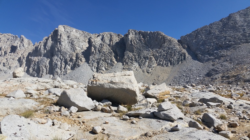
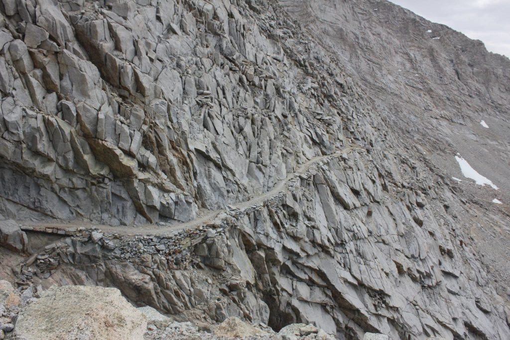
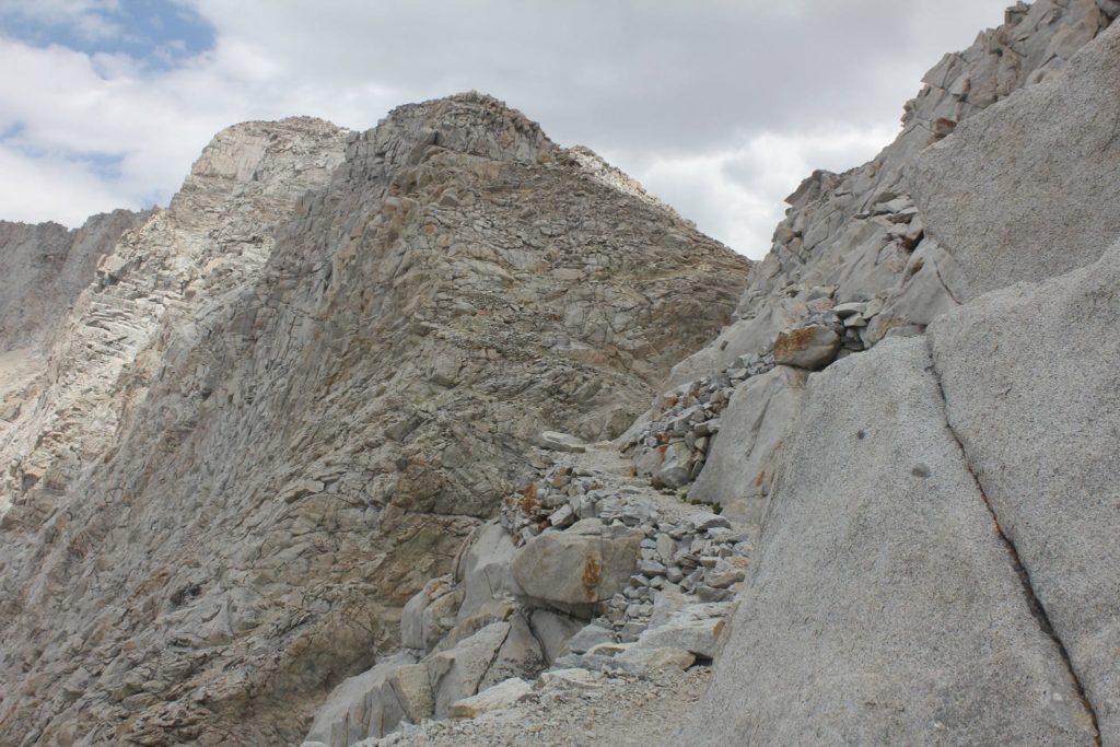
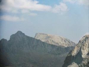
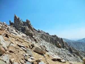
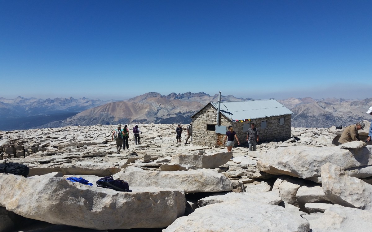
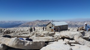
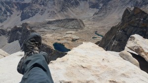
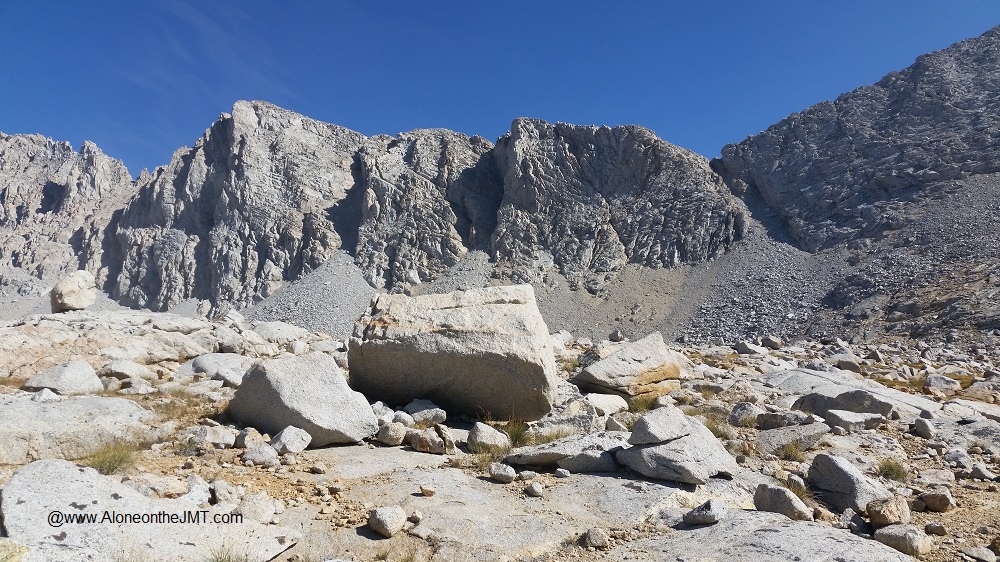
I was relieved when the trail curved toward the head of the slit, not down into it.  I spotted a narrow shelf cut in the nearly vertical mountain as I entered a dark cool alcove just a few hundred feet below the pass.  It felt like being behind a waterfall, without the water.  I crossed the head of the steep, jagged ditch that cut a thousand feet down the mountain.  As I exited, voices from above were cheering me on, “You’re almost here. You’re doing great. See you up here!”   I couldn’t see them, but I heard them loud and clear.  I was elated to be so close to the top and excited for the camaraderie that awaited me. I climbed a small set of switchbacks that took me up the final stretch and spilled me onto the pass. Forester Pass! I’m here!

It was buzzing with activity. There were five, or maybe six guys sitting around enjoying the victory. After doing a couple three-sixties to absorb the views that lay behind – and ahead of me –  I searched for a suitable place to squeeze my butt and pack in on the very narrow landing.  I finally settled on a pile of lumpy rocks.  The group cheerfully welcomed me and introduced themselves. One group was from Nevada City, just a couple hours from me and the others from the east coast, I think. We had a good time sharing trail stories, talking gear and eating trail mix.  I love summit parties!

I stretched my stiff achy hamstrings and quads and then sat back and relaxed as much as I could with a bunch of rocks up my butt.   I’d been there maybe 20 minutes when the steep southerly trail delivered another hiker.  Robert!  It’s Arkansas Robert!   Where the heck did he come from? I didn’t see them coming up the trail…

forester view from top reduced

“Robert!!! Hi!” I beamed at him, excited to see my friend.

“I need a minute,” he answered with a shaky voice and headed up away from the rest of us.  He was clearly having a moment; this wasn’t the happy jolly Robert I’m used to seeing. I figured he was having a flood of emotion like I had summiting Mt. Whitney. This stuff can be pretty powerful.

Later I learned that he’d climbed Forester Pass before.  It was the summer following the last big wet winter California had.  That year, Mother Nature dumped so much snow on the Sierras that hikers encountered snow well into late summer. The Sierra/JMT hikers who were out tell stories as if it’s ancient folklore: “Back in the Big Snow of ’10 parts of the trail were covered with snow until August and we had to crampon up the passes and glissade down them. Yep, there was even snow at Guitar lake in July! AND we had to cross 2 bridges in 12 feet of snow, barefoot to get there!” (Ok, I made the last part up.)

After the rest of the Arkansas Four arrived, Robert rejoined the group and told us his story of the Big Snow of ’10: “I was coming up this pass,” he started, nodding toward the trail from which he’d come, “and it was still buried under a bunch of snow. It was icy and slick. A lot of people had gotten off the trail because it was too scary. But for some reason, I forged ahead. I was near the top, right down there,” he said pointing to a spot near the big scary slit with his trekking pole, “and lost my footing. I slid so far down… I don’t know how, but I caught myself.  In those few moments, I really thought I was going to go all the way down. I thought I was a goner.” He paused for a few minutes and I could see the emotion in his face, “and coming up here today, I wasn’t expecting it, but it all came flooding back…” His voice was shaky and his eyes were a little misty. “Whew. I’ll tell ya, I’m sure glad to be here now!” We were silent as we listened to Robert’s story. A single word crossed my mind listening to his story and reflecting on the memorial I’d passed on the way up: Respect. These mountains demand our respect. Snow or no snow, it can be a dangerous place.forester views 3

The summit party got even better with my trail friends there. It was good to be reunited with familiar faces. The others left and we had the pass to ourselves: lounging around for a long time sharing trail mix and snapping photos.  I found out they’d stayed at Lake South America last night where they found a remote and picturesque lakeside spot that sounded perfect.

forester group pic
Arkansas Four and me (with Zinc Oxide all over my face.. geesh)

We spent the afternoon hiking together toward Vidette Meadow. Descending Forester pass we were immersed in soupy-thick smoke. The expansive views were diluted and cut off by a wall of yellow smoke: but displayed before us were vast glacial bowls and cirques dotted with patches of subalpine greenery and gloomy charcoal gray tarns sweeping toward the north. The air quality was the worst it had been since it rained ash at Crabtree Meadow.  Feather light shreds of burnt forest – some as big as a quarter –  wafted down upon us.  I felt a slight burning in my eyes that wasn’t sweat and my breathing was a little more labored than it should have been (we were descending!). It was so bad that some of the SOBO hikers we passed had bandannas over their noses and mouths trying to filter the polluted air. I guess this will go down in trail lore as the “Smoky Wildfire Year of ’15”.

By 3:30 we’d descended into Vidette Meadow Valley and the smoke wasn’t as bad.  Around mile ten, we found a big clearing with a bunch of sites next to a small creek and there was some discussion amongst the group about camping there. After exploring the area and finding lots of options for camp I dropped my pack and decided to call it home for the night.  I was hoping the guys were done too and was a little disappointed when they decided to move on.  I was enjoying their company and didn’t want it to end.

Yesterday at Wallace Creek, in their characteristic respectful way they’d invited me to camp with them. Tim was the first to offer, “we don’t want to infringe upon your independence in any way and we want to honor your solo adventure, but we want you to know you are more than welcome to camp with us…”  I was so appreciative of the offer  – and the way he presented it. This is why I love backpackers – we just ‘get’ each other.

But today, I was being characteristically stubborn and maybe a little pig-headed.   I thought that by staying with them, I’d be giving up something; latching on to men for comfort.  And I didn’t want to do that. That’s not who I am or why I came out here. I’m doing this alone dammit! I must do it alone!  So I dropped my pack and boldly proclaimed. “I’m home for the night.  I hope to run into you guys again.”

We said our farewells and as I watched them disappear around a bend into the thick forest, I felt my stomach sink and then a flood of loneliness swelled inside like a noxious gas.  I just stood for a few minutes in the big barren clearing, all by myself, in complete silence for the first time since ascending Forester Pass. I shrugged it off, picked up my pack and headed into the woods toward Vidette Meadow which by now was glowing vividly through the trees beneath the afternoon sun.

With boots off and feet soaking in the cool water, I looked back at the contents of my pack scattered about, ready to set up camp.  I got an uneasy eerie feeling being so deep in the trees and realized I didn’t really like the spot I’d chosen.  I didn’t want to be there… “Fuck this,” I said out loud, pulling on my socks and boots and leaping up to pack up and go find my friends. I’m not sure if I just needed an excuse or if I really just didn’t like the spot, but once I got back on the trail, I was excited and I comforted myself about my decision as I hiked along:  It’s ok to not want to be alone. This doesn’t lessen my experience or make me any less independent. Some company tonight will be nice…  

The two miles of trail between my almost- campsite and my friends’ camp was easy and quick.  And about half a mile in I stepped over a giant pile of fresh bear poop. I knew I didn’t like that site or a reason. There are bears here!

Within an hour, I again emerged from the woods and appeared on the edge of the camp of four friends from Arkansas.  They were clearly surprised and seemed genuinely happy to see me. “Yes, of course, we told you – you are more than welcome to camp with us! Find a spot to pitch your tent and come join us for dinner,” Tim said as I approached them asking, “hey is there room for one more?”

dear near vidette for blogh
nice buck near Vidette Meadow

After pitching camp, taking a hiker bath down the creek away from camp and filling my water, I joined them for dinner. We had a good time telling stories and watching the dear in the meadow over dinner.

Excerpt from my journal that night:

It’s been dark a while. I stayed up late enjoying the company of fellow backpackers and hearing their many stories of adventure.

I’m inside my tent now getting ready for bed and feeling veeeeery relaxed.  Someone I may or may not have met on the trail may or may not have given me a Xanax to help me sleep (in case the DEA is reading this, I don’t remember what they looked like and I didn’t get a name) :-).  I think it’s already kicking in… I hope to sleep tonight.

It was a good day!

Tyndall Creek to the Foot of Forester Pass

Day 6:  Tyndall Creek (via Forester Pass, ending at Vidette Meadow)

August 22, 2015: It’s 5:15 am. I finally gave up trying to sleep about a half hour ago and ventured outside the relative warmth of my tent into the frigid predawn darkness to grab my bear can so I could make coffee. It’s cold and windy out there, but I took a minute to stand in it and admire the rocky landscape resting serenely beneath the twinkling stars and black sky.  I’m back inside now, huddled in my down jacket with my bag wrapped around me.  My Pocket Rocket stove is set up inside my vestibule and Tyndall Creek water is heating up over the flame. I try to warm myself by embracing the air above, drawing in its heat while I nibble on tiny chunks of Bobo’s Maple Pecan Oat Bar, savoring each crumb, as I earnestly attempt to save some to enjoy with my coffee. camp at tyndall creek branded

Why can’t I sleep? I’ve been out here 5 nights and I’d be surprised if I’ve slept 20 hours. It’s getting a little frustrating. If it isn’t plain ole restlessness, it’s one of my arms throbbing painfully as it’s crushed between my body and the hard earth as I try in vain to sleep on my side. Being a stomach sleeper doesn’t work in a sleeping bag so I’ve tried to train myself to sleep on my side over the years. I’m still not very good it and toss and turns most nights. If it isn’t my arms, it’s the aches and pains in my thighs and hips pressing against the ground or jolting, shooting pains up the bottom of my feet. Yeahwhat the hell is that about?

Despite the insomnia I can’t believe how comfortable I’ve been out here at night. I haven’t been scared at all. I lay in the darkness of my tent feeling totally at peace. But then, I haven’t seen a single sign of bears yet either. No bear scat and the nights are still and silent. I like being on the rocks, you don’t hear the footsteps of nocturnal critters going out about their business: no rustling in the bushes or branches crunching and breaking beneath giant paws. Just silence – and last night a little wind flapping against my rain fly.  As I approach Yosemite – which is notorious for bear activity – that may change. We’ll see.

Coffee inside my tent on a chilly morning

I do hope to see a bear on this trip – but in broad daylight, while it has a tummy chock full of fish and berries and is frolicking peacefully in a meadow at least a quarter mile away, alone, with no cubs and it would be great if it doesn’t spot me. Is that too much to ask? It is, isn’t it? Dear universe, I would like to see a 400-pound wild animal with fangs the size of a VW bus and claws like daggers – but could ya do it in a way that is completely non-threatening so I don’t get too scared?  Much appreciated.  – Love, Carolyn

Ok,  so maybe I am tempting fate a bit by willing the universe to show me a bear on my terms. We humans can be so vain.

On that note, it’s time to make my oatmeal and start packing up the inside of my tent.  I have a pass to climb today…

********

I left my camp next to Tyndall Creek around 7, rock-hopped back over it toward the forbidden “no camping for restoration” zone and rejoined the trail heading North toward the rugged expanse of the Kings-Kern Divide. Despite the lack of sleep, I felt energized and excited about the adventure those not-too-distant mountains hold for me in the days to come. The trail was easy at first as it meandered away from the creek, through sparse patches of sub-alpine conifers and faded green grasses, inching me closer and closer to the jagged peaks dominantly piercing the clear morning sky.  view toward forester from basin

As I climbed toward Forester Pass I came upon a couple of big crystal-blue tarns resting coolly at the foot of a massive granite ridge. If only I could take a break at every beautiful spot on the trail…

After a couple miles I found myself in the center of an enormous granite basin just below Forester Pass. WOW. I mean WOW. Before me was the most breathtaking and remarkable scenery you can imagine.  The sandy trail snaked through swatches of yellowing grass melded to the bottom of the rocky bowl. The scenic creek flowed gently from its source somewhere in the range just yards away and through the meadow, bubbling and gurgling in a bed of reddish rocks as it cascaded toward the Kern River to the south behind me. I’m pretty sure my jaw literally dropped as I gaped and turned in a circle to soak in every tiny detail.  It was one of those scenic moments backpackers fantasize about; the spot that’s more pristine than any picture you’ve ever seen and profoundly visceral in its majesty.20150822_094119

I inhaled deeply and felt my body melt into the rock and grass and water. Something new was awakening deep inside me: stirring; beckoning; welcoming.  Like some invisible primordial force was drawing me out, fusing me with my surroundings.  And the sense of coming home that I get on every backpacking trip came to life and metamorphosed into a down-to-the-core feeling of belonging like I never experienced before. Deep down inside me, in some ancient and primal place I became connected to the earth – this earth that lay before me – the mountains and the lakes and the sky and the creek –  and I realized I’m not in nature, I am nature.  Yes, this isn’t just home, this is where I belong – where I fit. Where everything makes sense

I suppose some would call it god. I haven’t had much use for a god, but the feeling of peace that swept over me in that moment, realizing that I am one with nature was something I will never forget.

I wasn’t ready move on and let go of the moment just yet. I can’t stop at every spot, but I had to stop there. I decided it was the perfect place to wash my hair for the first time in 6 days.

me after washing hair below forester no smile
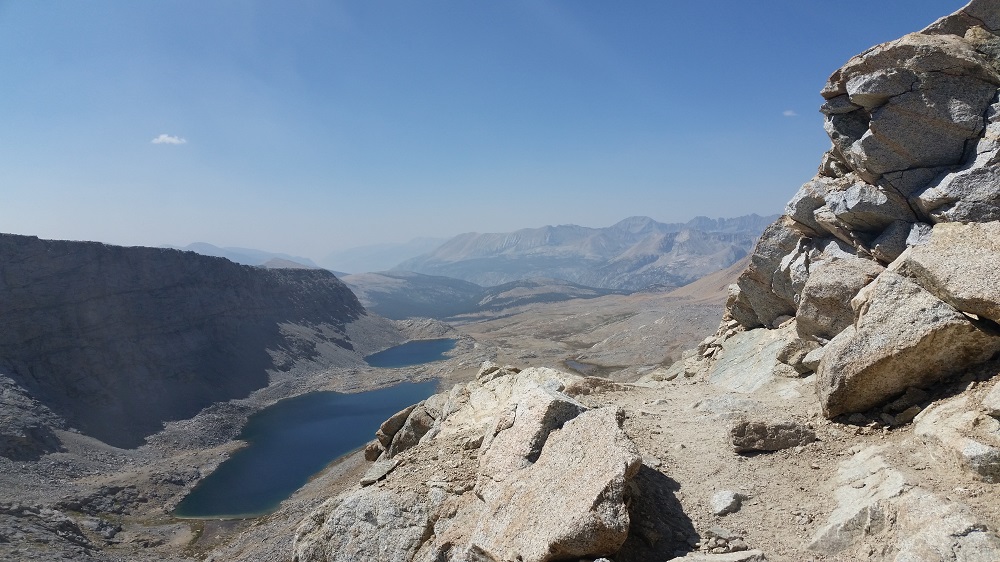
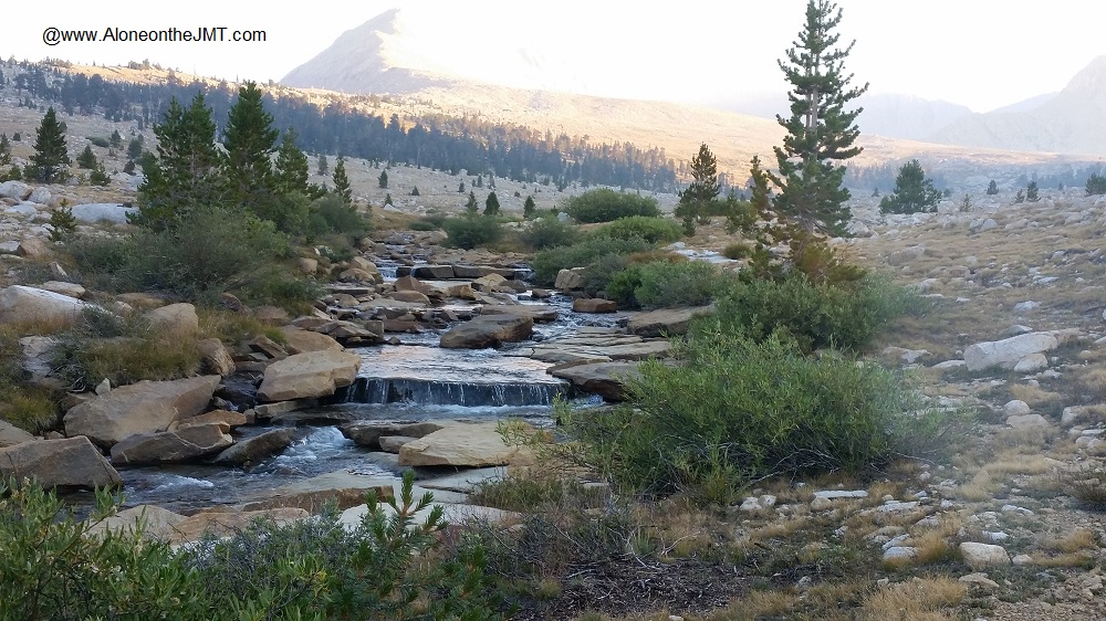
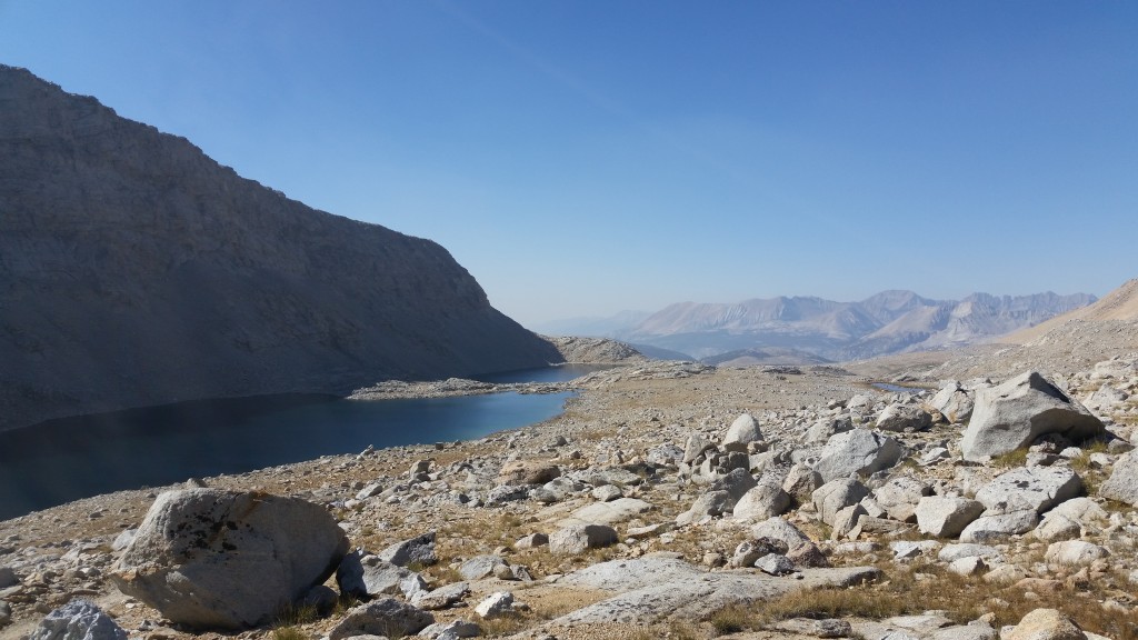
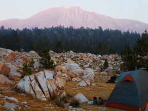
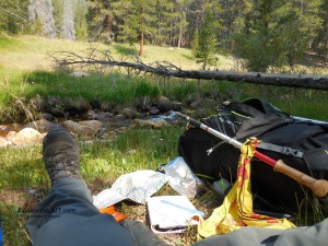
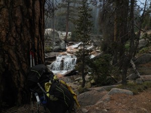
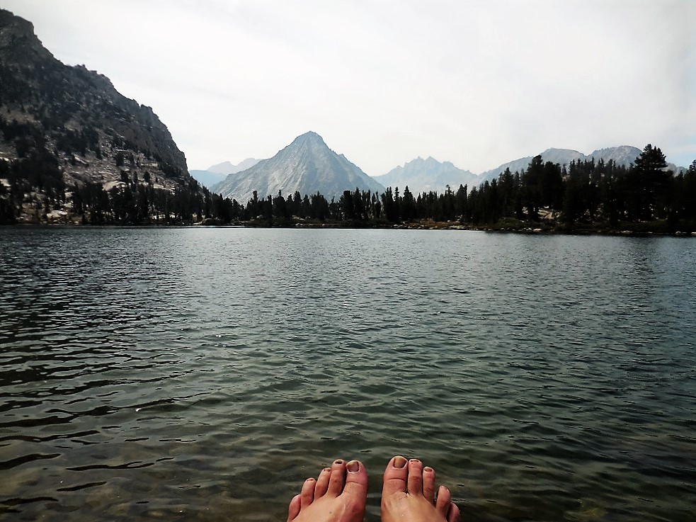
I scanned the basin searching for the perfect site for my break and bath, finally settling on a flat patch of grass next to a foot-wide section of the creek that babbled over a couple big red rocks creating a chute of water barely big enough for me to dunk my head under. I dropped my pack, plopped down on the ground, peeled off my boots and socks to let my feet air out in the sun and unbuttoned my dingy hiker shirt, stripping down to my black cami.  I laid on my side and dunked my head in letting the pure and frigid waters cascade over my dirty grimy hair (Holy shit, a baptism?!? Ok, that’s interesting…) BRRRR. Holy shit it’s cold. I turned on my other side to dunk the other half of my head, using my fingers to comb out all the trail dirt, sweat and grime of the past 5 days. I finished off my little alpine spa treatment by splashing water over my face, shoulders, neck and arms. Ahhh. I almost feel clean again! 

With cold mountain water dripping from my hair down my back and face, I sat for a while soaking in the desolation and isolation. I don’t know if anyone can understand what alone feels like until you’re in the wilderness miles and miles away from anything that resembles ‘real’ life.

I filled up my Nalgene, dropped an orange Nuun tablet in it without treating it and laid back against my pack in the soft cool grass next the tiny creek to dry out a little before tackling the pass that lay before me….

Tyndal Creek Camp – Night 5 on the JMT

Day 5, August 22, 2015

Tyndall Creek- Sunset

I love it here! I feel like I’m in a Star Trek episode: beamed onto a friendly alien planet where I get to explore the desolate moonscape-like terrain. My only wish is that this planet were free of the thick yellow smoke that hangs in the air so I could see the craggy mountainscape off in the distance. Oh well, it could be worse… I could be home in front of the TV dreaming of being on the trail! No need to beam me up Scotty, I’m good.

tyndall creek camp smaller
Smokey views from Tyndall Creek Camp

After hiking all day, trekking past a couple of small lakes and finally reaching the twisty Tyndall Creek which I had to cross multiple times, I found the few worn-down-to-the-dirt camping spots crowded together in the conifers on the left-hand side of the trail.  I’m here! I made it!  However, the vast and untouched boulder-strewn landscape that surrounded me beckoned to be explored; so I moved on. Being confined to that tiny area with everyone else isn’t exactly the wilderness adventure I came out here for.

I ventured up the trail and to the right, searching the several hundred feet of rocky terrain between the trail and the creek for my new temporary home. To my dismay, I was confronted by a string of “No Camping: Closed for Restoration” signs for at least a ½ mile.  It seemed that no matter how far I hiked with my tired legs and heavy pack, I couldn’t escape the signs. Determined to find my own private piece of heaven I crossed the shallow, gently cascading waters of Tyndall Creek and headed toward the trail that leads to Shepherd Pass.

I easily reached the other side and did a quick visual scan: No signs! Awesome! I guess most people don’t bother to cross the creek to camp so no need for restoration.   Treading lightly, I conscientiously searched for a spot where I would leave the smallest imprint to call home for the night.

When planning for this hike I saw Facebook posts, books and articles advising on the best camping spots on the trail. I scoffed at the idea of camping in worn out back-country campgrounds.  For me, doing the John Muir Trail was about experiencing “true wilderness” as much as possible – much like John Muir did (despite the crowds I knew I’d encounter).  My imagination led me to virgin spots where I could experience the natural, untouched solitude of life on the trail. Huddling in dusty camper corrals with everyone else, where a million people have camped before isn’t how my adventure played out in my imagination.  I suppose that goes against my self-proclaimed Leave-no-Trace (LNT) Nazism a little bit, but I’m diligent and step carefully. I’m determined to enjoy unspoiled lands and leave no visible sign I was here for the next adventurers who seek the same.

Morning views Tyndall Creek camp

And now camp is set up more than 100 feet from the creek tucked away in the field of boulders of every size and shape, closer to the Shepherd Pass trail than the JMT.  I pitched my tent on crushed rock,  doing my best to avoid the short yellowish-brown tufts of grass that would be crushed underneath my weight. When I leave no one will know I was here.

I’m absolutely exultant. This place is magical, awe-inspiring, breathtaking and profoundly serene.  I can’t wait to wake up to clear blue skies and the morning views that await. Like every other night out here so far, I’m optimistic that tomorrow I’ll wake up to another smoke-free morning. The smoke wasn’t as bad today as yesterday, but I saw it, still flooding the Crabtreee Meadow valley as I crossed Bighorn Plateau.  I’m keeping my fingers crossed that it will only get better as I travel north.

The easy 8 mile day I thought I was going to have today turned out to be not–so-easy.  I’ve made up my mind: the Tom Harrison Maps LIE! They lie about mileage and they especially lie about elevation. I swear I didn’t see all the elevation I climbed today on my map. I guess it could be I’m just not very good at reading those tiny little topo lines that are supposed to represent 40 feet intervals. 40 feet my ass – more like 4 HUNDRED feet.   So I hiked mile after mile after mile this afternoon thinking, I should be there by now. Where is Tyndall Creek? Did I pass it already? Did I miss it somehow? Am I even on the John Muir Trail? Pulling out my map every mile or so to make sure I hadn’t missed an important turn off or walked right by my destination.

In my frustration I half-jokingly came up with a new business idea: I’m going to create my own maps.  On my maps, all elevations and mileages will be exaggerated. For example:  when you study your map to plan your day you’ll think you have  12 miles and 2000’ elevation gain to get to your destination,  but it will actually only be 8 miles and 1000’.  That way, you’ll be ecstatic when your destination is so much closer and easier than you expected! I’ll call them the “Surprise and Delight” maps with the tagline:  “Hike further with less effort.”  I know this “brilliant” idea is completely ridiculous, but it kept me amused on my alleged 8 mile hike today. dnner at tyndall creek

The truth is, hiking is still hard. I’m still at 11,000’, my pack still weighs close to 40 lbs., I hiked 8 miles and a couple thousand feet today, and I’m 48, not 28.   Stuff hurts!  When will I earn my hiker legs? Day 7? Day 14? When??? Soon, I hope.

After meeting up with my friends from Arkansas at Wallace Creek today, I decided they need trail names.  When I wasn’t trying to figure out how to launch a new business of fake maps, I spent much of my afternoon trying to come up with fun monikers for each of them.  But in the end, the best I could do is a collective trail name: “The Arkansas Four”. I know, not very original… but I didn’t have the creative energy to name each one as I trudged up and over mountains carrying the ill-fitting pack they helped me adjust a little better at lunch. That led me to ponder how boring trail names would be if they were just the city or state we came from. I’d simply be “California” But there are lots of people from California. So maybe “Concord”- or “California number 15044”. Yah, I’d need to come up with something more creative for the Arkansas Four.

When I arrived at Tyndall creek I kept an eye out for the Arkansas Four, but didn’t see them. They must have gone on to Lake South America.  In a way I was relieved (even though, I have to admit, I found myself eagerly searching every campsite for them). I had mixed feelings about running into them; I came to do this alone, I didn’t really want to have to make the decision to camp with them or not.  This is better.

I met my first woman solo hiker today! I was ambling down a wooded trail somewhere between Crabtree Meadow and here when we crossed paths. I was so excited to see her that I  practically lunged at her and shrieked, “You’re Alone!?!”  She looked a little surprised (frightened?) and took a step back, probably thinking I was some wild old- lady lunatic. I realized it’s probably best not to greet solo female hikers in the middle of nowhere with what could be translated as: “Are you alone, little lady???” (insert malicious sneer). I guess she was convinced I didn’t have plans to eat her for dinner and stopped to chat with me a bit. She was half my age – if that – and didn’t seem nearly as impressed with the whole solo-female hiker sighting as I. She left Happy Isles 16 days ago and is finishing out of Whitney Portal tomorrow. Oh, the speed of youth! Anyway, I was thrilled to finally see my first solo female through-hiker. I hope to meet more.

***

Alpenglow from Tyndall Creek

I’m back from the creek now where I took a quick hiker bath and filled my Camelback and Nalgene bottle. The water is cool and crystal clear and fresh.  I’m not going to bother treating the water in my Nalgene. I’m pretty high up and the water is flowing enough.  I’ll mostly use it for making coffee and oatmeal and brushing my teeth in the morning anyway. Dinner is done and my Soloist pot washed. I’m enjoying my tea, sitting on a boulder soaking in the alpenglow views on the peaks to my north and east. How do I describe this most utopian and peaceful moment? Perfection.

Tomorrow is Forrester Pass- my first JMT Pass!!! A 5 mile, 2300 foot climb (or so Tom Harrison claims!) and then only 2-3 miles to my next camp somewhere in Vidette Meadow I think.  I’m not really sure yet, I’ll see how my day goes… From there it’s on to Kearsarge Pass and Independence for my first resupply. Wow!  It looks like I may end up there a day ahead of schedule.  I finally fit all my food, toiletries and first aid items in my bear canister this morning and now I have to fill it up again in a couple days. That means one thing: I better eat up!

**SCROLL ALL THE WAY DOWN PAST COMMENTS AND CLICK TO READ THE NEXT POST! ***

Plateaus, Peaks and What I Left Behind

8/21/15 – Day 5: Crabtree Meadow to Tyndall Creek via Wallace Creek

“Well you just never know who you’re going to run into out here!”  Arkansas Robert!   I’d come 3 ½ miles from Crabtree meadow and my gear troubles, traversed the vibrant Sandy Meadow, trekked up rocky slopes dotted with old-growth red fir pines and weather sculpted flamboyant foxtails and finally down into the Wallace Creek basin, where I’d planned to take a break and fill up my Nalgene.  I wasn’t expecting to see anyone and was joyfully surprised to see my four trail friends from Arkansas lounging in the shade of the Sierra conifers on the shore of the shallow and gently cascading Wallace Creek.

Robert greeted me with his now familiar signature line and the others with bright smiles and warm welcomes. It’s so fun to run into people I know out here! I stopped at the edge of their half circle and we shared our adventures from the day before:  the climb down Mt. Whitney and the smelly smoky ash-rain filled night.  We’re all concerned about the fires, but their attitude is the same as mine: we’ve come too far to bail.  All we can do is take it one day at a time.

I told them about the medevacked squirrel with the excitement of a six year old telling her parents about a caterpillar she captured in an empty mayonnaise jar. They’d heard the helicopter from their camp on Whitney Creek and wondered what all the fuss was about. I was happy to clear up the mystery and make them laugh with my squirrel tale. crabtree marker sign smaller

I was enjoying their company too much to hike down the creek further and find my own spot, so I happily accepted their invitation to join them for lunch.  I plopped myself down in the dirt where I was standing, pulled off my dusty Salomons to air out my tired sweaty feet and fished my lunch  out of the front compartment of my Flash 62 backpack: which I hadn’t quite forgiven for this morning’s shenanigans.

Unlike the first time we met, today we lingered in the shade over our trail-lunches and conversed beyond introductions.  The foursome had the kind of easy friendship that comes with decades of knowing one another. Robert and Tim met in kindergarten and Lee and Tony came into the mix through grade school and high school.  They got along like brothers and had endless tales of adventure and life experiences to share, each contributing their section of the story on cue, like people who have spent a lot of time together do.  Every summer for decades they’ve taken a guy’s trip and have been everywhere from Glacier National Park to the Everglades to Alaska. I listened earnestly as I munched on my Teriyaki flavored Primal Spirit Soy jerky, passing it around to prove how delicious tofu jerky can be.

It took less than fifteen minutes for the conversation to shift from the polite small talk of strangers to all the things new acquaintances should never talk about: politics (which stemmed from our mutual contempt for Trump), religion, the meaning of life and solving all the world’s problems.  Conversation flowed easily and naturally. Who would have thought a Liberal atheist from the Bay Area would have so much in common with four retired men from Arkansas???  I’m well aware that living in the Bay Area, I exist in a bubble that is very different from most other places in the country (I’m also well aware I can be a bit of a snob about it too), so I generally steer clear of charged topics until I really get to know someone. It was a nice bonus to be among like-minded friends.

A warm and sunny summer day. Creekside on the John Muir Trail.  A gentle breeze, great company, stimulating conversation.  Life doesn’t get any better than this.  These are the moments I live for, where my version of reality comes to life.   I “fit” here. It feels like home.

Rock Creek Lunch Break branded

With 5 or 6 miles to hike to get to camp at Lake South America or Tyndall Creek, my new friends from Arkansas reluctantly packed up and hit the trail, leaving me to loll in our idyllic spot in solitude.  I lugged my backpack and boots downstream to rinse my clothes and clean up, taking advantage of the last minutes of unobstructed sunlight before the smoke floated in, chilling the afternoon air. I laid my wet clothes out on the grass, propped my pack against a tree facing the sun, closed my eyes and lazed against it to dry off in the warm sun, listening to the waters of the cascading creek, the birds busily chirping and the soft breeze flow through the branches above me. This is what peace feels like.

*************

An hour later I was crossing the vast and barren Bighorn Plateau. This late in the season it’s blanketed in tufts of golden grass rising up from a bed of sand and broken rock. Wow! Just Wow!  Despite the yellowish haze obscuring the views of the Mt. Whitney range, it was a magnificent sight. I tried to imagine what the view would be in a normal year, when half of California isn’t on fire. I couldn’t help but feel a little jilted, but in the big scheme of things it didn’t matter:  I’m on the JMT. I spun in place doing a couple 360s feeling like Mary Poppins – only the backdrop was a rugged and faded plateau instead of the vibrantly rolling hills of the Alps.

DSCN0120
Looking back toward Whitney and Crabtree Meadow

I’ve been hiking mostly alone for 5 days now. Until this afternoon my thoughts were about getting from point A to point B, dodging blood thirsty coyotes, not falling off cliffs and trudging up mountains in the thin air, focusing on getting enough oxygen into my depleted body. But today, hiking across the desolate Bighorn Plateau my thoughts drifted to my new friends from Arkansas and the bond they shared.  I mentally examined the concept of lifelong friendships with the fascination one gives an alien object; dissecting it with the fingers of my brain in an attempt to understand its inner workings.  How do people stay connected over decades? How do they manage to not grow apart and drift away?  What is it like to have a circle of close friends and family you’ve known a lifetime that you can depend on; to know that no matter what, someone has your back?  I chalked this up to yet another of life’s “normalcies” that other people have, but not people like me.

Most of my life I’ve felt like an outsider looking in;  mingling and mixing with the ‘normal’ people with their big happy families and friendships born in sandboxes at preschool and sustained through Girl Scouts,  homecoming dances, graduations, marriages, births and divorces. I’ve watched with the fascination of someone who went to thirteen elementary schools and learned early in life that making friends was a futile endeavor.   By the time I reached high school I didn’t even know how to make friends anymore. I was quiet, withdrawn and used to being teased and bullied at every new school I went to. Usually it was because of my weight – but mostly just because I was an outsider and easy prey.

High school foreshadowed the life that lay ahead for me: I didn’t fit into the predefined social cliques nor did I have tons of options when it came to choosing friends. I wasn’t outgoing, athletic, pretty, cool or funny.  I was smart, but too serious and mature beyond my years for even the brainy clique.  Plus, I was awkward and self-conscious and didn’t know how to relate to people my age.  I made a few friends – outcasts like me – but I never really felt like anyone “fit” me. We outcasts came together, not because we liked each other necessarily, but out of pure necessity: finding safety in numbers. We’d pair up and quietly slink down the hallways between classes hoping no one would notice us and huddle together in the corners of the cafeteria at lunch, each of us trying desperately to fade into the group and become invisible to the bullies on the prowl for their next victim.

I eventually found my place with the burnouts; learning at a young and impressionable age that Carolyn the ‘bad girl” had a lot more company than the smart quiet girl. And so the patterns of my life were born; cycles of partying and the friends and relationships that came with it,  followed by getting clean and leaving them behind for new sober friends and then falling off the wagon and alienating my new healthy friends…

Mt Whitney climbing out of Crabtree toward Bighorn Plateau

Confidence and sociability came with age and experience. By the time I moved to San Francisco at 21 I found it easy to meet people, but even during my periods of lucidity most of the people who came into my life didn’t stick.  My periods of sobriety were quests for personal discovery and growth; uncovering my truths and finding the reasons I kept going into dark places. This has meant a lot of very hard soul-searching and reinventing myself over and over again. Each new phase meant learning what – and who -fit into my new reality and often making the hard choice to move on: alone.  Which has always been a source of shame and doubt for me. Why can’t I hold on to friends like “normal” people do? How many times do I have to reinvent myself? Why can’t I just be normal?

I paused in place on the rocky trail and spun around soaking it the view of Bighorn Plateau to get out of my head.  This little trip down memory lane was consuming me and I wanted to step back into the present.  Behind me Mt. Whitney majestically jutted toward the sky in the smoky distance. I smiled. I climbed that.

And in that moment something happened. Standing on that plateau with Mt Whitney behind me and hundreds of miles of peaks and passes ahead of me it all came together. I am exactly where I am supposed to be.

smaller view of whitney from Bighorn
Mt Whitney through the smokey Bighorn Plateau

My heart swelled with…. Happiness? Pride? Relief? I wasn’t sure, but I felt completely and totally and unabashedly free. Freer than I have ever felt before. Not just because I’m on the John Muir Trail and have nowhere to be for the next 25 days but free from all the judgement I’ve carried about the relationships and friendships I’ve had to say goodbye to over the years. Free from what I thought I should be and should have. Free from some manufactured idea of what my life should look like. Free from the falsehoods of a world dressed up in Hallmark moments and cheesy prime-time sitcoms that neatly wrap up every relationship issue in a half hour.  Free from a world that tells people like me that we aren’t ok because we don’t have what Hollywood and Capitalist America tells us we’re supposed to have.

Yes I was dealt a shitty hand.  Yes, I’ve had to fight and dig and claw my way through life alone, figuring things out as I go and learning all my lessons the hard way.  I could have settled for “surviving” like so many people do, but that has never been good enough for me.  I’ve never been one to sit on the side lines, taking the safe route. I  am not one to just go through the motions, biding my time on this planet.  I want to live – I mean really live.  That has meant a life of experiences, risks and experiments – some of them healthy and some – well, let’s just say, maybe not so much. Trying things – and people – on for size is how I’ve discovered who I am and what fits.

Today I was set free. Today I saw myself in a kinder, more empathetic light: I am exactly where I want to be and I owe that to the sum of my experiences. Good and bad.

I got here by being brave enough to face my truth. By making mistakes, getting into bad relationships and trying on friends that didn’t fit.  I learned something from each and every one of those experiences. And they got me here, to this exact spot at this most awesome and beautiful moment. Not everyone’s path is the same – and that is ok.

I was so deep in thought that I barely noticed the plateau was behind me and I was beginning my descent toward Tyndall Creek on a wooded trail.  My mind was racing with all the clarity that was flooding in. Like some invisible gate of self-love and empathy had flung open and I could see clearly for the first time. How could I have known what type of men I wanted to date or women I wanted to befriend if I didn’t even know who I was?  All those years of selling myself out had left me an empty shell; a chameleon ready to take on whatever colors I needed to blend in. But not anymore. The last couple of years have been about learning to be true to myself. About learning that I don’t even want to blend in and be like everyone else! It’s been about accepting – and now celebrating – my uniqueness.

I wanted to scream into the forest,  “YES I AM DIFFERENT GODDAMMIT AND IT’S OKAY!”

It’s fucking OK…

I trekked on with renewed purpose and an awakened sense of myself. Just a couple more miles t to Tyndall creek where I may or may not meet up with my new friends. And either way, it will be perfectly OK.


Squirrel Tales and Gear Fails

Day 5, August 21, 2015: Crabtree Meadow to Tyndall Creek

I HATE my backpack!!! HATE IT. HATE IT. HATE IT!!!  If I had a temper, I’d have kicked the damn thing clear across Crabtree Meadows this morning. But I don’t. So I didn’t.

I’m sorry REI, I love you and most of your gear but the Flash 62 is a piece of shit. Ok, I’ll take some responsibility…  I probably shouldn’t have waited until just 4 weeks before my trip to decide I needed a new backpack.  I was trying not to spend a total fortune on new gear. I’d already updated my tent, stove, sleeping bag, cook set, boots, sleeping pad, base layer, socks, and even hiking pants (you can see my full gear list here). Did I really need a new backpack too? I tried to convince myself that it could wait.

REI Flash 62 - A love-hate relationship
REI Flash 62 – A love-hate relationship

But backpacking in Lassen National Park for 6 days during the eighth of my nine JMT training/shake-down hikes, I had to concede: the way my pack squeaked while I hiked and pulled to my right side causing me to constantly fidget and tug at the waist belt and load straps would be super annoying after a couple weeks on the trail. I couldn’t deny it any longer: I needed a new backpack.

I loved my old Flash 62, it served me well for several years, so after doing some window shopping, online comparisons, and trying a couple on inside the store, I decided the new Flash 62 would be a good choice.  Then it went on sale at REI Outlet and I got a member’s only 20% off coupon – I ended up getting it for only $79. How could I refuse a deal like that?

I was so excited the day UPS dropped it off on my doorstep!  But the excitement disappeared when I pulled the flimsy backpack out of the box.  I’m not sure what I expected for a $79, but I didn’t expect “ultra-light” (2 lbs. 14 oz.) to be synonymous with poor quality.  As I scrupulously inspected my new pack I had doubts the tiny compression strap buckles could hold up under the bionic-strength compression demands I put on my packs. And the “ActiveX LT perimeter aluminum frame” seemed way too frail for the rugged wilderness. I was skeptical this pack would be durable enough for 30 days on the trail, but I trust REI so I decided to give it a shot.

crabtree marker sign smaller

I took it out on a trial run for three days in Emigrant Wilderness, loading it with about 30 lbs. of gear and food. I liked how light it felt on my back and how it moved with my body effortlessly.  The fit was ‘ok’, even though the shoulder straps sat a couple inches above my shoulders no matter how tight I pulled the straps.  I’m 5’4” and I bought a medium. Even though every sign pointed to the pack being too big for me I just couldn’t accept that I’d wear a small anything.  (I know, I know completely different than say, a shirt, but tell my old chubby-girl brain that!). Even though the fit was off a little, it felt pretty comfortable, so I didn’t think too much about it.

Then I discovered a bigger problem:  my first morning out, as I slung my new Flash 62 over my shoulder to hit the trail, I noticed the top of the Activflex LT perimeter aluminum frame had popped out. There are little flappy cover things that fit over the frame to hold it in place. When it pops out the pack pulls away and bobs in the breeze.  When I first discovered this on the trail in Emigrant, I took my pack off and tried to pull the flaps back over the frame, but it was impossible. Being full, everything was too taut. I decided to live with it for the day; we were only hiking a few miles anyway.   I hiked all day with the bobbing and swaying, vowing to investigate the flaw and figure out how to fix it later.

Packing up at Crabtree

When I got home and read the reviews I didn’t see any complaints about the frame. I thought that was odd because it was a definite pain in the ass.  But I did learn that a “multi-day” pack doesn’t mean a “30 day pack” and the REI Flash 62’s max load capacity is about 35lbs and I’d be cramming about 40 lbs into it. I was just 2 weeks out; scheduling another outing to test a new backpack wasn’t an option so I decided I’d make the most of the one I had. I thought about using my old one, but the squeak and sliding seemed worse than carrying too much weight and remembering to put the frame in place every morning.

This morning I regretted my decision. Apparently, yesterday when I tightened and compressed all the straps to make it into a day pack for the Mt. Whitney climb everything came unhinged. I hadn’t had any problems with it so far on this trip so I forgot to check it before stuffing all my gear inside.

See the animal on the rock? This is the trail to Whitney from Guitar Lake

As I left camp and hiked toward the trail to Tyndall Creek I felt something jabbing me in the back. I squirmed and felt around with my hands trying to figure out what was poking me. I took a few more steps. More jabbing and poking. I’d squirm and wriggle under the weight of my pack some more.  A few more steps, more prodding.  What the hell? It couldn’t be ignored. The pack had to come off.   Any backpacker knows the last thing you want to do after heaving a 45 pound pack over your shoulder, tightening, buckling, adjusting, bouncing and adjusting some more until it fits just right, is take it off.  But sometimes you have no choice.  I slid my nemesis off my back in frustration and let it hit the ground with a thud. There it was. Not only had I forgotten to pop the top of the frame into place, but a new flaw presented itself: the ends of the frame had come loose and were sticking out from somewhere. That’s what was poking me in the back. 

I was simmering in frustration.  I just wanted to be on the trail! I didn’t want to be dealing with this!  My head resounded with the piece of mind I wanted to give REI:  This is the most ridiculous thing I’ve ever seen! Who designed this piece of crap?  Some nerdy engineer who has never been outside before, much less worn a backpack on an actual trail? I imagined a team of backpack-design engineers holed up in a basement lab with no windows, geeking out over the load-to-weight ratios (not sure if that’s even a thing…) and getting orgasmic over saving nano-grams with their fancy Activflex LT perimeter aluminum frame as they drew it out in complex algorithms and formulas on a white board. Finally “testing” it on a virtual backpacking trip on a reality-sized screen while they sipped Mountain Dew from cans and watched. “Yep, looks good to me.” “Yep, me too, let’s sell this thing!”

FAIL!

I found two tiny pockets near the waist belt that house each end of the aluminum frame.  The frame isn’t sewn in (no… 4 cms of thread would have added way too many nano-grams!), it was just supposed to slide right in and magically stay there! No one every bothered to turn the empty pack upside down, apparently!   (Maybe they should have had the Samsonite gorillas test it instead of the engineers). This is the stupidest design I have ever seen. REI your design team should be fired.

I vigorously tried to squeeze the “Activflex LT perimeter aluminum frame” back into place without emptying the pack: no such luck. I had no choice, I had to do what I least wanted to do: unpack. 

Trail scenery day 5
Trail scenery day 5

I can live with a pack that doesn’t fit quite right. I can even live with the discomfort of carrying more weight than it’s meant to (that problem solves itself as my pack gets lighter every day) but having to fight with this damn frame and remembering to squeeze all four points back in place – and make sure they stay there as I fill my pack – every day, stretched the limits of my patience. There’s no excuse for it – it’s just poor design. But I’m 50 miles into the wilderness. There’s not much I can do. Fix the damn frame and move on.

Unpacking my gear, I found a puddle of water in the bottom of the bladder sleeve. Oh great. Is my bladder busted now?  I pulled it out and inspected it, finding 4 little punctures.  I flashed back to when I’d absent-mindedly plopped it down on a rock at camp. Note to self: rocks are hard, bladders are soft. Do not slam soft things onto rough rocky surfaces.  I really need to pay closer attention to everything I do out here!

I was grateful for the brush-on superglue I accidentally bought on one of my last-minute trips to Target.  I couldn’t find the superglue aisle and ended up in the crafts section. Happy to find anything that resembled a tiny tube of superglue I grabbed the first one I saw. To my surprise when I opened it to repair my cracked Nalgene bottle a couple days ago (yeah, I guess I’m kind of hard on my gear – who breaks Nalgene???),  I discovered I’d grabbed brush-on superglue! Pure genius! No mess, no fuss, no fingers permanently stuck to my water bottle!   Within minutes the holes were sealed and the Camelback was good as new. Victory!

Another view of Mt Whitney trail

I tried to comfort my annoyed self by searching for a logical reason for all this shit going wrong on my fifth morning on the trail: maybe the trail gods weren’t sadistic meanies out to fuck with my head,  but popped the frame out of place in order to protect me from some bigger catastrophe. I reasoned with my inner tantrum-prone 5 year old:   Ok so maybe the whole frame thing happened so I’d  discover the leak before I  had 2 liters of water all over the inside of my pack.  The truth is my trash compactor bag would have protected my important gear –  but it was worth a shot!

Ok, bladder fixed. Check. Stupid frame in place. Check.  Time to finish packing so I can get on the trail…. SNAP! The flimsy buckle that vertically compresses the main compartment of my backpack busted a tooth as I tightened the strap down.  Great. Just great. I had to laugh.  It was either that or lay on the ground, curl up in a fetal position and cry  – and that’s not how I roll. Instead I laughed like a lunatic… because crazy is  how I roll.

Gear Report Card for the day: Super-Glue, A+. REI Flash 64, D-.

On a brighter note you may have noticed by now that I did NOT get evacuated last night.  When the helicopter landed several hundred yards away as I made dinner and rested in camp, I attempted to jump up and run down to see what was going on.  I say “attempted” because my body quickly reminded me that I had climbed a pretty big mountain: 16 miles and 8000’ in elevation, I wasn’t doing anything quickly.

I crammed all my food back into my bear can and hobbled the three hundred yards to the other end of the meadow with my Soloist pot full of rehydrating chili in hand (it didn’t fit in my bear can and I didn’t want to leave it for the marmots and bears), pleading with some invisible magical force that had power over the mission of the helicopter:  Please don’t be an evacuation. I don’t wanna goWhat if it is an evacuation? What if this is the end of my trip? 

Crabtree Meadow area in the smoke

When I got there I found a couple guys camped in the trees on the edge of the meadow just feet from where the helicopter landed.  There were people busily working around the chopper; pulling things out, putting things in, and mulling about.  My fellow campers’ backs were to me as they watched the excitement.

“Hello!” I yelled through the heavy chopping sounds of helicopter blades cutting through the smoky air. One of the men, a rugged-looking mountain-man close to my age turned around and said hi back.  His friend was holding a cell phone up, filming the whole event and didn’t acknowledge me.

“Do you know what’s going on?” I asked, “Are we getting evacuated?”

“No, we aren’t getting evacuated. The Ranger said it’s a Medi-vac”

Relief swept over me. Yay! I get to stay!  Then what he said hit me… Oh wow, someone is hurt though… “A medi-vac!?! What happened?”

“They’re medi-vaccing a squirrel.”
Wait… WHAT???

“A squirrel?” I was sure I misheard him.

“Yup, the Ranger found a dead squirrel up on the ridge and because of the plague that closed Curry Village in Yosemite this week, they aren’t taking any chances.  He called in the state and they’re flying it out for testing.” The rugged man my age was clearly as amused by this as I and laughed incredulously as he told me what he knew.

A squirrel. All this fuss over a dead squirrel. I’m who-knows-how-close to a raging wild fire and they flew a helicopter in for a squirrel??? A  DEAD Squirrel… not even an alive squirrel!!!  I’ve seen a lot of crazy shit in my life, but this one  takes the cake..

Guitar Lake views day 4

I chatted with the two men while we watched the official-looking helicopter crew  back and forth from the Ranger’s cabin to the helicopter doing serious official-looking dead squirrel re-con work. Once I saw them ceremoniously carry the tiny shoe-box sized coffin to the helicopter and fly way, I went back to camp.

Just kidding, there wasn’t really a tiny coffin. But for all the fuss, I wouldn’t have been surprised – I mean it did get its own helicopter!

What really happened is I watched until it got boring and then limped back to camp to eat dinner and entertain myself with how I would tell this story to everyone I met on the trail for the next 25 days.  I chuckled to myself:  here I thought a helicopter was flying in to warn us the fire was close. I expected to hear a stern voice over a loud speaker. “The Kings Canyon fire is a mile away.  All backpackers must exit the forest NOW. We can’t take you with us. We need to warn the rest. Just hike east, don’t worry you can outrun it.  Good luck!”

Or I expected to see Military Seal-like teams drop from the sky on rope ladders to search the area for hikers, rounding us up and hoisting us into the chopper to carry us to safety.

But no. Despite the proximity of the fire – which seemed way too close, the official helicopter was there to take away a dead squirrel. Really, you can’t make this shit up!

So I wasn’t evacuated last night and my gear is now all in order. I’m finally ready to get day 5 going and hit the trail toward Tyndall Creek.

Happy Trails!

Mt. Whitney: The descent

Whitney trail to whitney
Mt Whitney trail, looking up

Day 4: 7:30 pm at CrabtreeMeadow BaseCamp

I reluctantly peeled myself away from the top of the U.S. around 1:30 this afternoon and began my 7 1/2 mile hike back to camp.  As I descended the rocky summit I  immediately ran into familiar faces. First, Robert and Tim, two of the four guys from Arkansas I met early this morning.  I’d been hiking along at a good pace and was lost in thought when I came upon their camp in the trees next to the trail.  It was one of just two or three camping spots along the creek that flowed from Timberline Lake down to Crabtree Meadow. The men seemed as surprised to see me appear out of the  crisp morning mist as I them. They were waking up with hot coffee and leisurely preparing themselves for the day’s climb.  Anxious to get to Guitar Lake and begin my summit, I only lingered long enough for introductions and to learn they came from Arkansas to hike the JMT, they started at Cottonwood Pass the day after me and were also headed to Happy Isles! Yay! My first fellow NOBOers.

“You just never know who you’re going to run into out here!”  Robert greeted me just yards below the Mt. Whitney summit with his big warm smile.  They were resting on a giant rock waiting for their fellow Arkansians who were still inching their way up Mt. Whitney.  I was elated to see my fellow NOBOers again and excitedly told them about the brutal climb and my emotional summit. They looked way too relaxed and fresh sitting on that rock, smiling away, nibbling on trail mix.  “I really didn’t think it was that bad” Tim said, and Robert nodded in agreement.  (Whatever…!).  They may be 10 or 15 years older than me, but obviously in much better shape!

We said “Goodbye for now”, knowing the chances were good we’d meet again.  I continued down the trail and ran into the other half of the Arkansians, Tony and Lee, not too far away. They didn’t appear quite as chipper and fresh as their friends – looking like I felt during the last steps of the summit just a couple hours before: red faced, out of breath and slowly dragging their booted feet up the mountain 6 inches at a time. They looked exhausted, frustrated and completely over it. I smiled and offered encouragement, “You’re almost there. It’s not too much further!” They both managed to eke out pained half-smiles as they inched past me.

As I maneuvered my way up and down the rocky trail, through narrow passes blasted out of rocks the size of two story buildings and along the narrow path wedged into the narrow crest, the sapphire blue tarns I’d fantasized about on the way up still beckoned. Soon. I’ll be there soon.  I passed day hikers who’d breathlessly ask “Are we close?” Their eyes searched me, begging for the answer they craved…

“Yes, you’re almost there… you’re doing great!”  I empathetically answered. They’d give me a weak grateful smile as they trudged up the monstrous mountain 6 inches at a time.

Next I ran into Scott who I met my first night out at Chicken Spring Lake. His two female companions were somewhere behind. After exchanging congrats and trail tidings I continued on.

The trail to Mt. Whitney - last mile
The trail to Mt. Whitney – last mile

The trail between the summit and Trail Junction is the most harrowing 2 miles of the whole trek. As much as I wanted to rush down (damn my impatience!), taking my time, scouting the trail ahead and watching every step was critical to getting to the bottom safely. On my ascent I thought, it’s just 1000 feet over 2 miles, this will be easy! HA!  Sure, the elevation gain isn’t bad, but there are sections where the 12 inches of trail are carved into the 60 degree sloped mountain.  That means there was nothing but nearly-vertical slopes of  jagged granite above and below me.  The fact that I was just one misstep, dizzy spell, or twisted ankle away from sliding down 4000 feet of rock-shards didn’t escape me. If I slip, I’m gone.  Period.   

I kept thinking, I can’t believe more people don’t die up here. With all the inexperienced hikers, dizzying thin air, slippery slidey narrow trails and the rapid changes in weather how is it possible people aren’t falling off every day?  And at one point I even said it out loud to a young day-hiking couple who stopped to let me pass. They looked terrified, “don’t say that!” they half-jokingly scolded. Ok, so maybe it’s not something you say out loud when you’re in the depths of a potentially life threatening situation.  Ooops.

As I mulled this over and carefully hiked on, the trail suddenly dropped off into nothingness 10 feet in front of me. What the hell? This can’t be right… I’m supposed to go down THAT? I looked around to confirm I was on the trail: I didn’t see anything else that looked like a trail… But this can’t possibly be right…  I’ll kill myself trying to get down that. I didn’t come up this way — did I?? I scanned my memories of  the hike up, trying to remember coming up a trail as treacherous as what lay before me… Nothing. There was no such memory. This just can’t be right… ? 

The drop off
The drop off of death!

So I halted, froze in my tracks just feet from the edge of an abrupt drop-off, scouting the area, desperately hoping to find another way.  After two or three visual passes of the rocky landscape, I spotted the outline of a trail snaking up the mountain above me.  Oh thank god. One more step and I’d have been vulture food!  Finding a rock trail in a field of broken rock is challenging sometimes! (I took a picture of this moment, see above. It looks like a trail, doesn’t it? –Except for the falling off the cliff part!)

Yes, descending Mt. Whitney was way scarier than ascending Mt. Whitney!

It took me about 90 minutes to reach Trail Junction where I rested before heading down the endless switchbacks to Guitar Lake.  As I nibbled a Honey Stinger Chocolate Waffle given to me by a group of young guys from New Jersey I’d met at that very spot on the way up, I wondered where they were. They had flown from New Jersey just to climb Mt. Whitney, but their adventure was ending at Trail Junction. They were turning back without summiting. They were done. Despite taking their time hiking up and acclimating for a couple days, the elevation was making them sick. They offered me their food because they’d been too sick to eat it and they didn’t want to carry it back down. I gratefully took all the vegan options they had; which was four Honey Stinger Waffles.  As I savored the sugary chocolaty deliciousness of their discarded weight, I pondered their defeat; it was hard to imagine getting that close to a goal and not finishing… I felt grateful I’d made it.

Me at Trail Junction taken by the NJ guys on the way up

I so wanted to skip merrily down the switchbacks and get to the tarns before the smoke washed out the sun; but skipping wasn’t an option.  As I slowly zig-zagged down the mountainside, my strained knee started to throb.  The pain that had been tolerable on the climb up became a handicap going down.  If I didn’t land on it just right, a sharp pain shot through the back of my knee and up my leg. The Ibuprofen may have helped slightly, but it wasn’t giving complete relief.

Hobbling along trying to ignore the pain in my leg, I welcomed the distraction of meeting SOBO JMT hikers who were on the last leg of their journey.  Some had been out 25 days and despite looking dirty, tired and even a little miserable climbing their last peak 6 inches at a time, I could see the spark of elation, pride and achievement in their eyes. I was in awe: they were at the finish line of the journey I was just beginning. (And they were carrying all their gear! I can’t imagine carrying a near-full backpack up to Trail Junction at 13,000 feet.)Whitney trail to whitney

As the hours passed, smoke from the forest fires flooded into the valley obliterating what I suspected were hundreds of miles of magnificent views.  I was disappointed: there I was at 13,000 feet, high above giant craggy spires and granite mountains and all I could see were faint outlines through the thick sooty haze.  But it wasn’t a total loss: while the wildfires stole my views of vast peaks and majestic horizons, the lakes and tarns directly below took center stage; framed by the ashy vapor spewing from scorched wilderness. Tiny buds of color sprouted around Guitar Lake like wildflowers, as hikers set up camp and pitched their tents, completing the picture before me.

After several hours I finally reached the end of the switchbacks and the trail alongside the tarns I’d so dreamily fantasized about. But they were too far away – at least a quarter mile over rock and mud and I was too tired to walk any more than I had to. On a normal day it might have been worth it. But putting out the extra effort to jump into a freezing cold lake under chilly smoky skies wasn’t exactly motivating me. So I hiked on…

View toward Whitney Portal and Lone Pine

As I approached Guitar Lake for the second time today, I could hear and feel the same buzz of excitement I’d felt coming into Crabtree Meadow last night.  Guitar Lake had transformed from the quiet serene place I’d encountered early this morning to another refuge-like camp. It was packed; with tent upon tent and people everywhere.  As much as I wished I was done hiking, I was glad I wasn’t staying at Guitar Lake. It was way too crowded (and rocky and completely barren. Where do they all go the bathroom???)

Approaching the crowd I got the community and engagement I didn’t get at the summit.  Backpackers!!!   They smiled at me, said hello and asked about my summit experience.  Many of them were JMTers finishing up the last leg of their journey. Out of the sea of tents, Kat came running toward me.  “Carolyn! Hi! I’ve been watching for you since we got here. How was it??? CONGRATULATIONS!!! ”

Whitney view 20150820_115650
The dreamy tarns

I met Kat last night at Crabtree as she headed to the outdoor facilities too-close to my tent.  She noticed me sitting alone with maps and the contents of my bear can spread on the ground around me and yelled “Hi!” When I said hi back she came closer and started asking me a whole bunch of questions: “Are going up Whitney? You’re hiking the JMT? Alone? Do you have your camp spots mapped out?”

I told her I was summiting Whitney the next day, doing the JMT, yes alone and no, I hadn’t mapped out any specific camp sites. I was playing it by ear and figuring it out as I go.  She got all excited and walked into my camp, introducing herself and immediately started giving me tips. She’s about my age and friendly and upbeat. I liked her instantly.  We also discovered we live 15 miles from one another in the Bay Area. Small world.

She sat with me marking the best places to camp on the section of Tom Harrison’s maps I was carrying with me. She confessed that she’s always wanted to thru-hike the JMT but hasn’t because her husband isn’t healthy enough, so she’s settled for doing small sections over the years. She told me they were going to attempt to climb Mt. Whitney, but she wasn’t sure he’d be able to make it. I sensed a familiar sadness and regret for the sacrifices she’s made in her marriage.  I could empathize.

She gave me lots of helpful information about the trail up to Vidette Meadow. It perfectly augmented the information my friend Steve had given me from his JMT hike. It was good to learn where there is no camping. It would be extremely frustrating if, after a long 10+ mile day, I got to a spot and discovered there was no place to camp.

I was happy to see my new trail friend running toward me, excited to hear all about the summit! We spent several minutes chatting on the edge of Guitar Lake before wishing each other luck in our respective journeys and saying goodbye. Whitney spires 1000

The last three miles went pretty quickly, despite how tired and achy I’d become. I stopped at the creek on the south end of the picturesque Timberline Lake (no camping) to fill my Camelback bladder, soak my tired feet and clean up. It was about 6:00 and the sky was dark and gloomy and the air cool enough that I needed to put on my down jacket. I could have laid down on the soft grass and slept all night. But I had to move on. Another mile and half to go.

______________________________________________________________________

7:15 pm – Ahhhhhh. I’m back at Crabtree Meadows. Exhausted. Happy. Content.

I’m stretched out on my Tyvek sheet leaning against my big rock sipping tea and boiling water for dinner. What a day—a host of emotions, experiences and sights… a lot to process.

I arrived back to an empty and desolate Crabtree Meadow.  Everyone has moved on to Guitar Lake to position themselves for their Mt. Whitney summit tomorrow. There are a few people here, but they’re spread few and far between. I have the whole southern section to myself tonight. What a difference a day makes! It’s quiet and kind of spooky: the smoke is super thick like pea soup, I can’t see anything but the trees immediately before me. The air smells like burning forest and it’s raining ash. I wonder how close the fires have gotten. With the amount of smoke in the air, they feel too close.

Crabtree without smoke

What will I do if it gets any worse? How will I know if it’s time to —–  Wait…  Is that a helicopter?  Uh oh, I hear a helicopter and it’s really close… It’s right above me.   Oh shit, it just landed.  UH-OH…  Are we getting evacuated?

Stay tuned…. (to continue reading, scroll all the way to the bottom and click on “Next Post“)


Hanging out on top of Mt. Whitney

Inching closer to the hut, now in sight, I finally gave in to the the swells of tears flooding my eyes.  Like the stones that tumbled off the trail into the steep abyss under the weight of my feet, they spilled out and rolled down my face until evaporating in the warm thin air.  Elation, exhaustion, and triumph all brimmed inside me.

First view of the Whitney Hut
View of the Whitney hut – the finish line

The summit was abuzz with chatter and activity as hikers rested and celebrated. I hadn’t expected to see so many people and I felt a little self-conscious. In my real life, I don’t cry.  I might get a little choked up now and then, but actual full-on waterworks crying:  not so much. It’s not something I’m bragging about or proud of, I just have a really hard time crying. In fact, I had a therapist once who made it her personal mission to try to get me to cry during our sessions, which only served to make me clam up even more – and look for a new therapist.  So standing alone on a mountain leaning on my trekking poles weeping wasn’t exactly a normal thing for me. I bowed my head and used my dirty shirt to dry my face while I tried to collect myself.

“I’ve climbed this mountain four times and I cry every single time”.  The man’s voice caught me off guard: I thought I was doing a better job of hiding my tears. I lifted my head and looked toward the voice. A tall man with a grayish-brown beard, probably in his mid-to-late fifties was leaning against the hut cooling off in the shade a few feet away.

I wiped my face with the back of my hand and smiled, “Yeah, it sneaks up on you, doesn’t it?” Any embarrassment or awkwardness I was feeling evaporated as the realization that this might be a normal reaction to climbing Mt. Whitney sunk in. As usual, I couldn’t recognize the magnitude my own accomplishment. I needed a stranger to tell me it was ok to cry because climbing Mt.  Whitney is a big fucking deal. Such a big deal in fact, that less than 10% of the population ever even attempt to climb a 14,000 foot mountain.  It was so much easier to see the accomplishment looking at a 55 year old graying man with a little paunch in his gut than to see it in myself.

I hope this journey will help me recognize my own strength, courage, and accomplishments.

The summit of Mt. Whitney

The tall nice man continued, “Yes it definitely sneaks up on you. It’s a beautiful thing. And that climb isn’t easy. It sure seemed a lot easier the last time I did it.”

“Oh my god it was hell! I am so happy to be here. This is just…Amazing… ” My voice trailed off as I soaked it all in.

“I haven’t been up here in 20 years and man it was it a lot harder than I remembered.  I’m here with my brother and his boy. It’s my nephew’s first time. He’s 17 now. My brother did it with me last time. But he’s been sick and couldn’t do it…. ” And on he went, telling me every detail of this and past hikes up Mt. Whitney.  As grateful as I was for his comforting words, I’d stopped listening.  With my composure regained, I looked for the one thing I wanted to take care of first.  My eyes darted around, searching…. where is it?

“Wow, good for you – and congratulations,” I absentmindedly responded. “Well I’m going to look for the register now, I want to sign in.”

“Oh, it’s right over there by the door,” He pointed to a big metal box sitting atop a pile of rocks right next to the door of the hut. Somehow I’d missed it. I’d been looking for a rock pile with a cover on it, out in the open like I’d seen at the top of Pyramid Peak in Desolation Wilderness 20 years ago: the last – and only time – I’d bagged a peak.

Mt Whitney Shelter
Mt Whitney Shelter

“Oh yes, I see it!” As I walked toward him and the hut, I paused to look him in they eye, “thank you very much!”  I wanted, in some small way, to convey my gratitude. Not for pointing out the Summit Register, but for sharing his own teary-eyed experience in an effort to comfort me.

“No problem. Enjoy!” He looked me in they eye, smiled and gave me a slight nod.  I think he knew.

I was excited to sign the Registry: proof that I was actually there!  As I signed my name and read others’ entries I wondered:  What do they do with this registry anyway? Do they keep it? And if so, why? And where? Will I be able to use it as an alibi someday?  — “No Your Honor Ms. Higgins couldn’t have committed this murder, you see, she was on top of Mt Whitney at the time – look I have proof. Right here – Carolyn Higgins signed in at 11:33 am on August 20, 2015 right between John Climber who signed in at 11:32 and Mary Hiker who signed in at 11:34.  Therefore Carolyn Higgins is innocent!!!” Oh how I love my courtroom dramas!   (NOTE: I was really curious about what they do with the registry so I looked it up. My findings are at the end of this post, in case you’re curious too…).

After signing in and lingering over the registry a few minutes to fully absorb the moment, I entered the hut. The Mt. Whitney Summit Shelter is officially named the Smithsonian Institute Shelter and was originally proposed after Byrd Surby, a U.S. Fisheries employee (OK, the irony is killing me: his name was Byrd and he worked with fish???  It doesn’t take much to amuse me!), was struck and killed by lightning on the summit in 1904.  But it wasn’t built until 1909, to house scientists who used the 14,505-foot summit to study high-altitude phenomena in the time before sustained high-altitude flight was possible. In 1909 the site was also used by Smithsonian Astrophysical Observatory director Charles Greeley Abbot to conduct spectroscopic observations of Mars to investigate the existence of water on the planet. (Source: Wikipedia. Ok, so I’m a bit of a history geek…. I had to look this up when I got home…)

Whitney Spires
Whitney Spires

It now serves as protection for hikers in case of electrical storms. Standing inside the barren stone hut, I imagined what it would be like to be holed up inside with thunder clapping and lightening flashing outside. A familiar excited nervousness fluttered in my gut as I thought of how scary – and exciting – it would be!

I made my way outside and behind the hut to the eastern side of the summit where there was a crowd of people laughing and talking, taking pictures and eating. I ran into the nice man again and he offered to take my picture. After returning the favor, taking pictures of him with his brother and nephew, I headed to the edge of the mountain to see the views.  Everyone seemed to know one another and I felt like an outsider as I approached.  Sometimes I really hate being an introvert.

I faced my anxiety head on, put a smile on my face and walked into the crowd saying hello to anyone who looked at me. No one really seemed all that interested in chatting.  I was disappointed; I expected a big happy inclusive community at the top with a bunch of people I could celebrate with. Instead it felt like high school all over again and I was walking into the quad where all the popular kids were hanging out. Only in high school I would slink by hoping no one would notice me because if they did, it was just to torment me about my weight or my Big Yank jeans and Kmart sneakers. Being quiet, fat, and poor in high school was the trifecta of dweebdom. It’s amazing how you never really get over that stuff.

But there on the top of Mt. Whitney 30 years later, I realized everyone was probably just going through their own range of emotions absorbing their accomplishment, just as I was. Or they were just as shy and didn’t know how to respond to this dirty middle aged woman geekily smiling at them.  I continued toward the edge of the mountain, navigating around the couples, threesomes and bigger groups to take my turn on the popular vista points, pausing a couple times to offer to take pictures of the groups.  Each huge rock that jutted out from the tip- top of the mountain lent a new jaw-dropping view of Lone Pine, Independence and Death Valley 14,505 feet below. I smiled. Excitement fluttered inside me. This is so freaking awesome! 

View toward Guitar Lake from Mt Whitney trail

I found a flat rock the size of a Prius on the south-eastern edge of the summit to claim as my own for my lunch break.  I was surrounded on the side that wasn’t a cliff by a group of Whitney Portal day hikers all bright and cheery in their clean clothes and shiny hair with their LL Bean day packs, Gucci sunglasses and Movado watches.  If I had to guess, I’d say they were from Los Angeles… just a hunch. I felt conspicuously grungy next to them. I’d only been out 4 days and already my REI hiking pants and light green shirt were dingy with trail dust. I hadn’t showered in 4 days and my red hair streaked at the roots with gray was haphazardly pulled into braids just so I wouldn’t have to think about how dirty it was.

Oh well, I’m a thru-hiker. I’m supposed to be dirty. I laid my dirty self down on my rock languishing in its warmth penetrating my tired back. What a gorgeous day!

 It was sunny and 75 degrees – surprisingly warm for 14,505 feet. And although I could see the smoke from the wildfires in the distance, it hadn’t blown east yet. I was enjoying the warmth of the sun and resting my eyes when, among the chatter of the crowd I heard the magic words:  “I have Verizon Service.” A fit, sparkly clean man in a skintight lime-green Under Armor T-Shirt was standing on a rock with an iPhone in his hands announcing he had 4G.

Yay! I grabbed my phone from my pack.  First I checked my texts to make sure my assistant hadn’t texted me with any work emergencies. The plan was, if anything critical came up that my back-cup colleague couldn’t handle, she’d text me and whenever I got service I’d respond. I was happy to see no texts from her.  I willed myself not to check work email. I’m on vacationRelax, my team has it covered. Everything is good.  Next I checked in on Facebook and texted my friend and emergency contact, Laurel. ‘”I made it to the top” – at Mt. Whitney.  Within seconds all of the “congratulations” and “way-to-go’s” came pouring in from my friends and colleagues.   My feelings of aloneness and isolation disappeared instantly. I was grateful for this connection: to have people at home who cared about and supported me. It was a nice contrast to what I was feeling on the mountain surrounded by clean strangers.Whitney view 20150820_115650

I heard the LA group talking about all the switchbacks they climbed coming up from Whitney Portal.  My friendly smiles hadn’t succeeded in engaging them so I thought I’d try to actually speak to them, “I heard there are 99 switchbacks. It must have been brutal!” They all paused and looked at me.  I smiled and went on, “I mean, I had a lot of switchbacks coming up from Guitar Lake, but I don’t think it was even close to 99…”

*Crickets*

Finally one of the kids of the group, a boy about 14 said, “Yeah, I counted, there were really 99 switchbacks.” And they all just turned toward each other and continued their conversation. Okie Dokie. I can take a hint… And I looked back down at my phone and continued texting my friends.

Ok fine, I don’t need you snotty LA people anyway.

But then the oranges came out…

A man sitting inches from me pulled a gallon-sized Ziploc bag full of quartered oranges from his dainty day pack and handed them to his friends. “Here eat these, I don’t want to carry them down.”  He passed the bag around, but only one or two people took some. The rest just passed it along to the person next to them.  My head was about to explode: How can you pass them??? Oh my god TAKE ONE!  Why aren’t you eating them? Give them to me!   My mouth was watering.

He must have had the sliced oranges inside a cooler with ice, because they were perfectly plump and juicy and fresh looking with droplets of  crisp clear water and fresh orange juice sliding down the inside of the bag.  I’m used to eating fresh fruits and veggies every day and was already craving real food that didn’t have to be rehydrated.  I couldn’t take my eyes off the beautiful oranges as they passed them around a second time. Please offer me one. Please…. They didn’t. And the half-full bag just sat there within arm’s reach. I desperately wanted to ask for one but I felt so dirty and grungy next to them, asking for food was just more humility than I could muster in my current state. “Brad, do you remember that weird dirty lady on the top of Mt Whitney who was begging for food? That was sooo weird…. “ I imagined them saying, in full Valley-Girl-speak, as they gathered around their 1000 inch Ultra HD 4K TV in their 10,000 square foot McMansion sipping Dom Perignon  showing their friends their pictures of the trip.  No, I definitley could not ask for an orange slice, and Yes,  I hated them for not offering me one. whitney summit plaque small

I’d had enough of the LA crowd with their fancy sunglasses and fresh fruit so I packed up all my stuff and went to find a nice quiet spot away from them all (actually, I just had to pee). I hobbled over the loose granite boulders and past the rock wind shields built by people crazy enough to spend the night up there. They reminded me of graves; rock walls built around a patch of dirt just big enough for a person to lay in. I backpacked with a guy last year who had spent the night on Mt. Whitney. He said it was miserable: windy, cold and he had a headache and nose bleeds all night. No thank you.

I found a new spot on the Northern edge of the peak – far away from the people and their stupid fresh fruit.  I spent about an hour relaxing, rubbing my feet and sore leg (it hurt a little on the way up but was starting to throb as I sat still), soaking in the views and writing.  The smoke was starting to roll in from the West. I could see the vast white plumes billowing toward the sky from the various fires: the Cabin Fire in Golden Trout Wilderness in Sequoia National Forest, The Rough Fire, also in Sequoia, and the fire in Yosemite near Lee Vining plus others further to the north.  It literally looked like half of California was on fire from my perch atop the United States. I decided it was time to pack up and begin my descent.  I still had 7 ½ miles and at least 4 -5 hours of hiking to get back to Crabtree Meadows and I wanted to try to stop for a swim in one of those tarns!

I popped a couple more Ibuprofen, sipped my water and packed up. Down I go…

_______________________________________________________________________________

What really happens to the Whitney Summit Register? Here is the best information I could find.

“What happens to the register books when they are full, where are they stored?”

Answer:  The 1883-1941 summit registers have been preserved as part of a collection at UC Berkeley’s Bancroft Library titled “Sierra Club Mountain Registers and Records 1860-2005.”

All the Mt Whitney registers since 1979 are stored in the Park Archives at the Park Administrative Offices in Three Rivers. The official US Government register paper is supplied and removed from the summit register by the Crabtree ranger. The stack of signed sheets for a year (containing thousands of signatures) typically stands one and a half inches high. Thus, it does not present a storage problem. The existence/location of Mt Whitney registers for 1942-1978 remains an unsolved problem. No other summit registers are kept by the Park.

Periodically, summit registers from other Sierra Peaks make their way to the collection at the Bancroft Library. To learn of an effort to care for summit registers on the other big peaks in the Range of Light, one is referred to Harry Langenbacher’s Sierra Peaks Summit Register page (http://summitregister.langenbacher.org/).

Source: Whitney Zone Archive 

Next post: The Descent


Day 4 – Climbing Mt. Whitney

Day 4: Thursday, August 20

It’s 5:20 am and I’m huddled in my sleeping bag inside my tent sipping  coffee and soaking my oatmeal with dried raspberries.  It’s still too cold to be outside. It was a chilly night but I stayed warm inside my bag with just my base layer and beanie. My guess is it’s about 40 degrees out now, even though the tiny key chain thermometer  I picked up at the last minute while standing in line at REI says 48 – I don’t believe it.

For the brief time I was outside to retrieve my bear can and stove I noticed the last of the nighttime stars earnestly fighting to keep their place in the morning sky against the imperious rising Sun. I was relieved to see them – that’s a good sign it’ll be a smoke free morning.  I thought about hurrying and hiking in the dark to get an early ascent on Whitney but I hear coyotes howling and the trail to Guitar Lake is in the woods. Dawn is not a time I want to be alone in woods. Starting my day as prey to pack of wild hunters is not how I envisioned my 4th day on the trail going for me.

The Starbucks Via’s bold French Roast flavor and jolt of caffeine are warming my insides and waking me up. I’m preparing my backpack for the day’s climb, tightening all the straps to make it smaller and more compact and filling it with what I’ll need for the day: Mary’s multi seed crackers and Justin’s Almond Butter for lunch, a couple of Lara Bars, Gorp, Orange Stinger Energy Chews and Nuun tablets for electrolytes and flavor. I’m also packing my rain jacket and pants, headlamp, first aid kit, Swiss Army knife, SPOT, phone, journal, map, and my Tyvek ground sheet. I’ll wear my down jacket since it’s still cool. I think that should give me all I need for the day and in case I fall off a cliff and need to survive a couple days before Search and Rescue finds me….

Guitar view heading into guitar lake smaller 1000 px
View heading toward Guitar Lake on the JMT from Crabtree Meadow

7:30 am at Guitar Lake

Where the hell is Guitar Lake? I’ve done at least 3 miles, I should be there by now.  I was growing impatient that the trail seemed longer than I thought it should have been. But I quickly forgot my frustration as I hiked out of the tree line and into the land of majestic granite mountains and peaks jutting toward the sky.  I strained my eyes – and my neck – to find the peak I’d be conquering. Honesty I had no idea what I was looking for.  This is where I usually regret my lack of attention to detail and planning. It would’ve been nice to know what Mt. Whitney actually looked like.  I expected to see one giant peak rising high above the rest, but that wasn’t the case. Everything around me was giant!  All I knew was there are jagged ridges and a hut somewhere near the top, but from my angle I couldn’t distinguish Mt. Whitney from anything else in the vast range that lay before me.

Heading toward Guitar Lake from Crabtree

As I continued up toward the expansive granite sierras I was still searching for the elusive Guitar Lake. Another small hill to climb. Please let Guitar Lake be on the other side of this ridge. I reached the top of the hill and breathed a sigh of relief: there it was.  I was looking straight down on a guitar shaped lake. A wave of emotion swept over me as I froze in my tracks. I was awe-struck.  Tears flooded my eyes and my jaw quivered.  I can’t begin to describe everything I was feeling standing atop the little ridge at 11,460’ overlooking Guitar Lake. A jumble of happiness, peace, pride, accomplishment and even a little sadness swirled deep inside me while my mind quickly took inventory of all I’d been through and overcome to get me to this very spot: standing alone on the John Muir Trail overlooking Guitar Lake at the foot of Mt. Whitney.  My eyes devoured the scene before me and I reveled in my aloneness: a tiny speck amidst nature’s enormous beauty. Standing in the silent and crisp morning air as the sun’s orange glow illuminated the gray-white peaks to the West. I’ve reached another milestone.  I am at the famous Guitar Lake. The very place so many of my hiking heroes  visited and wrote about. My heroes- all those people who seemed bigger than life doing things that “people like me” don’t do. And yet here I am. Doing it. 

Guitar Lake
Guitar Lake

I took my first break to shed my down jacket and have a snack before heading up.  I plopped down on a big rock above the lake  writing, nibbling on a peanut butter Lara Bar, sipping Nuun infused fizzy water from my Nalgene, and gazing upon the very same Guitar Lake about to summit the very same Mt. Whitney that before today had only been places I fantasized about.   I let it sink in. I’m here! Pretty surreal.

Later…

Shit got real about a half mile above Guitar Lake: right on cue, at 12,000’.  I became lightheaded and even a little disoriented as my brain sluggishly tried to function normally. My legs felt like oversized granite boulders that instead of doing their job and carrying me to my goal, had to exhaustingly be lugged along.  The thin air felt like a giant invisible hand reaching out of the sky and wrapping its greedy little fingers around my lungs squeezing the oxygen from every cell in my body. Suddenly a climb that felt challenging felt almost impossible. My already slow progress halted to a crawl as I began the slow ascent up what seemed like a million and one switchbacks to the top of the highest mountain in the lower forty eight.

View of whitney and trail

So this is what all the fuss is about! This is why people turn back (usually at 12,000’!).  I pushed on, going slower than a sunrise on a frigid morning. It was frustrating, but it was either go slow or not at all. And I’d made up my mind:  Unless I’m puking my guts out or so dizzy I can’t stand up by myself I am NOT turning back so just keep moving forward, this isn’t a race. I have all day…  One foot in front of the other. You got this. My supportive inner voice was wide awake and doing her best to coach me through as I battled every impatient cell in my body that ached  to go as fast as possible and be done with it. Slow down. This isn’t a race. Take your time.

The trail to Mt. Whitney - last mile
The trail to Mt. Whitney – last mile

I had to stop and catch my breath after every few steps (literally, like 5 steps).  After doing this for who knows how long, I’d sit and take a real break to drink some water and eat a snack which would energize and invigorate me.  Feeling refreshed I’d leap up and forge ahead all Gung-Ho again.  I quickly learned there is no Gung-Ho above 12000 feet. Each time, the thin air would immediately zap the Gung-Ho right out of me. And literally within 10 seconds every muscle in my legs was spent and I couldn’t breathe again.  My stubborn and impatient “fuck it, just push through as fast as possible” self was defeated. I began to accept that wasn’t going to work on this one.  As soon as I tried to pick up the pace Mother Nature’s invisible hand pushed against my chest holding me in place despite my earnest attempts to hike forward.  I could hear her admonishment reverberate through my brain, “this is not your mountain, it’s mine. And if you want it, you will do it my way!”

Fuck!  Ok Mountain you win.

Baby steps…Left foot. Right foot…Just take baby steps. Baby. Steps. Right. Left. Tiny little steps. Step. Step. Step. Just 6 inches at a time. No big steps…

The harrowing Trail to Whitney

And for the next 3 ½ miles and 3000 feet up I was forced to give in to the mountain, dragging my heavy legs one tiny baby step at a time. Repeating to myself over and over and over again: baby steps, breathe, and don’t look up. Nothing matters but the 2 feet of trail right in front of me.  Baby steps: left… right…. left…. right…breathe….  

Whitney Spires
Whitney Spires

After a little while I entered an almost peaceful Zen-like state. My mantra pulsed through me, pushing the pain and the exhaustion and every other thought out of my brain.  Left. Right. Left foot. Right foot.  Left…..Just a tiny step. Just worry about the 2 feet of ground in front of you, don’t look up.  Just another 6 inches – left… right…..left… breathe…

Omg this is so hard. Why are my legs so heavy?  FOCUS: Breathe. In and out, in and out. Right foot…. Left foot….. Right… Left…. Right… 

My impatient self was not digging this baby- step shit at all. Frustrated with my snail’s pace and anxious to be done with this sadistic mountain I’d lift my head and sneak a peek at more than 2 feet of the trail in front of me, totally killing my moments of Zen. How much further is it?  Am I there yet?  FU-UCK!  Am I moving backwards??? Ohmygod. I’m going backwards!!!  The next switchback is actually farther away! Am I walking so slow that I’m actually going backward??? Oh my god I’m in hell.  FOCUS. Baby step. Baby step. 2 feet in front. Breathe.  In and out. In and out. Breathe. Left….right…. Leeeeftt… riiiiight….

And so my Mt. Whitney assent went: climbing up and up and up, dragging my heavy legs, looking no more than 2 feet ahead and moving no more than 6” at a time.   As much as I wanted to rush and have it be over with the mountain demanded: “if you want me you have to earn me…MY way!”

View toward Guitar Lake from Mt Whitney trail

Every once in a while I’d break my 2 foot rule and lift my head to soak in the jaw-dropping views surrounding me. I’d gaze yearningly at the crystal blue tarns below, teasing me with their serene and inviting waters. I’d pass the time fantasizing about diving off the side of the hellish mountain directly into their crisp sapphire waters, washing the salty sweat mixed with zinc oxide and dirty grime off my exhausted body. How I wished I could plunge into the pure high Sierra holy water and cleanse myself of this brutal and unforgiving mountain. Later. I’ll jump in later. I promised myself a refreshing dip in one of the tarns on the way out as my reward. But now. I must. Climb. Baby steps. BreatheThe earth 2 feet in front of me is all that matters – don’t look ahead. Just keep moving these leaden boulder legs up this mountain. 2” at time.

The mountain whispered in my ear,  “If you want me you have to earn me. If you want me, you have to earn me. If you want me, earn me.” Whitney view 20150820_115650

There I was at nearly 14,000 feet, totally exposed, on a trail carved out of the edge of a vast granite mountain, succumbing to Mother Nature.   Understanding that if I wanted to reach the summit, I’d have to do it her way.  Woman vs. Nature. My will to get it done fast versus her will to make me honor the challenge of conquering her. She demanded my respect: “If you want me, you have to earn me.”  I had a sudden and stark realization:  I could learn a lot from this mountain. And up I went, one tiny baby step at a time. 

Whitney feet 20150820_120509
My tired feet at the top of Mt Whitney. Great views!

 11:30 am: The summit of Mt Whiney.

I’m here! I made it!! (Not everyone did, I passed several people on the trail who  turned back before reaching the top- many half my age! This was no joke.)

The last leg of the climb seemed to have no end… The summit hid from view on the other side of a huge field of broken rock with a narrow and harrowing trail blasted into the side of the mountain.  You can’t see the summit until you’re just a few hundred feet away – and before that you just climb and scramble, and climb and scramble- hoping you don’t get a bout of dizziness and tumble 4000 feet down the steep western slope of the mountain.

I’d caught sight of the hut at one point and then lost it again. Where is that damn hut?  And finally about midway up a humongous 45 degree rock slope I felt I was close.  And when I finally reached the last 1/8 mile of the trail and spotted the tiny rock hut sitting amidst giant pieces of broken mountain. , I cried from sheer exhaustion, relief and immense pride.   Another milestone.  I’m here! On top of the tallest mountain in the continental US. I made it!!!  Holy shit, I made it!

Me on top of Mt. Whitney.

Click here to read the next post:  Hanging out on Mt. Whitney